Gordo Topo Map Alabama
To zoom in, hover over the map of Gordo
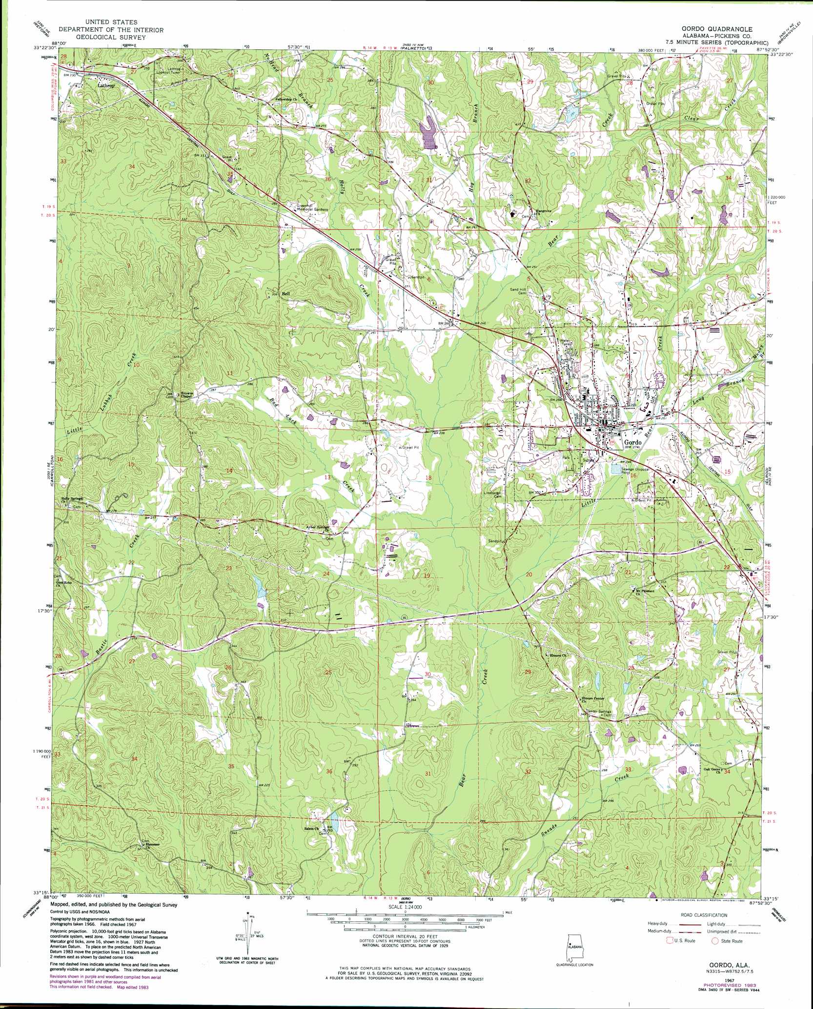
USGS Topo Quad 33087c8 - 1:24,000 scale
| Topo Map Name: | Gordo |
| USGS Topo Quad ID: | 33087c8 |
| Print Size: | ca. 21 1/4" wide x 27" high |
| Southeast Coordinates: | 33.25° N latitude / 87.875° W longitude |
| Map Center Coordinates: | 33.3125° N latitude / 87.9375° W longitude |
| U.S. State: | AL |
| Filename: | o33087c8.jpg |
| Download Map JPG Image: | Gordo topo map 1:24,000 scale |
| Map Type: | Topographic |
| Topo Series: | 7.5´ |
| Map Scale: | 1:24,000 |
| Source of Map Images: | United States Geological Survey (USGS) |
| Alternate Map Versions: |
Gordo AL 1967, updated 1968 Download PDF Buy paper map Gordo AL 1967, updated 1983 Download PDF Buy paper map Gordo AL 2011 Download PDF Buy paper map Gordo AL 2014 Download PDF Buy paper map |
1:24,000 Topo Quads surrounding Gordo
Fernbank |
Millport |
Kennedy |
Newtonville |
New Lexington |
Ethelsville |
Reform |
Palmetto |
Brownville |
Gin Creek |
Reform Sw |
Carrollton |
Gordo |
Elrod |
Lake Lurleen |
Aliceville North |
Cunningham |
Kirk |
Romulus |
Coker |
Aliceville South |
Pleasant Ridge |
Mantua |
Ralph |
Fosters |
> Back to 33087a1 at 1:100,000 scale
> Back to 33086a1 at 1:250,000 scale
> Back to U.S. Topo Maps home
Gordo topo map: Gazetteer
Gordo: Dams
Lowes Dam elevation 97m 318′Gordo: Populated Places
Bell elevation 98m 321′Bostic elevation 81m 265′
Gordo elevation 85m 278′
Lathrop elevation 75m 246′
Noland elevation 80m 262′
Gordo: Post Offices
Gordo Post Office elevation 82m 269′Gordo: Reservoirs
Lowes Lake elevation 88m 288′Gordo: Streams
Bad Luck Creek elevation 71m 232′Clear Creek elevation 79m 259′
Hog Branch elevation 73m 239′
Holly Creek elevation 72m 236′
Little Bear Creek elevation 67m 219′
Long Branch elevation 74m 242′
Muddy Branch elevation 80m 262′
Gordo digital topo map on disk
Buy this Gordo topo map showing relief, roads, GPS coordinates and other geographical features, as a high-resolution digital map file on DVD: