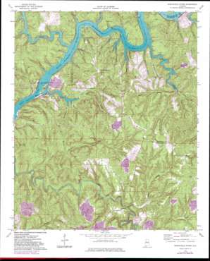
Burchfield Store Topo Map Alabama
To zoom in, hover over the map of Burchfield Store
USGS Topo Quad 33087d3 - 1:24,000 scale
| Topo Map Name: | Burchfield Store |
| USGS Topo Quad ID: | 33087d3 |
| Print Size: | ca. 21 1/4" wide x 27" high |
| Southeast Coordinates: | 33.375° N latitude / 87.25° W longitude |
| Map Center Coordinates: | 33.4375° N latitude / 87.3125° W longitude |
| U.S. State: | AL |
| Filename: | o33087d3.jpg |
| Download Map JPG Image: | Burchfield Store topo map 1:24,000 scale |
| Map Type: | Topographic |
| Topo Series: | 7.5´ |
| Map Scale: | 1:24,000 |
| Source of Map Images: | United States Geological Survey (USGS) |
| Alternate Map Versions: |
Burchfield Store AL 1974, updated 1976 Download PDF Buy paper map Burchfield Store AL 1974, updated 1983 Download PDF Buy paper map Burchfield Store AL 1974, updated 1983 Download PDF Buy paper map Burchfield Store AL 1975, updated 1977 Download PDF Buy paper map Burchfield Store AL 2011 Download PDF Buy paper map Burchfield Store AL 2014 Download PDF Buy paper map |
1:24,000 Topo Quads surrounding Burchfield Store
> Back to 33087a1 at 1:100,000 scale
> Back to 33086a1 at 1:250,000 scale
> Back to U.S. Topo Maps home
Burchfield Store topo map: Gazetteer
Burchfield Store: Bars
Squaw Shoals (historical) elevation 78m 255′Burchfield Store: Bends
Dunns Bend elevation 79m 259′Nancy Ann Bend elevation 106m 347′
Burchfield Store: Crossings
Howtons Ferry (historical) elevation 78m 255′Patton Ferry (historical) elevation 78m 255′
Burchfield Store: Dams
John Hollis Bankhead Lock and Dam elevation 57m 187′Lock Number Eleven (historical) elevation 78m 255′
Lock Number Seventeen (historical) elevation 57m 187′
Lock Number Sixteen (historical) elevation 57m 187′
Burchfield Store: Parks
Big Indian Creek Public Use Area elevation 99m 324′Old Lock 16 Public Use Area elevation 66m 216′
Burchfield Store: Populated Places
Bull City elevation 175m 574′Providence elevation 172m 564′
Burchfield Store: Reservoirs
Bankhead Lake elevation 57m 187′Burchfield Store: Ridges
Brown Ridge elevation 198m 649′Graveyard Ridge elevation 175m 574′
Pumpkin Ridge elevation 164m 538′
Burchfield Store: Springs
Farleys Spring elevation 145m 475′Burchfield Store: Streams
Big Coal Bed Branch elevation 76m 249′Big Creek elevation 78m 255′
Big Indian Creek elevation 78m 255′
Big Yellow Creek elevation 78m 255′
Bradbottom Branch elevation 78m 255′
Burchfield Branch elevation 58m 190′
Burke Branch elevation 78m 255′
Burton Branch elevation 79m 259′
Canoe Branch elevation 91m 298′
Cold Branch elevation 78m 255′
Devils Den Branch elevation 116m 380′
Fox Creek elevation 83m 272′
Harrigan Branch elevation 79m 259′
Island Branch elevation 67m 219′
Jackson Branch elevation 94m 308′
Joe Branch elevation 97m 318′
Little Indian Creek elevation 75m 246′
Nathan Branch elevation 58m 190′
Prudes Creek elevation 77m 252′
Shoal Creek elevation 78m 255′
Spring Branch elevation 78m 255′
Steep Creek elevation 78m 255′
Suck Creek elevation 106m 347′
Tan Troff Branch elevation 78m 255′
Turkey Pen Branch elevation 82m 269′
Watson Branch elevation 78m 255′
Whiteoak Creek elevation 66m 216′
Wildcat Branch elevation 92m 301′
Willowstump Branch elevation 78m 255′
Works Branch elevation 78m 255′
Burchfield Store: Summits
Iron Ore Mountain elevation 201m 659′Burchfield Store: Valleys
Coon Hollow elevation 75m 246′Granny Harris Hollow elevation 82m 269′
Redbud Hollow elevation 98m 321′
Waxtree Hollow elevation 78m 255′
Burchfield Store digital topo map on disk
Buy this Burchfield Store topo map showing relief, roads, GPS coordinates and other geographical features, as a high-resolution digital map file on DVD:


