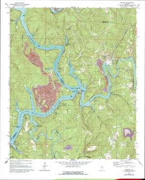
Gilmore Topo Map Alabama
To zoom in, hover over the map of Gilmore
USGS Topo Quad 33087e2 - 1:24,000 scale
| Topo Map Name: | Gilmore |
| USGS Topo Quad ID: | 33087e2 |
| Print Size: | ca. 21 1/4" wide x 27" high |
| Southeast Coordinates: | 33.5° N latitude / 87.125° W longitude |
| Map Center Coordinates: | 33.5625° N latitude / 87.1875° W longitude |
| U.S. State: | AL |
| Filename: | o33087e2.jpg |
| Download Map JPG Image: | Gilmore topo map 1:24,000 scale |
| Map Type: | Topographic |
| Topo Series: | 7.5´ |
| Map Scale: | 1:24,000 |
| Source of Map Images: | United States Geological Survey (USGS) |
| Alternate Map Versions: |
Gilmore AL 1971, updated 1973 Download PDF Buy paper map Gilmore AL 1971, updated 1977 Download PDF Buy paper map Gilmore AL 1975, updated 1977 Download PDF Buy paper map Gilmore AL 2011 Download PDF Buy paper map Gilmore AL 2014 Download PDF Buy paper map |
1:24,000 Topo Quads surrounding Gilmore
> Back to 33087e1 at 1:100,000 scale
> Back to 33086a1 at 1:250,000 scale
> Back to U.S. Topo Maps home
Gilmore topo map: Gazetteer
Gilmore: Bars
Fork Shoals elevation 76m 249′Heard Shoals elevation 76m 249′
Lily Shoals elevation 76m 249′
Gilmore: Bends
Leeann Bend elevation 90m 295′Thompson Bend elevation 77m 252′
Gilmore: Bridges
Franklin Ferry Bridge elevation 76m 249′Maxine Bridge elevation 76m 249′
Gilmore: Capes
Beavers Point elevation 79m 259′Gilmore: Crossings
Cook Ford (historical) elevation 76m 249′Double Branch Ford elevation 76m 249′
Franklin Ferry (historical) elevation 76m 249′
Glaze Ferry (historical) elevation 76m 249′
Jasper Ford elevation 76m 249′
McCarty Ford elevation 76m 249′
McCartys Ferry (historical) elevation 76m 249′
Miller Ferry (historical) elevation 76m 249′
Sanford Ferry (historical) elevation 76m 249′
Snow Ferry (historical) elevation 76m 249′
Taylor Ferry (historical) elevation 76m 249′
Thomas Ford elevation 76m 249′
Two Branch Ferry (historical) elevation 76m 249′
Gilmore: Dams
Lock Number Thirteen (historical) elevation 76m 249′Maxine Tailings Pond Dam elevation 105m 344′
Gilmore: Mines
Gilmore Mine elevation 148m 485′Maxine Mine elevation 83m 272′
Maxine Mines elevation 116m 380′
Praco Mine elevation 130m 426′
Praco Mine Number 7 elevation 134m 439′
Riverside Mine elevation 103m 337′
Gilmore: Populated Places
Alliance elevation 141m 462′Driftwood elevation 94m 308′
Gilmore elevation 158m 518′
Little Shoal elevation 120m 393′
Maxine elevation 86m 282′
Wilderness Garden elevation 107m 351′
Gilmore: Reservoirs
Tailings Pond Number 2 elevation 105m 344′Gilmore: Ridges
Flint Ridge elevation 152m 498′Tucker Ridge elevation 141m 462′
Gilmore: Streams
Big Branch elevation 76m 249′Bluff Creek elevation 76m 249′
Canaan Branch elevation 77m 252′
Coal Bed Creek elevation 76m 249′
Coal Creek elevation 79m 259′
Double Branch elevation 76m 249′
Frileys Creek elevation 76m 249′
Glaze Creek elevation 76m 249′
Gutters Branch elevation 76m 249′
Hurricane Creek elevation 76m 249′
Kisner Slough elevation 76m 249′
Kitty Branch elevation 76m 249′
Lightfoot Branch elevation 84m 275′
Locust Fork elevation 76m 249′
Lost Creek elevation 76m 249′
Miller Slough elevation 76m 249′
Mulberry Fork elevation 76m 249′
Panther Branch elevation 77m 252′
Perry Branch elevation 76m 249′
Prescott Creek elevation 76m 249′
Richardson Slough elevation 76m 249′
Rocky Branch elevation 76m 249′
Sextons Branch elevation 77m 252′
Short Creek elevation 76m 249′
Skelton Creek elevation 76m 249′
Turkey Branch elevation 86m 282′
Valley Creek elevation 76m 249′
White Branch elevation 80m 262′
Gilmore: Valleys
Busby Hollow elevation 78m 255′Drip Spring Hollow elevation 91m 298′
Richardson Hollow elevation 76m 249′
Gilmore digital topo map on disk
Buy this Gilmore topo map showing relief, roads, GPS coordinates and other geographical features, as a high-resolution digital map file on DVD:


