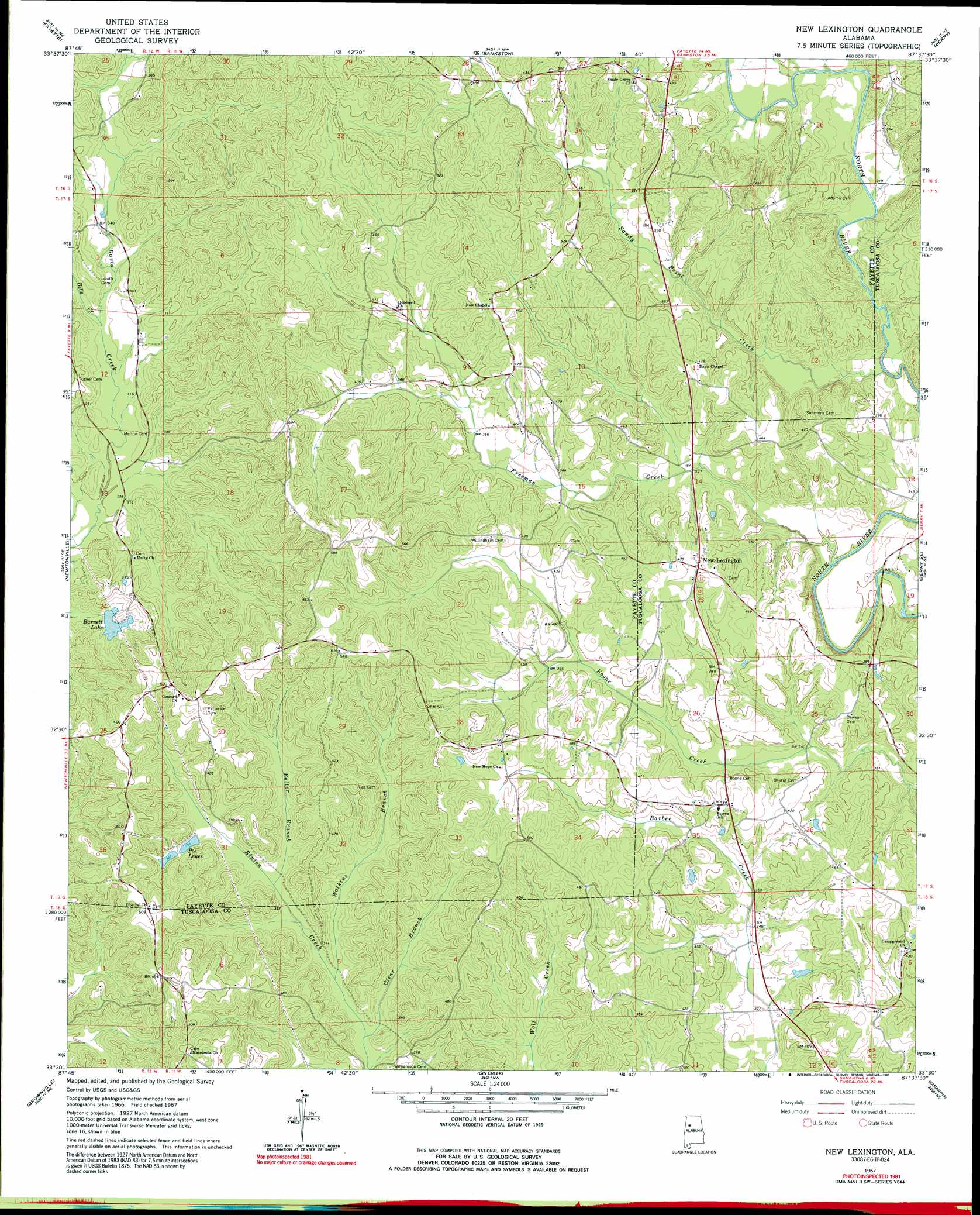
New Lexington Topo Map Alabama
To zoom in, hover over the map of New Lexington
USGS Topo Quad 33087e6 - 1:24,000 scale
| Topo Map Name: | New Lexington |
| USGS Topo Quad ID: | 33087e6 |
| Print Size: | ca. 21 1/4" wide x 27" high |
| Southeast Coordinates: | 33.5° N latitude / 87.625° W longitude |
| Map Center Coordinates: | 33.5625° N latitude / 87.6875° W longitude |
| U.S. State: | AL |
| Filename: | o33087e6.jpg |
| Download Map JPG Image: | New Lexington topo map 1:24,000 scale |
| Map Type: | Topographic |
| Topo Series: | 7.5´ |
| Map Scale: | 1:24,000 |
| Source of Map Images: | United States Geological Survey (USGS) |
| Alternate Map Versions: |
New Lexington AL 1967, updated 1968 Download PDF Buy paper map New Lexington AL 1967, updated 1991 Download PDF Buy paper map New Lexington AL 2011 Download PDF Buy paper map New Lexington AL 2014 Download PDF Buy paper map |
1:24,000 Topo Quads surrounding New Lexington
Bluff |
Winfield Se |
Hubbertville |
Howard |
Townley |
Belk |
Fayette |
Bankston |
Berry |
Oakman |
Kennedy |
Newtonville |
New Lexington |
Berry Se |
Wiley |
Palmetto |
Brownville |
Gin Creek |
Lake Tuscaloosa North |
Windham Springs |
Gordo |
Elrod |
Lake Lurleen |
Lake Tuscaloosa South |
Lake Nicol |
> Back to 33087e1 at 1:100,000 scale
> Back to 33086a1 at 1:250,000 scale
> Back to U.S. Topo Maps home
New Lexington topo map: Gazetteer
New Lexington: Dams
Barnett Lake Dam elevation 109m 357′New Lexington: Oilfields
Lexington Gas Field elevation 125m 410′New Lexington: Populated Places
Concord elevation 153m 501′New Hope elevation 138m 452′
New Lexington elevation 131m 429′
New Lexington: Post Offices
Davis Creek Post Office (historical) elevation 100m 328′Reuben Post Office (historical) elevation 116m 380′
New Lexington: Reservoirs
Barnett Lake elevation 97m 318′Poe Lakes elevation 109m 357′
New Lexington: Streams
Belle Creek elevation 96m 314′Bolter Branch elevation 98m 321′
Clear Branch elevation 94m 308′
Freeman Creek elevation 91m 298′
Rock Creek elevation 97m 318′
Sandy Point Creek elevation 92m 301′
Watkins Branch elevation 95m 311′
New Lexington digital topo map on disk
Buy this New Lexington topo map showing relief, roads, GPS coordinates and other geographical features, as a high-resolution digital map file on DVD: