Newtonville Topo Map Alabama
To zoom in, hover over the map of Newtonville
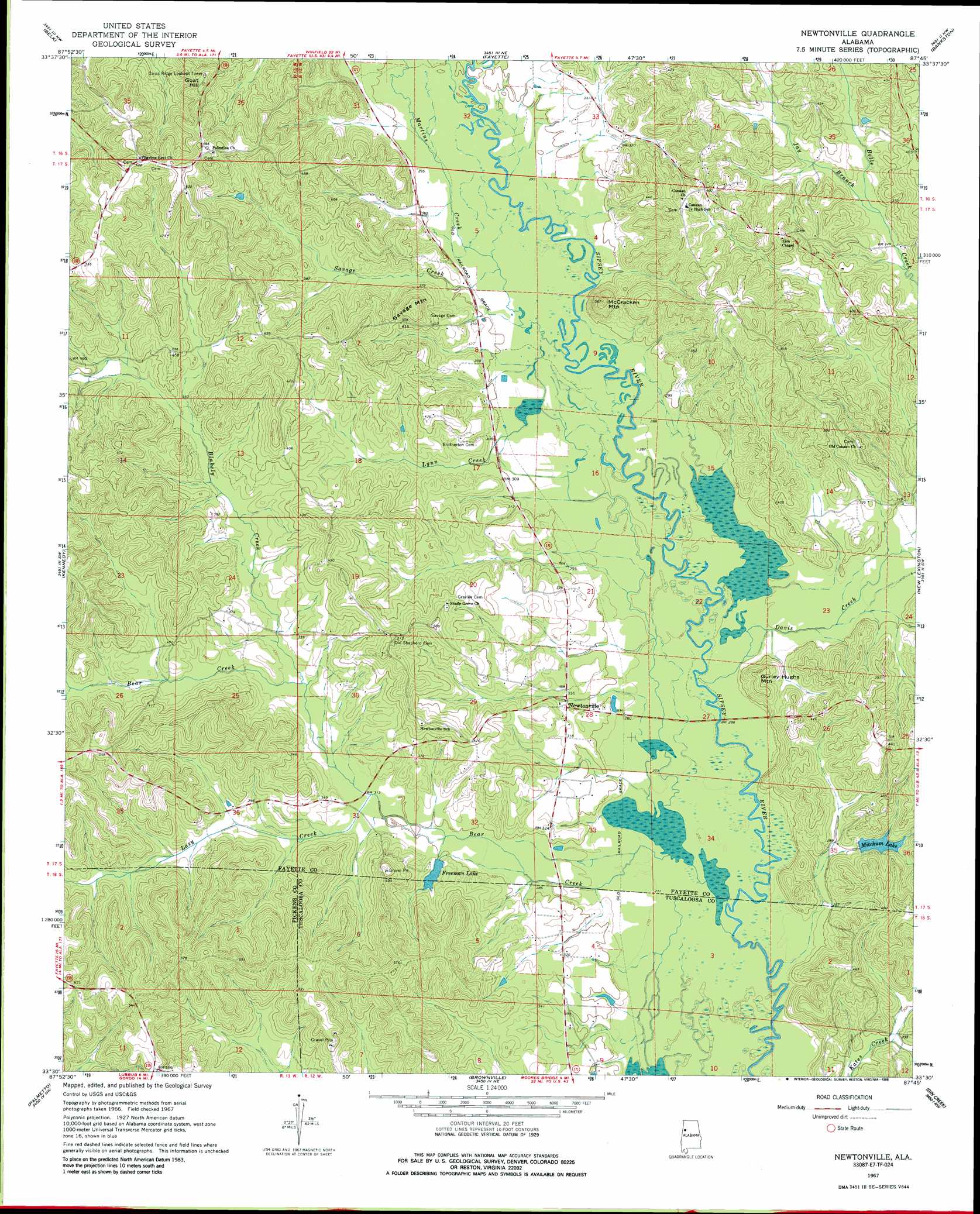
USGS Topo Quad 33087e7 - 1:24,000 scale
| Topo Map Name: | Newtonville |
| USGS Topo Quad ID: | 33087e7 |
| Print Size: | ca. 21 1/4" wide x 27" high |
| Southeast Coordinates: | 33.5° N latitude / 87.75° W longitude |
| Map Center Coordinates: | 33.5625° N latitude / 87.8125° W longitude |
| U.S. State: | AL |
| Filename: | o33087e7.jpg |
| Download Map JPG Image: | Newtonville topo map 1:24,000 scale |
| Map Type: | Topographic |
| Topo Series: | 7.5´ |
| Map Scale: | 1:24,000 |
| Source of Map Images: | United States Geological Survey (USGS) |
| Alternate Map Versions: |
Newtonville AL 1967, updated 1968 Download PDF Buy paper map Newtonville AL 1967, updated 1986 Download PDF Buy paper map Newtonville AL 1967, updated 1986 Download PDF Buy paper map Newtonville AL 2011 Download PDF Buy paper map Newtonville AL 2014 Download PDF Buy paper map |
1:24,000 Topo Quads surrounding Newtonville
Vernon |
Bluff |
Winfield Se |
Hubbertville |
Howard |
Hightogy |
Belk |
Fayette |
Bankston |
Berry |
Millport |
Kennedy |
Newtonville |
New Lexington |
Berry Se |
Reform |
Palmetto |
Brownville |
Gin Creek |
Lake Tuscaloosa North |
Carrollton |
Gordo |
Elrod |
Lake Lurleen |
Lake Tuscaloosa South |
> Back to 33087e1 at 1:100,000 scale
> Back to 33086a1 at 1:250,000 scale
> Back to U.S. Topo Maps home
Newtonville topo map: Gazetteer
Newtonville: Dams
Freeman Lake Dam elevation 94m 308′Mitchum Lake Dam elevation 108m 354′
Newtonville: Oilfields
Blakely Creek Oil Field elevation 104m 341′Newtonville Gas Field elevation 115m 377′
Newtonville: Populated Places
Jerusalem elevation 186m 610′Newtonville elevation 95m 311′
Newtonville: Reservoirs
Freeman Lake elevation 94m 308′Mitchum Lake elevation 98m 321′
Newtonville: Streams
Bear Creek elevation 79m 259′Blakely Creek elevation 97m 318′
Davis Creek elevation 82m 269′
Jay Branch elevation 100m 328′
Lazy Creek elevation 92m 301′
Lynn Creek elevation 87m 285′
Martins Creek elevation 88m 288′
Savage Creek elevation 91m 298′
Newtonville: Summits
Goat Hill elevation 182m 597′Gurley Hughs Mountain elevation 128m 419′
McCracken Mountain elevation 161m 528′
Savage Mountain elevation 165m 541′
Newtonville digital topo map on disk
Buy this Newtonville topo map showing relief, roads, GPS coordinates and other geographical features, as a high-resolution digital map file on DVD: