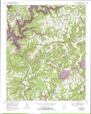
Cold Springs Topo Map Alabama
To zoom in, hover over the map of Cold Springs
USGS Topo Quad 33087h1 - 1:24,000 scale
| Topo Map Name: | Cold Springs |
| USGS Topo Quad ID: | 33087h1 |
| Print Size: | ca. 21 1/4" wide x 27" high |
| Southeast Coordinates: | 33.875° N latitude / 87° W longitude |
| Map Center Coordinates: | 33.9375° N latitude / 87.0625° W longitude |
| U.S. State: | AL |
| Filename: | o33087h1.jpg |
| Download Map JPG Image: | Cold Springs topo map 1:24,000 scale |
| Map Type: | Topographic |
| Topo Series: | 7.5´ |
| Map Scale: | 1:24,000 |
| Source of Map Images: | United States Geological Survey (USGS) |
| Alternate Map Versions: |
Cold Springs AL 1949, updated 1969 Download PDF Buy paper map Cold Springs AL 1949, updated 1977 Download PDF Buy paper map Cold Springs AL 1949, updated 1978 Download PDF Buy paper map Cold Springs AL 1949, updated 1984 Download PDF Buy paper map Cold Springs AL 1949, updated 1997 Download PDF Buy paper map Cold Springs AL 1951, updated 1951 Download PDF Buy paper map Cold Springs AL 2011 Download PDF Buy paper map Cold Springs AL 2014 Download PDF Buy paper map |
1:24,000 Topo Quads surrounding Cold Springs
> Back to 33087e1 at 1:100,000 scale
> Back to 33086a1 at 1:250,000 scale
> Back to U.S. Topo Maps home
Cold Springs topo map: Gazetteer
Cold Springs: Bridges
Parker Bridge elevation 98m 321′Cold Springs: Cliffs
Banking Grounds elevation 88m 288′Cold Springs: Crossings
Bronson Ford elevation 99m 324′Browns Ferry (historical) elevation 162m 531′
Lindseys Ferry (historical) elevation 76m 249′
Parker Ford (historical) elevation 84m 275′
Cold Springs: Dams
Lewis Smith elevation 87m 285′Cold Springs: Mines
Cold Springs Mine elevation 201m 659′Hope Mine elevation 128m 419′
Oscar McGuffs Mine elevation 186m 610′
Ryan Creek Mine elevation 197m 646′
Cold Springs: Populated Places
Ardell elevation 200m 656′Cold Springs elevation 213m 698′
Powellville elevation 177m 580′
Wilburn elevation 159m 521′
Cold Springs: Post Offices
Bremen Post Office elevation 213m 698′Cold Springs: Reservoirs
Lewis Smith Lake elevation 153m 501′Cold Springs: Streams
Bear Pen Branch elevation 153m 501′Big Branch elevation 153m 501′
Boyd Creek elevation 76m 249′
Brazeal Branch elevation 121m 396′
Clinton Branch elevation 153m 501′
Coon Creek elevation 153m 501′
Doctor Harris Spring Branch elevation 153m 501′
Jane Branch elevation 125m 410′
Lick Creek elevation 153m 501′
Long Branch elevation 153m 501′
Mill Creek elevation 83m 272′
Parker Branch elevation 76m 249′
Ryan Creek elevation 153m 501′
Stewart Branch elevation 104m 341′
Walls Branch elevation 101m 331′
Willoughby Branch elevation 153m 501′
Wilson Branch elevation 76m 249′
Cold Springs: Summits
Dooley Mountain elevation 195m 639′Gin Mountain elevation 208m 682′
Hammonds Shinbone Mountain elevation 202m 662′
Leeth Hill elevation 154m 505′
Mail Route Mountain elevation 189m 620′
Cold Springs: Valleys
Barr Hollow elevation 90m 295′Blevins Hollow elevation 88m 288′
John R Hollow elevation 109m 357′
Mary Ann Hollow elevation 91m 298′
Cold Springs digital topo map on disk
Buy this Cold Springs topo map showing relief, roads, GPS coordinates and other geographical features, as a high-resolution digital map file on DVD:


