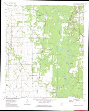
Pickensville Topo Map Alabama
To zoom in, hover over the map of Pickensville
USGS Topo Quad 33088b3 - 1:24,000 scale
| Topo Map Name: | Pickensville |
| USGS Topo Quad ID: | 33088b3 |
| Print Size: | ca. 21 1/4" wide x 27" high |
| Southeast Coordinates: | 33.125° N latitude / 88.25° W longitude |
| Map Center Coordinates: | 33.1875° N latitude / 88.3125° W longitude |
| U.S. States: | AL, MS |
| Filename: | o33088b3.jpg |
| Download Map JPG Image: | Pickensville topo map 1:24,000 scale |
| Map Type: | Topographic |
| Topo Series: | 7.5´ |
| Map Scale: | 1:24,000 |
| Source of Map Images: | United States Geological Survey (USGS) |
| Alternate Map Versions: |
Pickensville AL 1974, updated 1975 Download PDF Buy paper map Pickensville AL 1974, updated 1982 Download PDF Buy paper map Pickensville AL 2011 Download PDF Buy paper map Pickensville AL 2014 Download PDF Buy paper map |
1:24,000 Topo Quads surrounding Pickensville
> Back to 33088a1 at 1:100,000 scale
> Back to 33088a1 at 1:250,000 scale
> Back to U.S. Topo Maps home
Pickensville topo map: Gazetteer
Pickensville: Bars
Bell Ford Bar elevation 41m 134′Big Creek Bar elevation 33m 108′
Ford Bar elevation 41m 134′
Ivie Bar elevation 41m 134′
Parched Corn Bar elevation 34m 111′
Ringgolds Bar elevation 33m 108′
Shylock Bar elevation 37m 121′
Shylock Shoals elevation 37m 121′
Turnipseed Shoals elevation 33m 108′
Wallaces Bar elevation 51m 167′
Wilkinson Bar elevation 34m 111′
Pickensville: Channels
Coalfire Cut Off elevation 42m 137′Pickensville Cut Off elevation 43m 141′
Pickensville: Cliffs
Carraways Bluff elevation 35m 114′Ringo Bluff elevation 44m 144′
Pickensville: Crossings
Jackson Ferry (historical) elevation 33m 108′Memphis Ferry (historical) elevation 33m 108′
Nances Ferry (historical) elevation 41m 134′
Pickens Ferry (historical) elevation 41m 134′
Pickensville Ferry (historical) elevation 41m 134′
Pickensville: Dams
Aliceville Lock and Dam elevation 41m 134′Herdon Lake Dam elevation 40m 131′
Woods Lake Dam elevation 65m 213′
Pickensville: Lakes
Clear Lake elevation 40m 131′Garnette Lake elevation 34m 111′
Gavin Lake elevation 43m 141′
Stepp Lake elevation 35m 114′
Steps Lake elevation 34m 111′
Pickensville: Parks
Bigbee Valley Access Area elevation 42m 137′Damsite Eastbank Public Use Area elevation 36m 118′
Damsite West Bank Public Use Area elevation 40m 131′
Memphis Access Area elevation 43m 141′
Pickensville Recreation Area elevation 43m 141′
Ringo Bluff Access Area elevation 45m 147′
Pickensville: Populated Places
Aubrey elevation 54m 177′Bigbee Valley elevation 48m 157′
Brazelia (historical) elevation 68m 223′
Crow (historical) elevation 52m 170′
Grantsville (historical) elevation 47m 154′
Memphis elevation 51m 167′
Pickensville elevation 70m 229′
Plantersville (historical) elevation 46m 150′
Ravine elevation 64m 209′
Pickensville: Post Offices
Bigbee Valley Post Office elevation 49m 160′Pickensville: Reservoirs
Aliceville Lake elevation 41m 134′Aliceville Lake elevation 33m 108′
Pickensville: Streams
Beaver Creek elevation 33m 108′Big Creek elevation 34m 111′
Cypress Branch elevation 34m 111′
Cypress Branch elevation 33m 108′
Cypress Branch elevation 34m 111′
Indian Camp Creek elevation 40m 131′
Owl Creek elevation 33m 108′
Pine Knot Branch elevation 35m 114′
Tucker Branch elevation 33m 108′
Tucker Branch elevation 34m 111′
Wallace Creek elevation 34m 111′
Pickensville digital topo map on disk
Buy this Pickensville topo map showing relief, roads, GPS coordinates and other geographical features, as a high-resolution digital map file on DVD:


