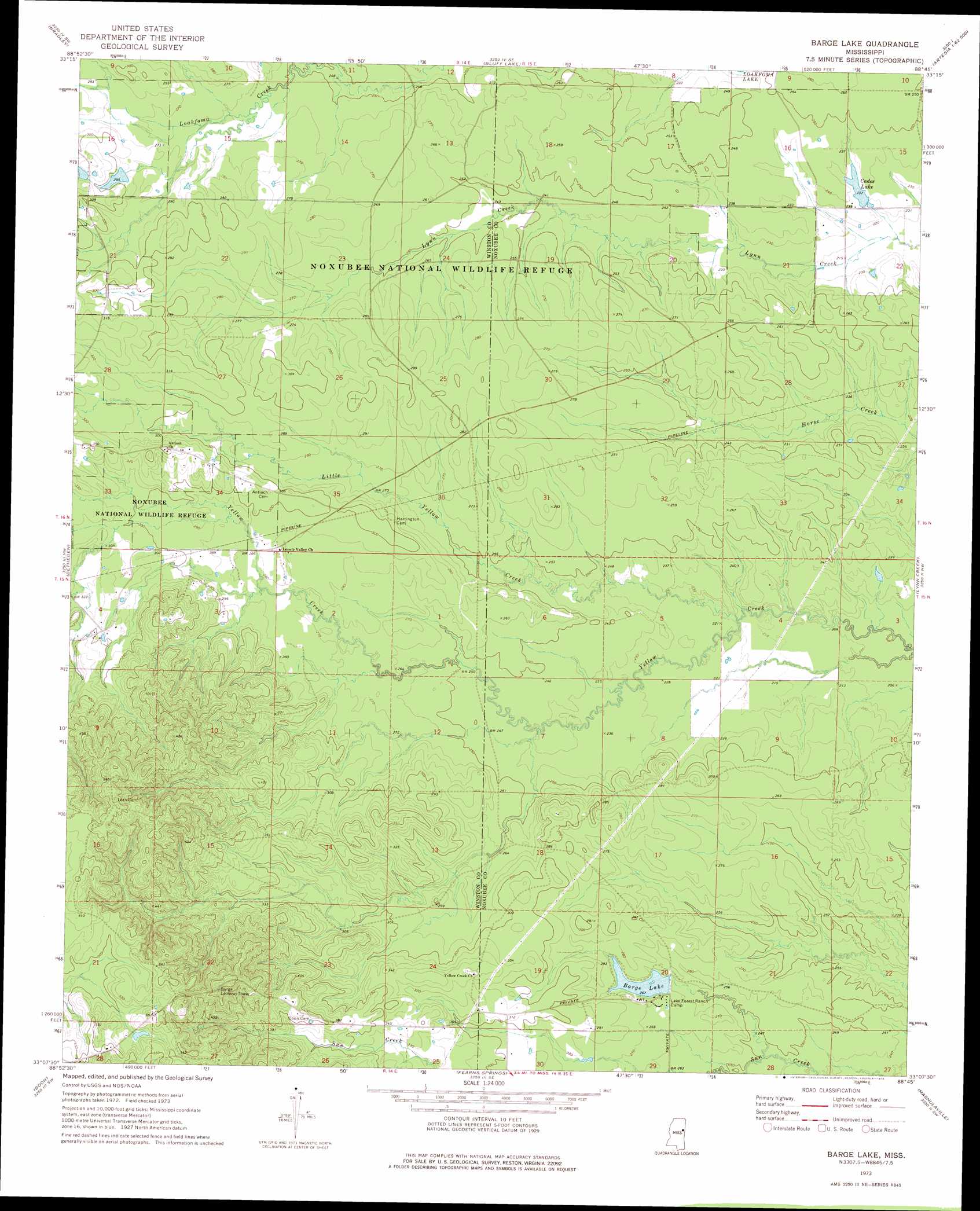
Barge Lake Topo Map Mississippi
To zoom in, hover over the map of Barge Lake
USGS Topo Quad 33088b7 - 1:24,000 scale
| Topo Map Name: | Barge Lake |
| USGS Topo Quad ID: | 33088b7 |
| Print Size: | ca. 21 1/4" wide x 27" high |
| Southeast Coordinates: | 33.125° N latitude / 88.75° W longitude |
| Map Center Coordinates: | 33.1875° N latitude / 88.8125° W longitude |
| U.S. State: | MS |
| Filename: | o33088b7.jpg |
| Download Map JPG Image: | Barge Lake topo map 1:24,000 scale |
| Map Type: | Topographic |
| Topo Series: | 7.5´ |
| Map Scale: | 1:24,000 |
| Source of Map Images: | United States Geological Survey (USGS) |
| Alternate Map Versions: |
Barge Lake MS 1973, updated 1975 Download PDF Buy paper map Barge Lake MS 1973, updated 1975 Download PDF Buy paper map Barge Lake MS 2012 Download PDF Buy paper map Barge Lake MS 2015 Download PDF Buy paper map |
1:24,000 Topo Quads surrounding Barge Lake
Double Springs |
Longview |
Starkville |
Artesia |
Bent Oak |
Sturgis |
Bradley |
Bluff Lake |
Crawford West |
Crawford East |
Louisville North |
Betheden |
Barge Lake |
Lynn Creek |
Brooksville |
Louisville South |
Boon |
Fearns Springs |
Mashulaville |
Macon |
Noxapater |
Vernon |
Preston |
Gholson |
Shuqualak |
> Back to 33088a1 at 1:100,000 scale
> Back to 33088a1 at 1:250,000 scale
> Back to U.S. Topo Maps home
Barge Lake topo map: Gazetteer
Barge Lake: Dams
Lake Forrest Dam elevation 80m 262′Triplett Lake Dam elevation 89m 291′
Barge Lake: Populated Places
Farewells (historical) elevation 83m 272′Singleton (historical) elevation 90m 295′
Barge Lake: Reservoirs
Barge Lake elevation 79m 259′Cades Lake elevation 70m 229′
Barge Lake: Streams
Ball Ground Creek elevation 71m 232′Little Yellow Creek elevation 63m 206′
Barge Lake digital topo map on disk
Buy this Barge Lake topo map showing relief, roads, GPS coordinates and other geographical features, as a high-resolution digital map file on DVD: