Carrollton Topo Map Alabama
To zoom in, hover over the map of Carrollton
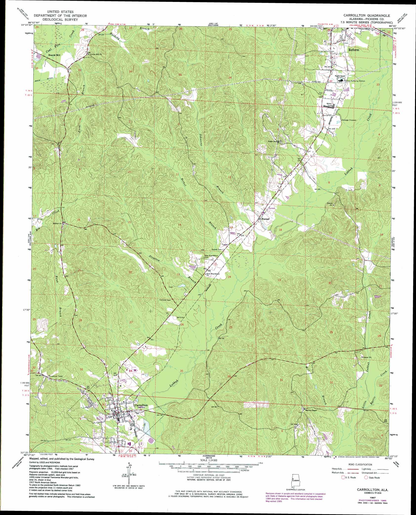
USGS Topo Quad 33088c1 - 1:24,000 scale
| Topo Map Name: | Carrollton |
| USGS Topo Quad ID: | 33088c1 |
| Print Size: | ca. 21 1/4" wide x 27" high |
| Southeast Coordinates: | 33.25° N latitude / 88° W longitude |
| Map Center Coordinates: | 33.3125° N latitude / 88.0625° W longitude |
| U.S. State: | AL |
| Filename: | o33088c1.jpg |
| Download Map JPG Image: | Carrollton topo map 1:24,000 scale |
| Map Type: | Topographic |
| Topo Series: | 7.5´ |
| Map Scale: | 1:24,000 |
| Source of Map Images: | United States Geological Survey (USGS) |
| Alternate Map Versions: |
Carrollton AL 1967 Download PDF Buy paper map Carrollton AL 1967, updated 1968 Download PDF Buy paper map Carrollton AL 1967, updated 1984 Download PDF Buy paper map Carrollton AL 2011 Download PDF Buy paper map Carrollton AL 2014 Download PDF Buy paper map |
1:24,000 Topo Quads surrounding Carrollton
Steens |
Fernbank |
Millport |
Kennedy |
Newtonville |
New Hope |
Ethelsville |
Reform |
Palmetto |
Brownville |
Forreston |
Reform Sw |
Carrollton |
Gordo |
Elrod |
Pickensville |
Aliceville North |
Cunningham |
Kirk |
Romulus |
Dancy |
Aliceville South |
Pleasant Ridge |
Mantua |
Ralph |
> Back to 33088a1 at 1:100,000 scale
> Back to 33088a1 at 1:250,000 scale
> Back to U.S. Topo Maps home
Carrollton topo map: Gazetteer
Carrollton: Dams
Parson Dam elevation 57m 187′Carrollton: Populated Places
Beards Mill elevation 66m 216′Carloss elevation 79m 259′
Carrollton elevation 75m 246′
Owens elevation 64m 209′
Stansel elevation 68m 223′
Carrollton: Post Offices
Carrollton Post Office elevation 75m 246′Carrollton: Reservoirs
Kilpatrick Lake elevation 57m 187′Carrollton: Streams
Anna Branch elevation 65m 213′Bastic Creek elevation 66m 216′
Bethel Branch elevation 59m 193′
Huckeby Branch elevation 64m 209′
Johnsons Branch elevation 60m 196′
Mill Branch elevation 66m 216′
Stratton Branch elevation 58m 190′
Carrollton digital topo map on disk
Buy this Carrollton topo map showing relief, roads, GPS coordinates and other geographical features, as a high-resolution digital map file on DVD: