Reform Sw Topo Map Alabama
To zoom in, hover over the map of Reform Sw
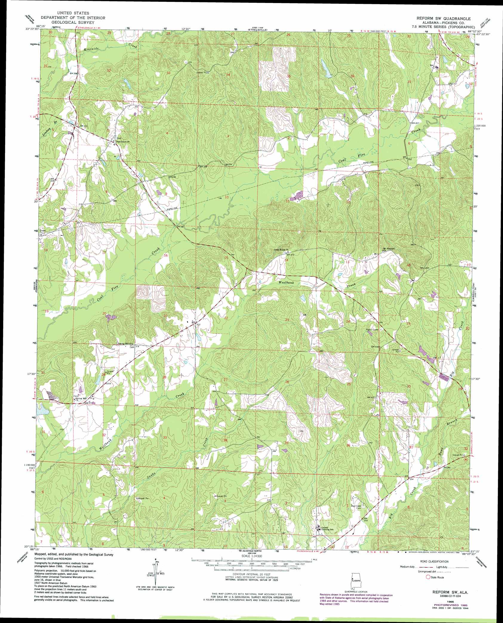
USGS Topo Quad 33088c2 - 1:24,000 scale
| Topo Map Name: | Reform Sw |
| USGS Topo Quad ID: | 33088c2 |
| Print Size: | ca. 21 1/4" wide x 27" high |
| Southeast Coordinates: | 33.25° N latitude / 88.125° W longitude |
| Map Center Coordinates: | 33.3125° N latitude / 88.1875° W longitude |
| U.S. State: | AL |
| Filename: | o33088c2.jpg |
| Download Map JPG Image: | Reform Sw topo map 1:24,000 scale |
| Map Type: | Topographic |
| Topo Series: | 7.5´ |
| Map Scale: | 1:24,000 |
| Source of Map Images: | United States Geological Survey (USGS) |
| Alternate Map Versions: |
Reform SW AL 1966, updated 1968 Download PDF Buy paper map Reform SW AL 1966, updated 1986 Download PDF Buy paper map Reform SW AL 2011 Download PDF Buy paper map Reform SW AL 2014 Download PDF Buy paper map |
1:24,000 Topo Quads surrounding Reform Sw
Columbus North |
Steens |
Fernbank |
Millport |
Kennedy |
Columbus South |
New Hope |
Ethelsville |
Reform |
Palmetto |
Trinity |
Forreston |
Reform Sw |
Carrollton |
Gordo |
Cliftonville |
Pickensville |
Aliceville North |
Cunningham |
Kirk |
Mcleod |
Dancy |
Aliceville South |
Pleasant Ridge |
Mantua |
> Back to 33088a1 at 1:100,000 scale
> Back to 33088a1 at 1:250,000 scale
> Back to U.S. Topo Maps home
Reform Sw topo map: Gazetteer
Reform Sw: Bridges
Lintons Bridge (historical) elevation 60m 196′Reform Sw: Dams
Shepherd Dam elevation 78m 255′Reform Sw: Oilfields
Woolbank Creek Gas Field elevation 60m 196′Reform Sw: Populated Places
Archer elevation 97m 318′Pine Grove elevation 97m 318′
Reform Sw: Reservoirs
Shepherds Lake elevation 78m 255′Reform Sw: Streams
Bunk Branch elevation 75m 246′Reform Sw digital topo map on disk
Buy this Reform Sw topo map showing relief, roads, GPS coordinates and other geographical features, as a high-resolution digital map file on DVD: