Bent Oak Topo Map Mississippi
To zoom in, hover over the map of Bent Oak
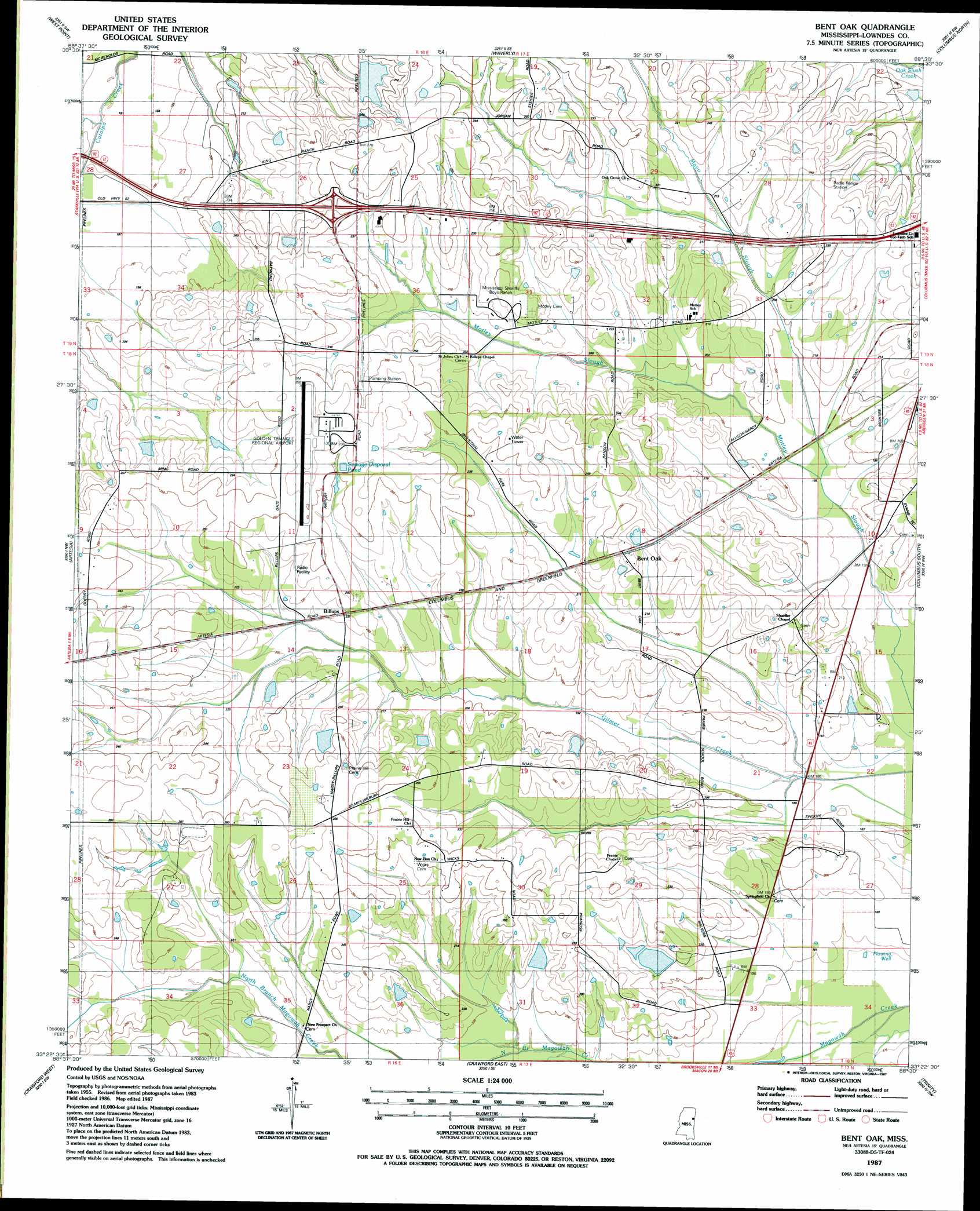
USGS Topo Quad 33088d5 - 1:24,000 scale
| Topo Map Name: | Bent Oak |
| USGS Topo Quad ID: | 33088d5 |
| Print Size: | ca. 21 1/4" wide x 27" high |
| Southeast Coordinates: | 33.375° N latitude / 88.5° W longitude |
| Map Center Coordinates: | 33.4375° N latitude / 88.5625° W longitude |
| U.S. State: | MS |
| Filename: | o33088d5.jpg |
| Download Map JPG Image: | Bent Oak topo map 1:24,000 scale |
| Map Type: | Topographic |
| Topo Series: | 7.5´ |
| Map Scale: | 1:24,000 |
| Source of Map Images: | United States Geological Survey (USGS) |
| Alternate Map Versions: |
Bent Oak MS 1987, updated 1987 Download PDF Buy paper map Bent Oak MS 2012 Download PDF Buy paper map Bent Oak MS 2015 Download PDF Buy paper map |
1:24,000 Topo Quads surrounding Bent Oak
Palo Alto |
Muldon |
Strong |
Hamilton |
Caledonia |
Cedar Bluff |
West Point |
Waverly |
Columbus North |
Steens |
Starkville |
Artesia |
Bent Oak |
Columbus South |
New Hope |
Bluff Lake |
Crawford West |
Crawford East |
Trinity |
Forreston |
Barge Lake |
Lynn Creek |
Brooksville |
Cliftonville |
Pickensville |
> Back to 33088a1 at 1:100,000 scale
> Back to 33088a1 at 1:250,000 scale
> Back to U.S. Topo Maps home
Bent Oak topo map: Gazetteer
Bent Oak: Airports
Golden Triangle Regional Airport elevation 80m 262′Bent Oak: Dams
Angus Farms Lake Dam elevation 68m 223′Chism Lake Dam elevation 65m 213′
Imes Lake Dam elevation 65m 213′
Mississippi No Name 161 Dam elevation 56m 183′
Mississippi No Name 162 Dam elevation 74m 242′
Mississippi No Name 163 Dam elevation 67m 219′
Thomas Lake Dam elevation 62m 203′
Thomas Lake Dam elevation 62m 203′
Bent Oak: Populated Places
Allendale (historical) elevation 67m 219′Bent Oak elevation 73m 239′
Billups elevation 70m 229′
McIntyre (historical) elevation 64m 209′
Prairie Hill (historical) elevation 81m 265′
Shula Grove (historical) elevation 70m 229′
Bent Oak: Streams
Mayo Slough elevation 56m 183′Bent Oak digital topo map on disk
Buy this Bent Oak topo map showing relief, roads, GPS coordinates and other geographical features, as a high-resolution digital map file on DVD: