Fernbank Topo Map Alabama
To zoom in, hover over the map of Fernbank
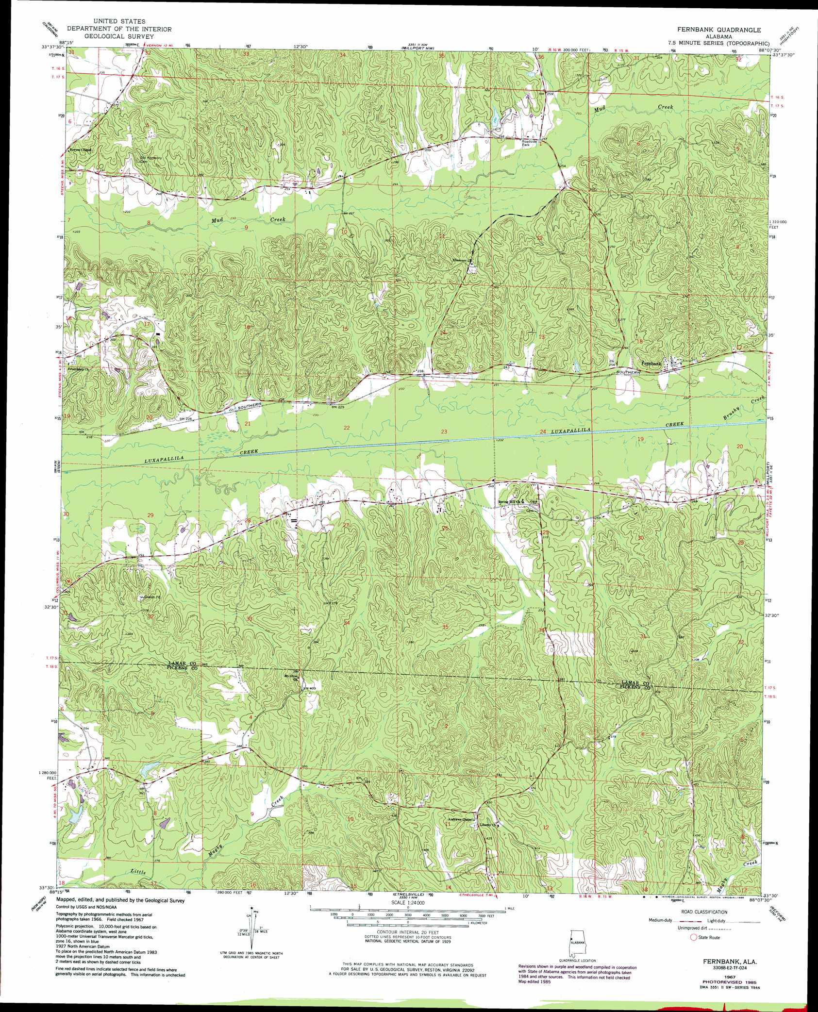
USGS Topo Quad 33088e2 - 1:24,000 scale
| Topo Map Name: | Fernbank |
| USGS Topo Quad ID: | 33088e2 |
| Print Size: | ca. 21 1/4" wide x 27" high |
| Southeast Coordinates: | 33.5° N latitude / 88.125° W longitude |
| Map Center Coordinates: | 33.5625° N latitude / 88.1875° W longitude |
| U.S. State: | AL |
| Filename: | o33088e2.jpg |
| Download Map JPG Image: | Fernbank topo map 1:24,000 scale |
| Map Type: | Topographic |
| Topo Series: | 7.5´ |
| Map Scale: | 1:24,000 |
| Source of Map Images: | United States Geological Survey (USGS) |
| Alternate Map Versions: |
Fernbank AL 1967, updated 1968 Download PDF Buy paper map Fernbank AL 1967, updated 1986 Download PDF Buy paper map Fernbank AL 2011 Download PDF Buy paper map Fernbank AL 2014 Download PDF Buy paper map |
1:24,000 Topo Quads surrounding Fernbank
Amory Sw |
Amory Se |
Sulligent Sw |
Vernon |
Bluff |
Hamilton |
Caledonia |
Millport Nw |
Hightogy |
Belk |
Columbus North |
Steens |
Fernbank |
Millport |
Kennedy |
Columbus South |
New Hope |
Ethelsville |
Reform |
Palmetto |
Trinity |
Forreston |
Reform Sw |
Carrollton |
Gordo |
> Back to 33088e1 at 1:100,000 scale
> Back to 33088a1 at 1:250,000 scale
> Back to U.S. Topo Maps home
Fernbank topo map: Gazetteer
Fernbank: Dams
Boggess Dam elevation 97m 318′Dolan Davis Dam elevation 73m 239′
Speed Dam elevation 97m 318′
Fernbank: Mines
Friersons Shaft Mine elevation 79m 259′Fernbank: Oilfields
Fernbank Gas Field elevation 72m 236′Mud Creek Gas Field elevation 76m 249′
Fernbank: Populated Places
Fernbank elevation 79m 259′Melborne elevation 78m 255′
Fernbank: Reservoirs
Boggess Lake elevation 97m 318′Dolan Davis Lake elevation 73m 239′
Speeds Lake elevation 97m 318′
Fernbank: Streams
Brushy Creek elevation 71m 232′Fernbank digital topo map on disk
Buy this Fernbank topo map showing relief, roads, GPS coordinates and other geographical features, as a high-resolution digital map file on DVD: