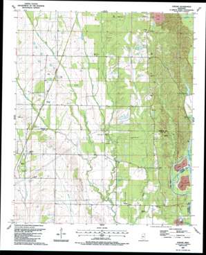
Strong Topo Map Mississippi
To zoom in, hover over the map of Strong
USGS Topo Quad 33088f5 - 1:24,000 scale
| Topo Map Name: | Strong |
| USGS Topo Quad ID: | 33088f5 |
| Print Size: | ca. 21 1/4" wide x 27" high |
| Southeast Coordinates: | 33.625° N latitude / 88.5° W longitude |
| Map Center Coordinates: | 33.6875° N latitude / 88.5625° W longitude |
| U.S. State: | MS |
| Filename: | o33088f5.jpg |
| Download Map JPG Image: | Strong topo map 1:24,000 scale |
| Map Type: | Topographic |
| Topo Series: | 7.5´ |
| Map Scale: | 1:24,000 |
| Source of Map Images: | United States Geological Survey (USGS) |
| Alternate Map Versions: |
Strong MS 1987, updated 1987 Download PDF Buy paper map Strong MS 2012 Download PDF Buy paper map Strong MS 2015 Download PDF Buy paper map |
1:24,000 Topo Quads surrounding Strong
> Back to 33088e1 at 1:100,000 scale
> Back to 33088a1 at 1:250,000 scale
> Back to U.S. Topo Maps home
Strong topo map: Gazetteer
Strong: Areas
The Flatwoods elevation 69m 226′Strong: Cliffs
Blocks Bluff elevation 79m 259′Boatyard Bluff elevation 68m 223′
Strong: Crossings
Colberts Ford elevation 53m 173′Vinton Ferry (historical) elevation 51m 167′
Strong: Dams
Dabbs Lake Dam elevation 82m 269′Dabbs Lake Dam elevation 82m 269′
Richardson Lake Dam elevation 55m 180′
Strong: Flats
Poe Field elevation 84m 275′Strong: Lakes
Shaw Lake elevation 49m 160′Strong: Parks
Barton Ferry Recreation Area elevation 66m 216′Strong: Populated Places
Corrine (historical) elevation 86m 282′Darracott elevation 89m 291′
Strong elevation 77m 252′
Vinton elevation 76m 249′
Whites elevation 79m 259′
Strong: Reservoirs
Douglas Lake elevation 61m 200′Richardson Lake elevation 57m 187′
Strong: Streams
Buttahatchee River elevation 51m 167′Cane Creek elevation 52m 170′
Carver Branch elevation 69m 226′
Fuller Creek elevation 58m 190′
Hang Kettle Creek elevation 56m 183′
Spring Creek elevation 60m 196′
Strong digital topo map on disk
Buy this Strong topo map showing relief, roads, GPS coordinates and other geographical features, as a high-resolution digital map file on DVD:


