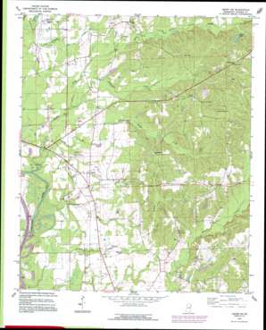
Amory Sw Topo Map Mississippi
To zoom in, hover over the map of Amory Sw
USGS Topo Quad 33088g4 - 1:24,000 scale
| Topo Map Name: | Amory Sw |
| USGS Topo Quad ID: | 33088g4 |
| Print Size: | ca. 21 1/4" wide x 27" high |
| Southeast Coordinates: | 33.75° N latitude / 88.375° W longitude |
| Map Center Coordinates: | 33.8125° N latitude / 88.4375° W longitude |
| U.S. State: | MS |
| Filename: | o33088g4.jpg |
| Download Map JPG Image: | Amory Sw topo map 1:24,000 scale |
| Map Type: | Topographic |
| Topo Series: | 7.5´ |
| Map Scale: | 1:24,000 |
| Source of Map Images: | United States Geological Survey (USGS) |
| Alternate Map Versions: |
Amory SW MS 1966, updated 1967 Download PDF Buy paper map Amory SW MS 1966, updated 1982 Download PDF Buy paper map Amory SW MS 1992, updated 1995 Download PDF Buy paper map Amory SW MS 2012 Download PDF Buy paper map Amory SW MS 2015 Download PDF Buy paper map |
1:24,000 Topo Quads surrounding Amory Sw
> Back to 33088e1 at 1:100,000 scale
> Back to 33088a1 at 1:250,000 scale
> Back to U.S. Topo Maps home
Amory Sw topo map: Gazetteer
Amory Sw: Airports
Monroe County Airport elevation 68m 223′Amory Sw: Crossings
Lackeys Ferry (historical) elevation 51m 167′Amory Sw: Dams
A L House Catfish Farm Dam elevation 74m 242′Robert Williams Pond Dam elevation 60m 196′
Weeks Lake Dam elevation 88m 288′
Amory Sw: Populated Places
Ashland (historical) elevation 67m 219′Athens elevation 92m 301′
Lackey elevation 67m 219′
Vassar (historical) elevation 101m 331′
Wesley (historical) elevation 66m 216′
Westville elevation 116m 380′
Amory Sw: Reservoirs
None elevation 74m 242′Weeks Lake elevation 93m 305′
Amory Sw: Streams
Broyles Creek elevation 54m 177′Butler Creek elevation 51m 167′
James Creek elevation 51m 167′
Nichols Creek elevation 51m 167′
Stonewall Creek elevation 60m 196′
Amory Sw digital topo map on disk
Buy this Amory Sw topo map showing relief, roads, GPS coordinates and other geographical features, as a high-resolution digital map file on DVD:


