Prairie Topo Map Mississippi
To zoom in, hover over the map of Prairie
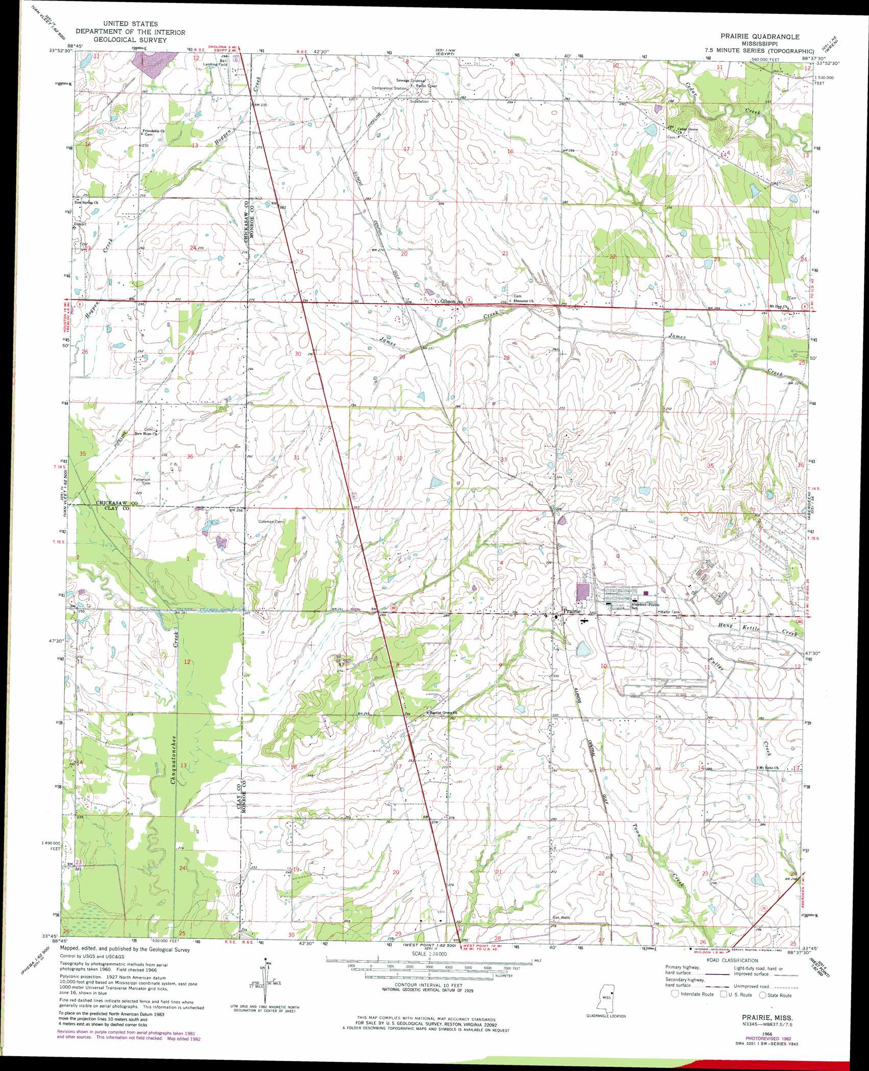
USGS Topo Quad 33088g6 - 1:24,000 scale
| Topo Map Name: | Prairie |
| USGS Topo Quad ID: | 33088g6 |
| Print Size: | ca. 21 1/4" wide x 27" high |
| Southeast Coordinates: | 33.75° N latitude / 88.625° W longitude |
| Map Center Coordinates: | 33.8125° N latitude / 88.6875° W longitude |
| U.S. State: | MS |
| Filename: | o33088g6.jpg |
| Download Map JPG Image: | Prairie topo map 1:24,000 scale |
| Map Type: | Topographic |
| Topo Series: | 7.5´ |
| Map Scale: | 1:24,000 |
| Source of Map Images: | United States Geological Survey (USGS) |
| Alternate Map Versions: |
Prairie MS 1966, updated 1967 Download PDF Buy paper map Prairie MS 1966, updated 1982 Download PDF Buy paper map Prairie MS 2012 Download PDF Buy paper map Prairie MS 2015 Download PDF Buy paper map |
1:24,000 Topo Quads surrounding Prairie
Troy |
Troy Se |
Shannon |
Nettleton |
Smithville |
Houston East |
Buena Vista |
Egypt |
Wren |
Amory |
Sparta |
Trebloc |
Prairie |
Aberdeen |
Amory Sw |
Montpelier |
Palo Alto |
Muldon |
Strong |
Hamilton |
Pheba |
Cedar Bluff |
West Point |
Waverly |
Columbus North |
> Back to 33088e1 at 1:100,000 scale
> Back to 33088a1 at 1:250,000 scale
> Back to U.S. Topo Maps home
Prairie topo map: Gazetteer
Prairie: Airports
Ball Airport elevation 89m 291′Prairie: Dams
Chuquatonchee Structure 19 Dam elevation 84m 275′Ingehosia Farms Lake Dam elevation 71m 232′
Prairie: Populated Places
Gibson elevation 80m 262′Prairie elevation 91m 298′
Terrells (historical) elevation 80m 262′
Prairie digital topo map on disk
Buy this Prairie topo map showing relief, roads, GPS coordinates and other geographical features, as a high-resolution digital map file on DVD: