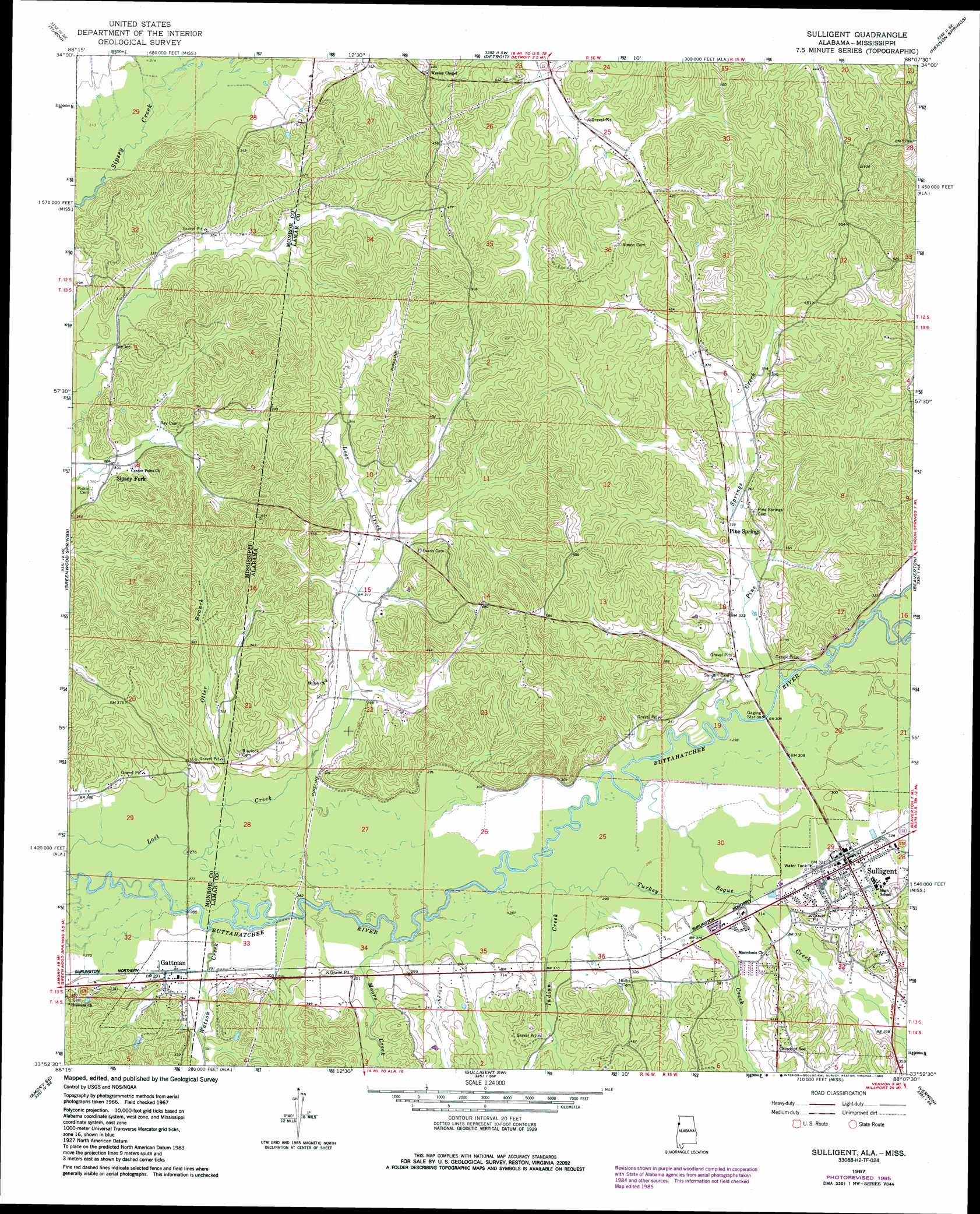
Sulligent Topo Map Alabama
To zoom in, hover over the map of Sulligent
USGS Topo Quad 33088h2 - 1:24,000 scale
| Topo Map Name: | Sulligent |
| USGS Topo Quad ID: | 33088h2 |
| Print Size: | ca. 21 1/4" wide x 27" high |
| Southeast Coordinates: | 33.875° N latitude / 88.125° W longitude |
| Map Center Coordinates: | 33.9375° N latitude / 88.1875° W longitude |
| U.S. States: | AL, MS |
| Filename: | o33088h2.jpg |
| Download Map JPG Image: | Sulligent topo map 1:24,000 scale |
| Map Type: | Topographic |
| Topo Series: | 7.5´ |
| Map Scale: | 1:24,000 |
| Source of Map Images: | United States Geological Survey (USGS) |
| Alternate Map Versions: |
Sulligent AL 1967, updated 1968 Download PDF Buy paper map Sulligent AL 1967, updated 1986 Download PDF Buy paper map Sulligent AL 2011 Download PDF Buy paper map Sulligent AL 2014 Download PDF Buy paper map |
1:24,000 Topo Quads surrounding Sulligent
Beans Ferry |
Tremont |
Bexar |
Weston |
Hamilton |
Smithville |
Turon |
Detroit |
Henson Springs |
Hamilton Sw |
Amory |
Greenwood Springs |
Sulligent |
Beaverton |
Guin |
Amory Sw |
Amory Se |
Sulligent Sw |
Vernon |
Bluff |
Hamilton |
Caledonia |
Millport Nw |
Hightogy |
Belk |
> Back to 33088e1 at 1:100,000 scale
> Back to 33088a1 at 1:250,000 scale
> Back to U.S. Topo Maps home
Sulligent topo map: Gazetteer
Sulligent: Oilfields
Wesley Chapel Gas Field elevation 134m 439′Sulligent: Parks
Brown Stadium elevation 110m 360′Sulligent: Populated Places
Gattman elevation 91m 298′Pine Springs elevation 101m 331′
Sipsey Fork elevation 92m 301′
Sulligent elevation 99m 324′
Sulligent: Post Offices
Sulligent Post Office elevation 100m 328′Sulligent: Streams
Bogue Creek elevation 88m 288′Indian Creek elevation 87m 285′
Moors Creek elevation 85m 278′
Otter Branch elevation 84m 275′
Otter Branch elevation 84m 275′
Pine Springs Creek elevation 90m 295′
Turkey Creek elevation 86m 282′
Watson Creek elevation 84m 275′
Sulligent digital topo map on disk
Buy this Sulligent topo map showing relief, roads, GPS coordinates and other geographical features, as a high-resolution digital map file on DVD: