Kosciusko Ne Topo Map Mississippi
To zoom in, hover over the map of Kosciusko Ne
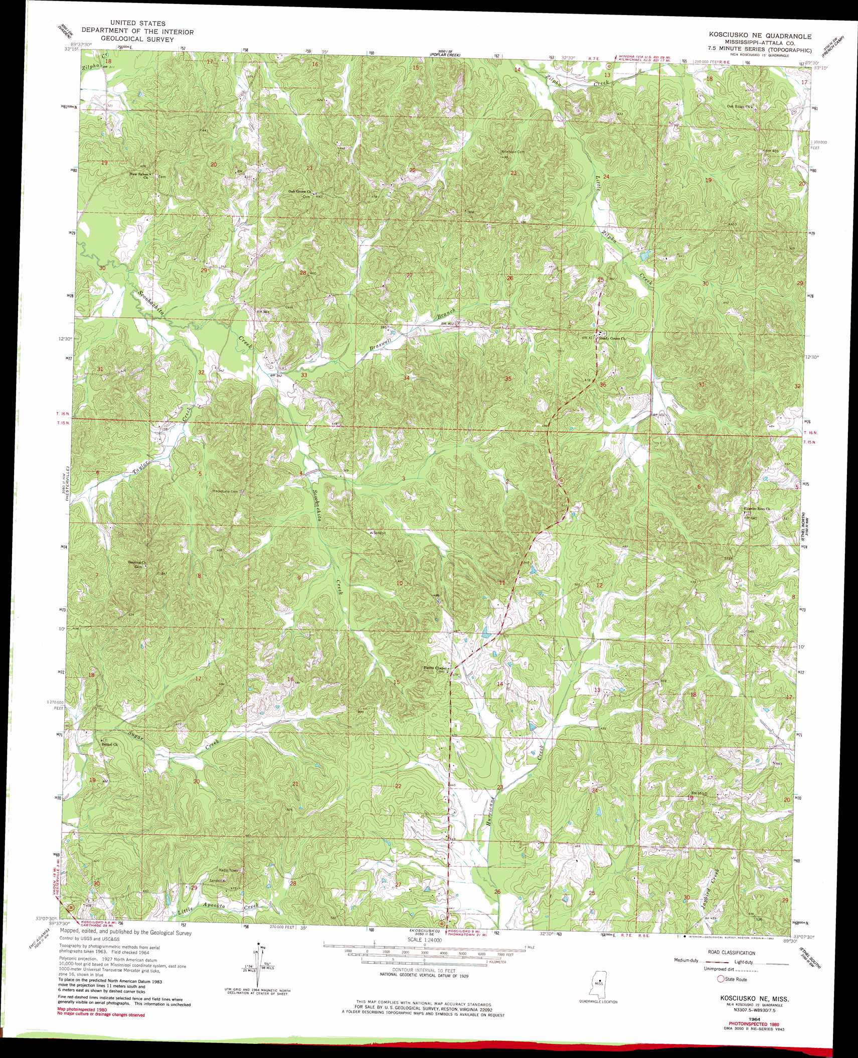
USGS Topo Quad 33089b5 - 1:24,000 scale
| Topo Map Name: | Kosciusko Ne |
| USGS Topo Quad ID: | 33089b5 |
| Print Size: | ca. 21 1/4" wide x 27" high |
| Southeast Coordinates: | 33.125° N latitude / 89.5° W longitude |
| Map Center Coordinates: | 33.1875° N latitude / 89.5625° W longitude |
| U.S. State: | MS |
| Filename: | o33089b5.jpg |
| Download Map JPG Image: | Kosciusko Ne topo map 1:24,000 scale |
| Map Type: | Topographic |
| Topo Series: | 7.5´ |
| Map Scale: | 1:24,000 |
| Source of Map Images: | United States Geological Survey (USGS) |
| Alternate Map Versions: |
Kosciusko NE MS 1964, updated 1965 Download PDF Buy paper map Kosciusko NE MS 1964, updated 1982 Download PDF Buy paper map Kosciusko NE MS 1964, updated 1982 Download PDF Buy paper map Kosciusko NE MS 2012 Download PDF Buy paper map Kosciusko NE MS 2015 Download PDF Buy paper map |
1:24,000 Topo Quads surrounding Kosciusko Ne
Bailey Lake |
Winona |
Kilmichael |
Stewart |
Tomnolen |
Peachahala Creek |
Vaiden |
Poplar Creek |
French Camp |
Weir |
West |
Hesterville |
Kosciusko Ne |
Ethel North |
Mccool |
Durant |
Mcadams |
Kosciusko |
Ethel South |
Ethel Se |
Newport |
Joseph |
Singleton |
Zama |
Four Corners |
> Back to 33089a1 at 1:100,000 scale
> Back to 33088a1 at 1:250,000 scale
> Back to U.S. Topo Maps home
Kosciusko Ne topo map: Gazetteer
Kosciusko Ne: Dams
Wade Lake Dam elevation 98m 321′Kosciusko Ne: Populated Places
Burkettsville (historical) elevation 124m 406′Chita (historical) elevation 125m 410′
Forrest (historical) elevation 168m 551′
Langley (historical) elevation 138m 452′
Macedonia (historical) elevation 139m 456′
Oak Ridge (historical) elevation 140m 459′
Pierces Chapel elevation 145m 475′
Pilgrims Rest (historical) elevation 171m 561′
Shady Grove elevation 126m 413′
Kosciusko Ne: Post Offices
Heath Post Office (historical) elevation 114m 374′Kosciusko Ne: Streams
Braswell Branch elevation 101m 331′Little Zilpha Creek elevation 104m 341′
Taylor Creek elevation 97m 318′
Kosciusko Ne digital topo map on disk
Buy this Kosciusko Ne topo map showing relief, roads, GPS coordinates and other geographical features, as a high-resolution digital map file on DVD: