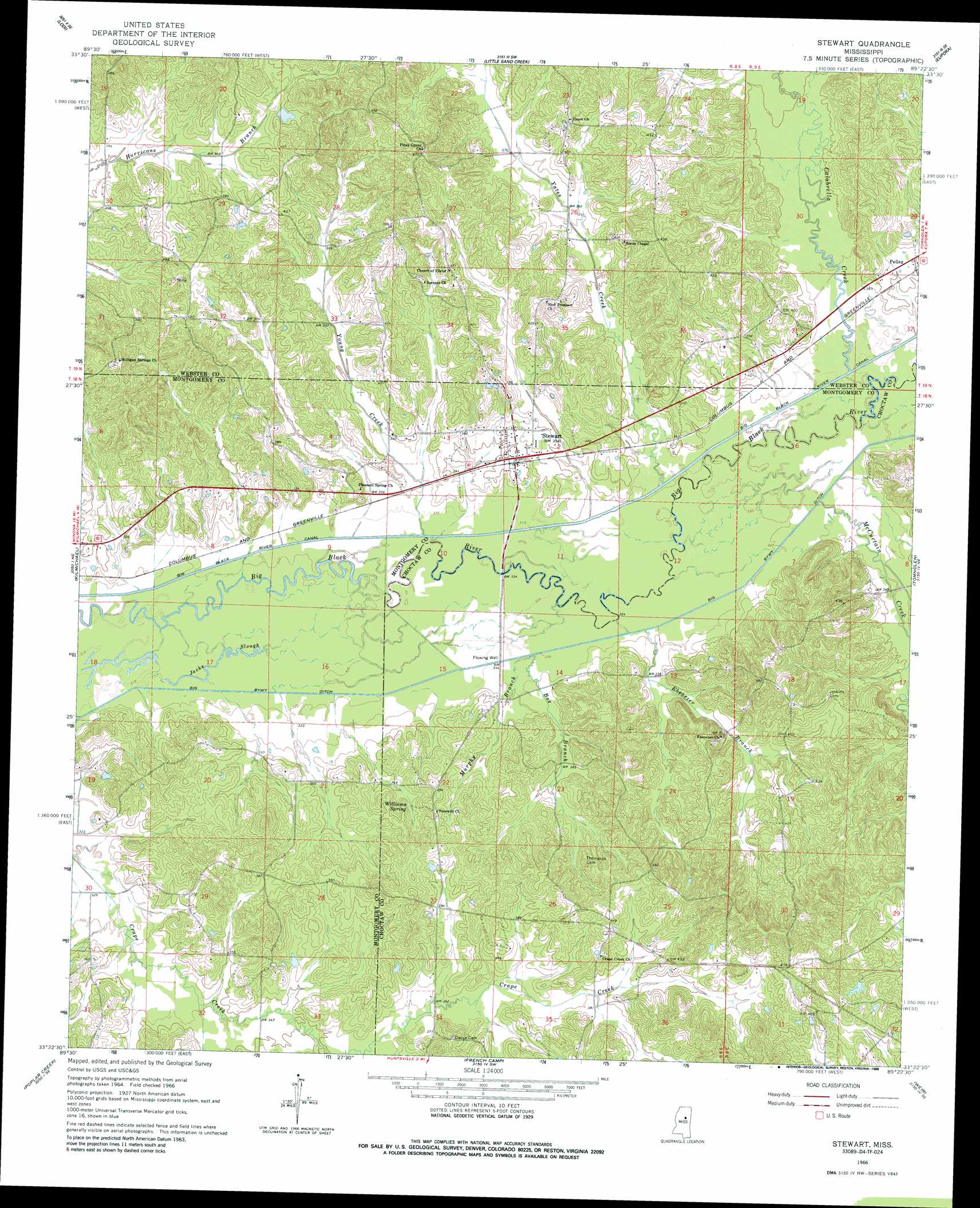
Stewart Topo Map Mississippi
To zoom in, hover over the map of Stewart
USGS Topo Quad 33089d4 - 1:24,000 scale
| Topo Map Name: | Stewart |
| USGS Topo Quad ID: | 33089d4 |
| Print Size: | ca. 21 1/4" wide x 27" high |
| Southeast Coordinates: | 33.375° N latitude / 89.375° W longitude |
| Map Center Coordinates: | 33.4375° N latitude / 89.4375° W longitude |
| U.S. State: | MS |
| Filename: | o33089d4.jpg |
| Download Map JPG Image: | Stewart topo map 1:24,000 scale |
| Map Type: | Topographic |
| Topo Series: | 7.5´ |
| Map Scale: | 1:24,000 |
| Source of Map Images: | United States Geological Survey (USGS) |
| Alternate Map Versions: |
Stewart MS 1966, updated 1967 Download PDF Buy paper map Stewart MS 1966, updated 1988 Download PDF Buy paper map Stewart MS 2012 Download PDF Buy paper map Stewart MS 2015 Download PDF Buy paper map |
1:24,000 Topo Quads surrounding Stewart
Duck Hill |
Sweatman |
Cadaretta |
Bellefontaine |
Hohenlinden |
Eskridge |
Lodi |
Little Sand Creek |
Eupora |
Sapa |
Winona |
Kilmichael |
Stewart |
Tomnolen |
Reform |
Vaiden |
Poplar Creek |
French Camp |
Weir |
Ackerman |
Hesterville |
Kosciusko Ne |
Ethel North |
Mccool |
Highpoint |
> Back to 33089a1 at 1:100,000 scale
> Back to 33088a1 at 1:250,000 scale
> Back to U.S. Topo Maps home
Stewart topo map: Gazetteer
Stewart: Dams
Gaylon Williams Lake Dam elevation 112m 367′Hunting Club Lake Dam elevation 110m 360′
Mississippi No Name 223 Dam elevation 106m 347′
Mississippi No Name 224 Dam elevation 109m 357′
Stewart: Populated Places
Pellez elevation 118m 387′Stewart elevation 107m 351′
Stewart: Springs
Williams Spring elevation 116m 380′Stewart: Streams
Box Branch elevation 98m 321′Calabrella Creek elevation 102m 334′
Ebenezer Branch elevation 99m 324′
McCurtain Creek elevation 101m 331′
Murphy Branch elevation 98m 321′
Yates Creek elevation 100m 328′
Young Creek elevation 96m 314′
Stewart digital topo map on disk
Buy this Stewart topo map showing relief, roads, GPS coordinates and other geographical features, as a high-resolution digital map file on DVD: