Sapa Topo Map Mississippi
To zoom in, hover over the map of Sapa
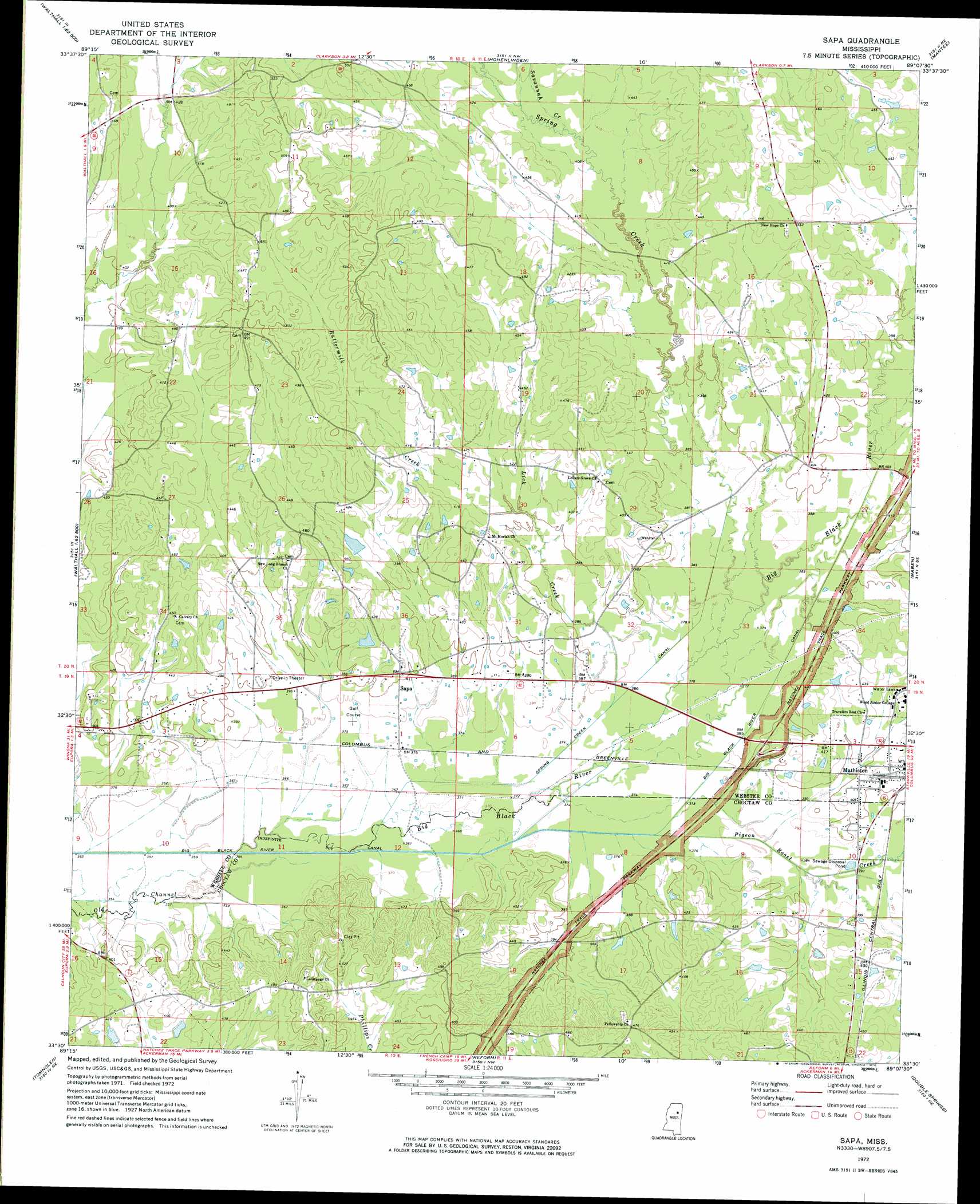
USGS Topo Quad 33089e2 - 1:24,000 scale
| Topo Map Name: | Sapa |
| USGS Topo Quad ID: | 33089e2 |
| Print Size: | ca. 21 1/4" wide x 27" high |
| Southeast Coordinates: | 33.5° N latitude / 89.125° W longitude |
| Map Center Coordinates: | 33.5625° N latitude / 89.1875° W longitude |
| U.S. State: | MS |
| Filename: | o33089e2.jpg |
| Download Map JPG Image: | Sapa topo map 1:24,000 scale |
| Map Type: | Topographic |
| Topo Series: | 7.5´ |
| Map Scale: | 1:24,000 |
| Source of Map Images: | United States Geological Survey (USGS) |
| Alternate Map Versions: |
Sapa MS 1972, updated 1974 Download PDF Buy paper map Sapa MS 2012 Download PDF Buy paper map Sapa MS 2015 Download PDF Buy paper map |
1:24,000 Topo Quads surrounding Sapa
Big Creek |
Calhoun City |
Atlanta |
Woodland |
Sparta |
Cadaretta |
Bellefontaine |
Hohenlinden |
Mantee |
Montpelier |
Little Sand Creek |
Eupora |
Sapa |
Maben |
Pheba |
Stewart |
Tomnolen |
Reform |
Double Springs |
Longview |
French Camp |
Weir |
Ackerman |
Sturgis |
Bradley |
> Back to 33089e1 at 1:100,000 scale
> Back to 33088a1 at 1:250,000 scale
> Back to U.S. Topo Maps home
Sapa topo map: Gazetteer
Sapa: Canals
Big Black River Canal elevation 110m 360′Spring Creek Canal elevation 114m 374′
Sapa: Dams
Church Lake Dam elevation 124m 406′Roland Lake Dam elevation 128m 419′
Sapa: Parks
Crawford Field elevation 122m 400′Sapa: Populated Places
Sapa elevation 127m 416′Sapa: Streams
Ballard Branch elevation 112m 367′Buttermilk Creek elevation 122m 400′
Irvin Branch elevation 113m 370′
Lick Creek elevation 114m 374′
Pigeon Roost Creek elevation 113m 370′
Savannah Creek elevation 125m 410′
Sheffield Creek elevation 116m 380′
Spring Creek elevation 119m 390′
Sapa digital topo map on disk
Buy this Sapa topo map showing relief, roads, GPS coordinates and other geographical features, as a high-resolution digital map file on DVD: