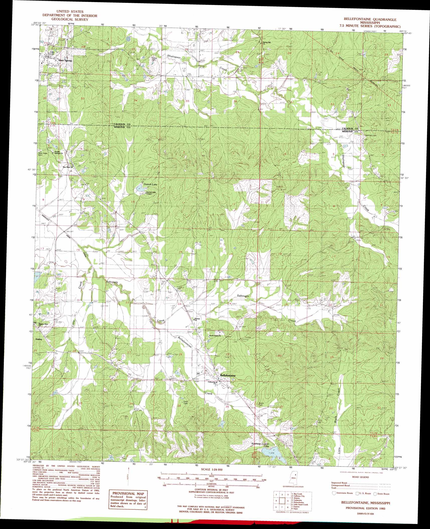
Bellefontaine Topo Map Mississippi
To zoom in, hover over the map of Bellefontaine
USGS Topo Quad 33089f3 - 1:24,000 scale
| Topo Map Name: | Bellefontaine |
| USGS Topo Quad ID: | 33089f3 |
| Print Size: | ca. 21 1/4" wide x 27" high |
| Southeast Coordinates: | 33.625° N latitude / 89.25° W longitude |
| Map Center Coordinates: | 33.6875° N latitude / 89.3125° W longitude |
| U.S. State: | MS |
| Filename: | o33089f3.jpg |
| Download Map JPG Image: | Bellefontaine topo map 1:24,000 scale |
| Map Type: | Topographic |
| Topo Series: | 7.5´ |
| Map Scale: | 1:24,000 |
| Source of Map Images: | United States Geological Survey (USGS) |
| Alternate Map Versions: |
Walthall NE MS 1976, updated 1977 Download PDF Buy paper map Bellefontaine MS 1983, updated 1984 Download PDF Buy paper map Bellefontaine MS 2012 Download PDF Buy paper map Bellefontaine MS 2015 Download PDF Buy paper map |
1:24,000 Topo Quads surrounding Bellefontaine
Benwood |
Skuna |
Bruce |
Vardaman |
Houston West |
Gore Springs |
Big Creek |
Calhoun City |
Atlanta |
Woodland |
Sweatman |
Cadaretta |
Bellefontaine |
Hohenlinden |
Mantee |
Lodi |
Little Sand Creek |
Eupora |
Sapa |
Maben |
Kilmichael |
Stewart |
Tomnolen |
Reform |
Double Springs |
> Back to 33089e1 at 1:100,000 scale
> Back to 33088a1 at 1:250,000 scale
> Back to U.S. Topo Maps home
Bellefontaine topo map: Gazetteer
Bellefontaine: Dams
Dorroh Lake Dam elevation 103m 337′Hardy Lake Dam elevation 116m 380′
West Lake Dam elevation 81m 265′
Bellefontaine: Populated Places
Bellefontaine elevation 106m 347′Embry elevation 102m 334′
Slate Spring elevation 104m 341′
Bellefontaine: Post Offices
Bellefontaine Post Office elevation 105m 344′Bellefontaine: Reservoirs
American Legion elevation 110m 360′Dorroh Lake elevation 100m 328′
Bellefontaine: Streams
Bellefontaine Creek elevation 92m 301′Little Creek elevation 86m 282′
Bellefontaine digital topo map on disk
Buy this Bellefontaine topo map showing relief, roads, GPS coordinates and other geographical features, as a high-resolution digital map file on DVD: