Grenada Topo Map Mississippi
To zoom in, hover over the map of Grenada
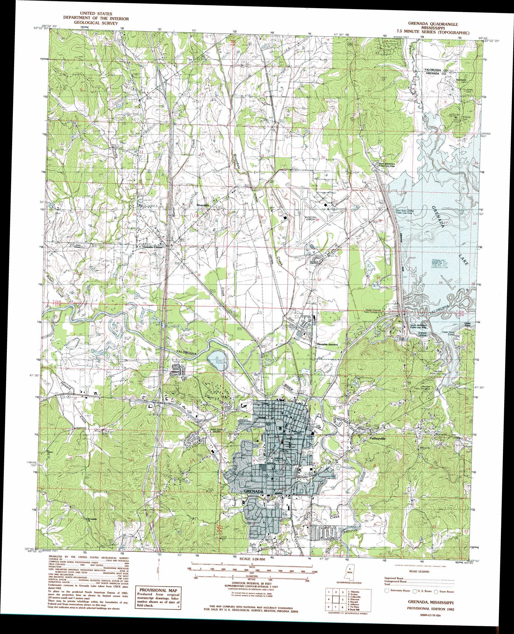
USGS Topo Quad 33089g7 - 1:24,000 scale
| Topo Map Name: | Grenada |
| USGS Topo Quad ID: | 33089g7 |
| Print Size: | ca. 21 1/4" wide x 27" high |
| Southeast Coordinates: | 33.75° N latitude / 89.75° W longitude |
| Map Center Coordinates: | 33.8125° N latitude / 89.8125° W longitude |
| U.S. State: | MS |
| Filename: | o33089g7.jpg |
| Download Map JPG Image: | Grenada topo map 1:24,000 scale |
| Map Type: | Topographic |
| Topo Series: | 7.5´ |
| Map Scale: | 1:24,000 |
| Source of Map Images: | United States Geological Survey (USGS) |
| Alternate Map Versions: |
Grenada MS 1983, updated 1984 Download PDF Buy paper map Grenada MS 2012 Download PDF Buy paper map Grenada MS 2015 Download PDF Buy paper map |
1:24,000 Topo Quads surrounding Grenada
Charleston |
Oakland |
Coker Lake |
Velma |
Pine Valley |
Paynes |
Tillatoba |
Scobey |
Coffeeville |
Benwood |
Cascilla |
Holcomb |
Grenada |
Kincaid |
Gore Springs |
Avalon |
Jefferson |
Tie Plant |
Duck Hill |
Sweatman |
Browning |
North Carrollton |
Mccarley |
Eskridge |
Lodi |
> Back to 33089e1 at 1:100,000 scale
> Back to 33088a1 at 1:250,000 scale
> Back to U.S. Topo Maps home
Grenada topo map: Gazetteer
Grenada: Airports
Grenada Municipal Airport elevation 60m 196′Grenada: Capes
Cedar Point elevation 82m 269′Grenada: Crossings
Interchange 206 elevation 81m 265′Interchange 211 elevation 79m 259′
Sherman Ferry (historical) elevation 49m 160′
Grenada: Dams
Grenada Dam elevation 55m 180′Grenada Farms Pond Dam elevation 69m 226′
Hanwood Lake Dam elevation 72m 236′
Lickfold Lake Dam elevation 50m 164′
Grenada: Parks
Bledsoe Park elevation 64m 209′Butler Hill Park elevation 66m 216′
Dam Area Central Public Use Area elevation 60m 196′
Lakeview Public Use Area elevation 74m 242′
North Abutment Public Use Area elevation 71m 232′
Old Fort Public Use Area elevation 70m 229′
South Abutment Public Use Area elevation 84m 275′
Grenada: Populated Places
Futheyville elevation 67m 219′Geeslin Corner elevation 61m 200′
Grenada elevation 66m 216′
Grenada Landing elevation 61m 200′
Kirkman Landing elevation 61m 200′
Memphis Junction elevation 55m 180′
Riverdale elevation 62m 203′
Grenada: Reservoirs
Grenada Lake elevation 55m 180′Grenada: Streams
Baker Creek elevation 52m 170′Batupan Bogue elevation 46m 150′
Brown Creek elevation 57m 187′
Dement Creek elevation 49m 160′
Gibbs Creek elevation 61m 200′
Martin Creek elevation 51m 167′
Perry Creek elevation 61m 200′
Perry Creek elevation 52m 170′
Purdie Creek elevation 50m 164′
Riverdale Creek elevation 50m 164′
Grenada digital topo map on disk
Buy this Grenada topo map showing relief, roads, GPS coordinates and other geographical features, as a high-resolution digital map file on DVD: