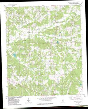
Lexington North Topo Map Mississippi
To zoom in, hover over the map of Lexington North
USGS Topo Quad 33090b1 - 1:24,000 scale
| Topo Map Name: | Lexington North |
| USGS Topo Quad ID: | 33090b1 |
| Print Size: | ca. 21 1/4" wide x 27" high |
| Southeast Coordinates: | 33.125° N latitude / 90° W longitude |
| Map Center Coordinates: | 33.1875° N latitude / 90.0625° W longitude |
| U.S. State: | MS |
| Filename: | o33090b1.jpg |
| Download Map JPG Image: | Lexington North topo map 1:24,000 scale |
| Map Type: | Topographic |
| Topo Series: | 7.5´ |
| Map Scale: | 1:24,000 |
| Source of Map Images: | United States Geological Survey (USGS) |
| Alternate Map Versions: |
Lexington North MS 1982, updated 1982 Download PDF Buy paper map Lexington North MS 2012 Download PDF Buy paper map Lexington North MS 2015 Download PDF Buy paper map |
1:24,000 Topo Quads surrounding Lexington North
> Back to 33090a1 at 1:100,000 scale
> Back to 33090a1 at 1:250,000 scale
> Back to U.S. Topo Maps home
Lexington North topo map: Gazetteer
Lexington North: Airports
C A Moore Airport elevation 99m 324′Lexington North: Dams
Black Watershed Y-36-21 Dam elevation 92m 301′Black Watershed Y-36-23 Dam elevation 63m 206′
Black Watershed Y-36-28 Dam elevation 86m 282′
Edmund Hooker Lake Dam elevation 98m 321′
Lexington North: Populated Places
Ituma elevation 97m 318′Lebanon elevation 100m 328′
Oregon elevation 97m 318′
Lexington North: Streams
Bophumpa Creek elevation 60m 196′Dry Creek elevation 69m 226′
Little Fannegusha Creek elevation 75m 246′
Whites Creek elevation 61m 200′
Lexington North digital topo map on disk
Buy this Lexington North topo map showing relief, roads, GPS coordinates and other geographical features, as a high-resolution digital map file on DVD:


