Arcola Topo Map Mississippi
To zoom in, hover over the map of Arcola
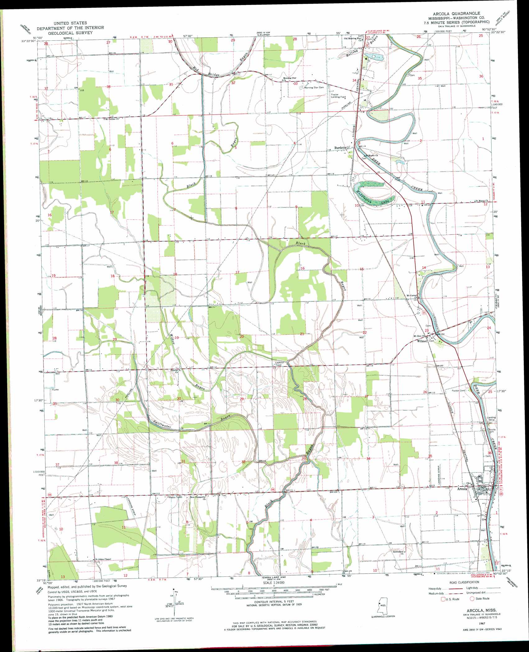
USGS Topo Quad 33090c8 - 1:24,000 scale
| Topo Map Name: | Arcola |
| USGS Topo Quad ID: | 33090c8 |
| Print Size: | ca. 21 1/4" wide x 27" high |
| Southeast Coordinates: | 33.25° N latitude / 90.875° W longitude |
| Map Center Coordinates: | 33.3125° N latitude / 90.9375° W longitude |
| U.S. State: | MS |
| Filename: | o33090c8.jpg |
| Download Map JPG Image: | Arcola topo map 1:24,000 scale |
| Map Type: | Topographic |
| Topo Series: | 7.5´ |
| Map Scale: | 1:24,000 |
| Source of Map Images: | United States Geological Survey (USGS) |
| Alternate Map Versions: |
Arcola MS 1967, updated 1968 Download PDF Buy paper map Arcola MS 1967, updated 1982 Download PDF Buy paper map Arcola MS 2012 Download PDF Buy paper map Arcola MS 2015 Download PDF Buy paper map |
1:24,000 Topo Quads surrounding Arcola
Arkansas City |
Scott |
Stringtown |
Shaw |
Boyer |
Luna |
Greenville |
Leland |
Holly Ridge |
Indianola |
Red Leaf |
Wayside |
Arcola |
Tribbett |
Kinlock |
Eminence |
Avon |
Swan Lake Nw |
Hollandale |
Midnight Nw |
Readland |
Glen Allan |
Percy |
Delta City |
Richey |
> Back to 33090a1 at 1:100,000 scale
> Back to 33090a1 at 1:250,000 scale
> Back to U.S. Topo Maps home
Arcola topo map: Gazetteer
Arcola: Airports
Abide Airpark elevation 33m 108′Arcola: Dams
Aqua Farms Dam elevation 33m 108′Ballard Lake Dam elevation 33m 108′
L and W Catfish Ponds Dam elevation 33m 108′
Wingfield Lake Dam elevation 33m 108′
Arcola: Lakes
Huddleston Lake elevation 35m 114′Arcola: Populated Places
Aldridge elevation 36m 118′Almy elevation 34m 111′
Arcola elevation 37m 121′
Burdette elevation 36m 118′
Hays elevation 37m 121′
Isenberg elevation 36m 118′
Johnston elevation 36m 118′
Jones Chapel elevation 36m 118′
Quay (historical) elevation 36m 118′
Wilmot elevation 36m 118′
Arcola: Streams
Rolling Bayou elevation 33m 108′Swiftwater Bayou elevation 29m 95′
Widow Bayou elevation 31m 101′
Arcola digital topo map on disk
Buy this Arcola topo map showing relief, roads, GPS coordinates and other geographical features, as a high-resolution digital map file on DVD: