Shellmound Topo Map Mississippi
To zoom in, hover over the map of Shellmound
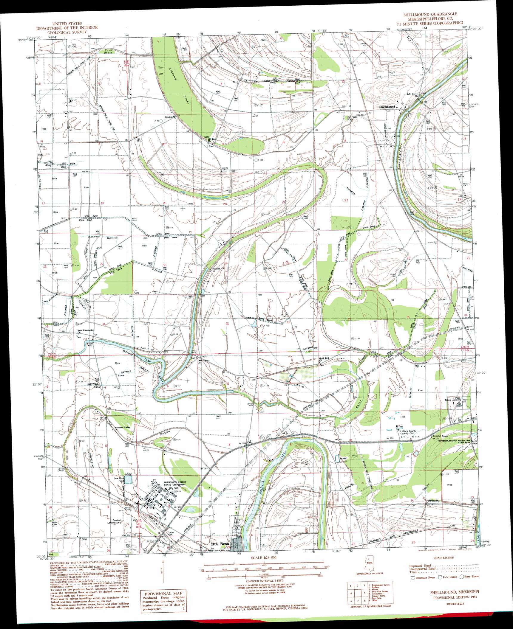
USGS Topo Quad 33090e3 - 1:24,000 scale
| Topo Map Name: | Shellmound |
| USGS Topo Quad ID: | 33090e3 |
| Print Size: | ca. 21 1/4" wide x 27" high |
| Southeast Coordinates: | 33.5° N latitude / 90.25° W longitude |
| Map Center Coordinates: | 33.5625° N latitude / 90.3125° W longitude |
| U.S. State: | MS |
| Filename: | o33090e3.jpg |
| Download Map JPG Image: | Shellmound topo map 1:24,000 scale |
| Map Type: | Topographic |
| Topo Series: | 7.5´ |
| Map Scale: | 1:24,000 |
| Source of Map Images: | United States Geological Survey (USGS) |
| Alternate Map Versions: |
Schlater SE MS 1974, updated 1975 Download PDF Buy paper map Shellmound MS 1983, updated 1984 Download PDF Buy paper map Shellmound MS 2012 Download PDF Buy paper map Shellmound MS 2015 Download PDF Buy paper map |
1:24,000 Topo Quads surrounding Shellmound
Drew |
Brooks |
Glendora |
Philipp |
Cascilla |
Ruleville |
Rattlesnake Bayou |
Schlater |
Money |
Avalon |
Sunflower |
Bear Gut Bayou |
Shellmound |
Greenwood |
Browning |
Moorhead |
Colony Town |
Itta Bena |
Sidon |
Gravel Hill |
Inverness |
Swiftown |
Montgomery |
Cruger |
Black Hawk |
> Back to 33090e1 at 1:100,000 scale
> Back to 33090a1 at 1:250,000 scale
> Back to U.S. Topo Maps home
Shellmound topo map: Gazetteer
Shellmound: Lakes
Lake Henry elevation 35m 114′Shellmound: Parks
Florewood River Plantation State Park elevation 40m 131′Shellmound: Populated Places
Fort Loring elevation 40m 131′Rixwood elevation 40m 131′
Shellmound elevation 41m 134′
Shellmound: Streams
Baker Creek elevation 35m 114′Shellmound: Swamps
Turo Brake elevation 37m 121′Shellmound digital topo map on disk
Buy this Shellmound topo map showing relief, roads, GPS coordinates and other geographical features, as a high-resolution digital map file on DVD: