Shaw Topo Map Mississippi
To zoom in, hover over the map of Shaw
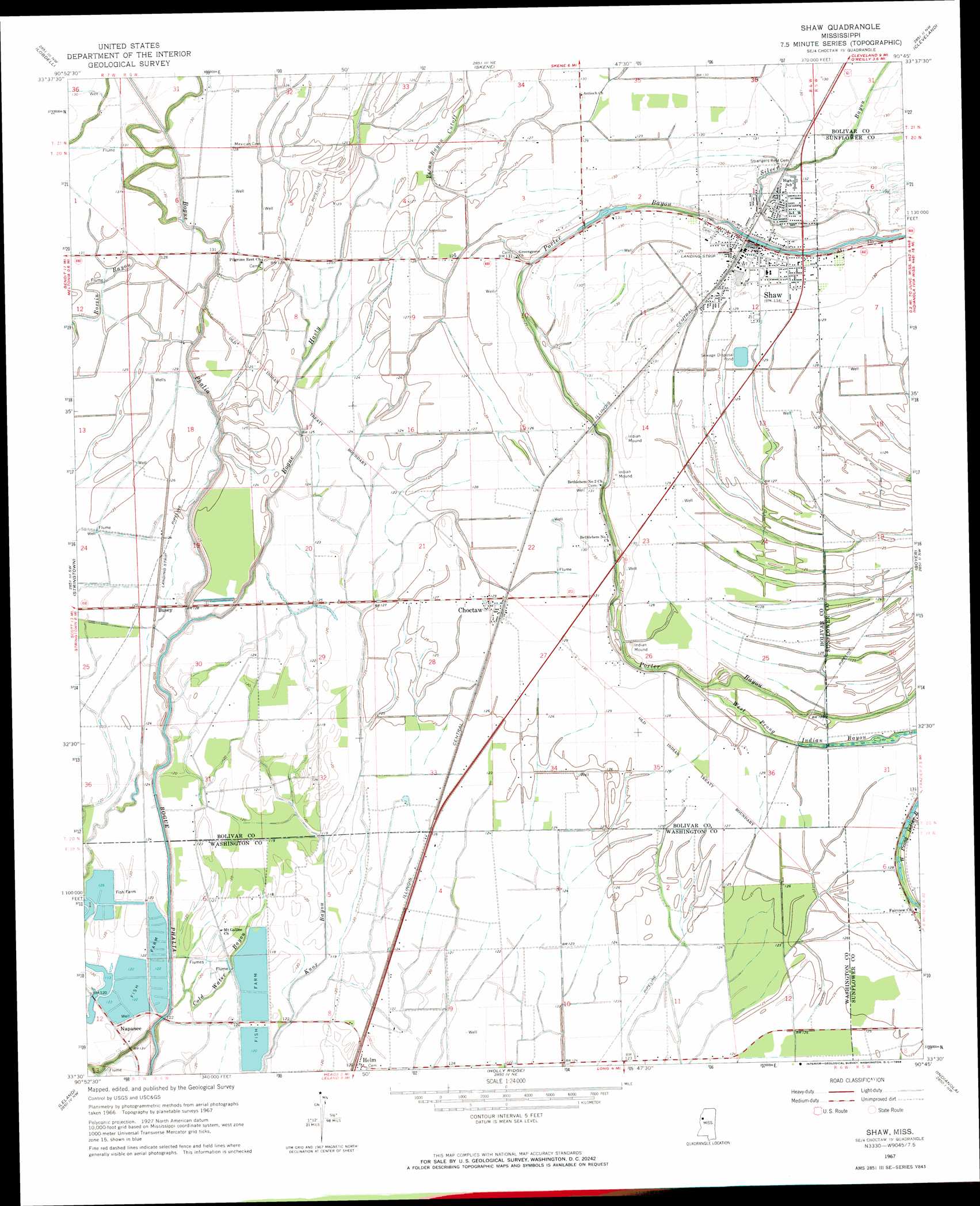
USGS Topo Quad 33090e7 - 1:24,000 scale
| Topo Map Name: | Shaw |
| USGS Topo Quad ID: | 33090e7 |
| Print Size: | ca. 21 1/4" wide x 27" high |
| Southeast Coordinates: | 33.5° N latitude / 90.75° W longitude |
| Map Center Coordinates: | 33.5625° N latitude / 90.8125° W longitude |
| U.S. State: | MS |
| Filename: | o33090e7.jpg |
| Download Map JPG Image: | Shaw topo map 1:24,000 scale |
| Map Type: | Topographic |
| Topo Series: | 7.5´ |
| Map Scale: | 1:24,000 |
| Source of Map Images: | United States Geological Survey (USGS) |
| Alternate Map Versions: |
Shaw MS 1967, updated 1968 Download PDF Buy paper map Shaw MS 1967, updated 1968 Download PDF Buy paper map Shaw MS 2012 Download PDF Buy paper map Shaw MS 2015 Download PDF Buy paper map |
1:24,000 Topo Quads surrounding Shaw
Rosedale |
Beulah |
Pace |
Merigold |
Drew |
Benoit |
Lobdell |
Skene |
Cleveland |
Ruleville |
Scott |
Stringtown |
Shaw |
Boyer |
Sunflower |
Greenville |
Leland |
Holly Ridge |
Indianola |
Moorhead |
Wayside |
Arcola |
Tribbett |
Kinlock |
Inverness |
> Back to 33090e1 at 1:100,000 scale
> Back to 33090a1 at 1:250,000 scale
> Back to U.S. Topo Maps home
Shaw topo map: Gazetteer
Shaw: Canals
Ditch Number Eight elevation 36m 118′Ditch Number Five elevation 37m 121′
Ditch Number Five A elevation 39m 127′
Ditch Number Nine elevation 36m 118′
Ditch Number Nine A elevation 35m 114′
Shaw: Dams
Harris Ranch Catfish Pond Dam elevation 33m 108′Shaw Sewage Lagoon Dam elevation 38m 124′
Shaw: Guts
Pecan Bayou Cutoff elevation 38m 124′Shaw: Populated Places
Busey elevation 38m 124′Choctaw elevation 39m 127′
Helm elevation 38m 124′
Napanee elevation 36m 118′
Shaw elevation 39m 127′
Turners Flat elevation 38m 124′
Shaw: Streams
Bogue Hasty elevation 32m 104′Clear Creek elevation 30m 98′
Cold Water Bayou elevation 32m 104′
Silver Bayou elevation 36m 118′
Shaw digital topo map on disk
Buy this Shaw topo map showing relief, roads, GPS coordinates and other geographical features, as a high-resolution digital map file on DVD: