Berlin Topo Map Arkansas
To zoom in, hover over the map of Berlin
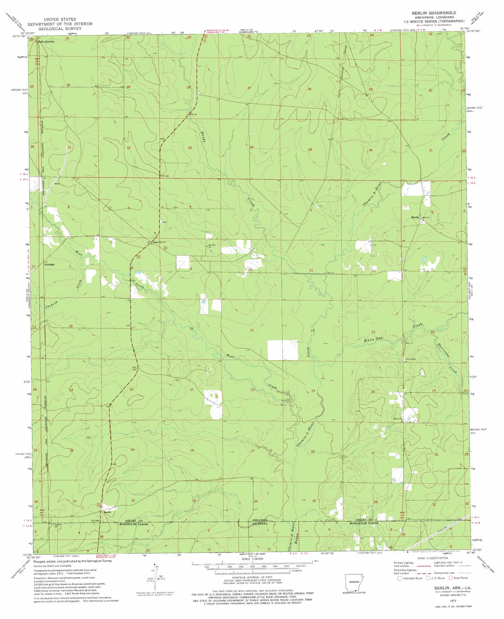
USGS Topo Quad 33091a7 - 1:24,000 scale
| Topo Map Name: | Berlin |
| USGS Topo Quad ID: | 33091a7 |
| Print Size: | ca. 21 1/4" wide x 27" high |
| Southeast Coordinates: | 33° N latitude / 91.75° W longitude |
| Map Center Coordinates: | 33.0625° N latitude / 91.8125° W longitude |
| U.S. States: | AR, LA |
| Filename: | o33091a7.jpg |
| Download Map JPG Image: | Berlin topo map 1:24,000 scale |
| Map Type: | Topographic |
| Topo Series: | 7.5´ |
| Map Scale: | 1:24,000 |
| Source of Map Images: | United States Geological Survey (USGS) |
| Alternate Map Versions: |
Berlin AR 1973, updated 1975 Download PDF Buy paper map Berlin AR 2002, updated 2003 Download PDF Buy paper map Berlin AR 2011 Download PDF Buy paper map Berlin AR 2014 Download PDF Buy paper map |
1:24,000 Topo Quads surrounding Berlin
Vick |
Milo |
Fountain Hill |
Mist |
Snyder |
Marais Saline |
Crossett North |
Hamburg |
Wilmot Nw |
Portland |
Felsenthal Dam |
Crossett South |
Berlin |
Wilmot Sw |
Wilmot |
Fish Lake |
Beckman |
Twin Oaks |
Bonita |
Laark |
Harrell Lake |
Bastrop |
Mer Rouge |
Bonita Sw |
Goodwill |
> Back to 33091a1 at 1:100,000 scale
> Back to 33090a1 at 1:250,000 scale
> Back to U.S. Topo Maps home
Berlin topo map: Gazetteer
Berlin: Populated Places
Berlin elevation 37m 121′Elon (historical) elevation 43m 141′
Geddie elevation 50m 164′
Gulledge elevation 41m 134′
Rawls elevation 46m 150′
Rolfe Junction elevation 44m 144′
Berlin: Streams
Chemin-A-Haut Creek elevation 32m 104′Hanks Creek elevation 33m 108′
Hill Creek elevation 31m 101′
Hurricane Creek elevation 37m 121′
Hurricane Creek elevation 33m 108′
Jackson Creek elevation 36m 118′
Maxwell Creek elevation 31m 101′
Weaver Creek elevation 33m 108′
West Creek elevation 32m 104′
White Oak Creek elevation 33m 108′
Berlin digital topo map on disk
Buy this Berlin topo map showing relief, roads, GPS coordinates and other geographical features, as a high-resolution digital map file on DVD: