Wilmot Nw Topo Map Arkansas
To zoom in, hover over the map of Wilmot Nw
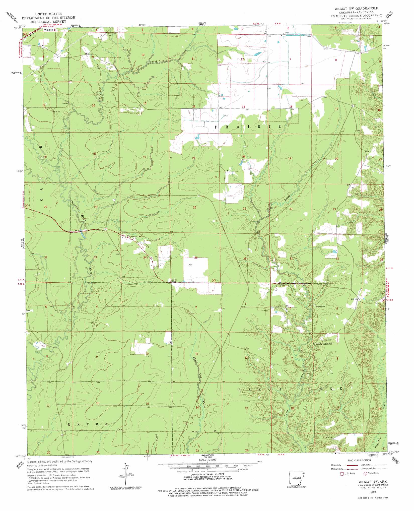
USGS Topo Quad 33091b6 - 1:24,000 scale
| Topo Map Name: | Wilmot Nw |
| USGS Topo Quad ID: | 33091b6 |
| Print Size: | ca. 21 1/4" wide x 27" high |
| Southeast Coordinates: | 33.125° N latitude / 91.625° W longitude |
| Map Center Coordinates: | 33.1875° N latitude / 91.6875° W longitude |
| U.S. State: | AR |
| Filename: | o33091b6.jpg |
| Download Map JPG Image: | Wilmot Nw topo map 1:24,000 scale |
| Map Type: | Topographic |
| Topo Series: | 7.5´ |
| Map Scale: | 1:24,000 |
| Source of Map Images: | United States Geological Survey (USGS) |
| Alternate Map Versions: |
Wilmot NW AR 1960, updated 1961 Download PDF Buy paper map Wilmot NW AR 1960, updated 1977 Download PDF Buy paper map Wilmot NW AR 2011 Download PDF Buy paper map Wilmot NW AR 2014 Download PDF Buy paper map |
1:24,000 Topo Quads surrounding Wilmot Nw
Longview |
Ladelle |
Mist Nw |
Line |
Jerome |
Milo |
Fountain Hill |
Mist |
Snyder |
Montrose |
Crossett North |
Hamburg |
Wilmot Nw |
Portland |
Eudora Nw |
Crossett South |
Berlin |
Wilmot Sw |
Wilmot |
Empire |
Beckman |
Twin Oaks |
Bonita |
Laark |
Fiske |
> Back to 33091a1 at 1:100,000 scale
> Back to 33090a1 at 1:250,000 scale
> Back to U.S. Topo Maps home
Wilmot Nw topo map: Gazetteer
Wilmot Nw: Areas
Brushy Prairie elevation 52m 170′Wilmot Nw: Dams
Young Lake Dam elevation 52m 170′Wilmot Nw: Populated Places
Wallace elevation 53m 173′Wilmot Nw: Reservoirs
Young Lake elevation 52m 170′Wilmot Nw: Streams
Haley Creek elevation 42m 137′Wilmot Nw digital topo map on disk
Buy this Wilmot Nw topo map showing relief, roads, GPS coordinates and other geographical features, as a high-resolution digital map file on DVD: