Wayside Topo Map Mississippi
To zoom in, hover over the map of Wayside
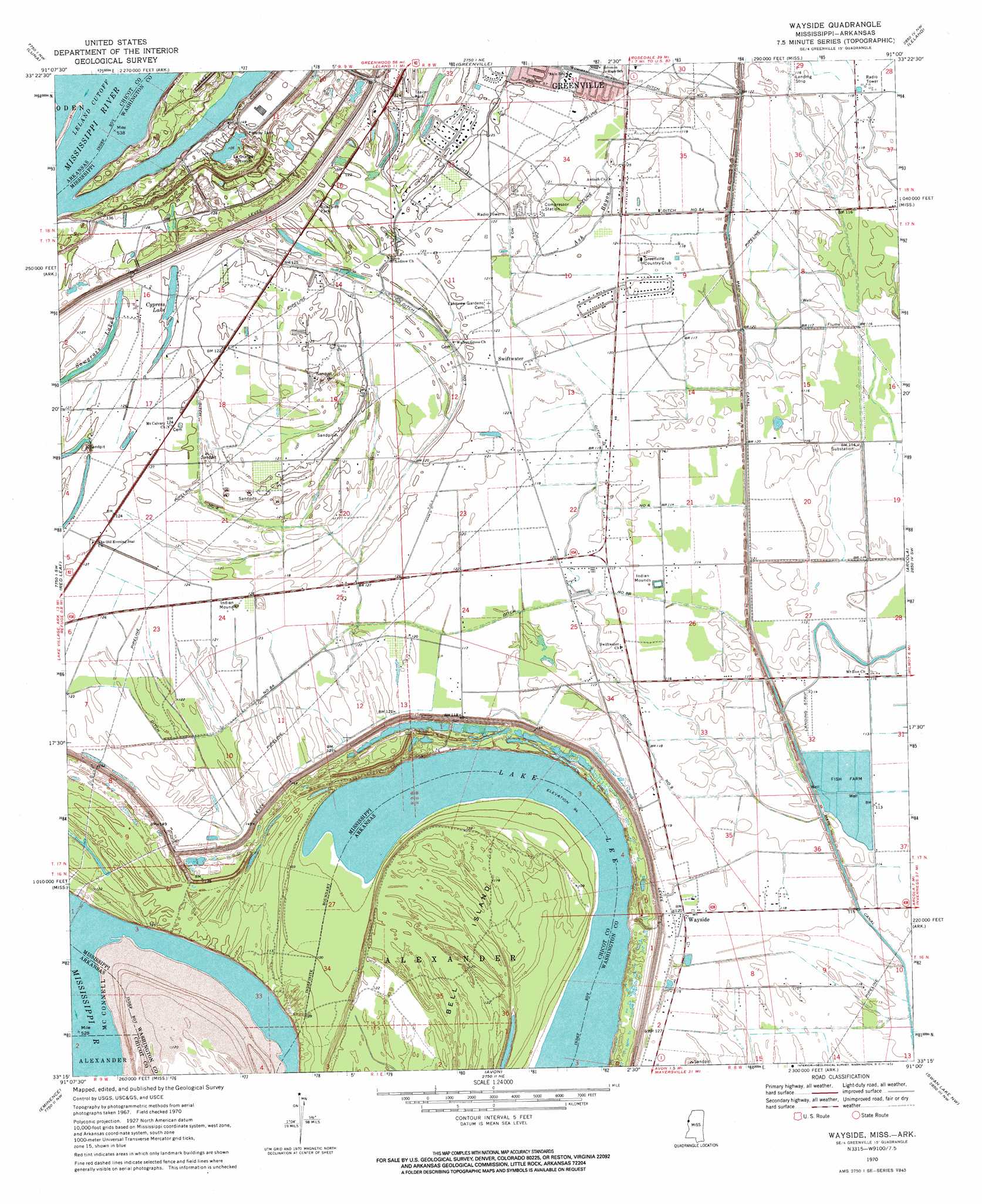
USGS Topo Quad 33091c1 - 1:24,000 scale
| Topo Map Name: | Wayside |
| USGS Topo Quad ID: | 33091c1 |
| Print Size: | ca. 21 1/4" wide x 27" high |
| Southeast Coordinates: | 33.25° N latitude / 91° W longitude |
| Map Center Coordinates: | 33.3125° N latitude / 91.0625° W longitude |
| U.S. States: | MS, AR |
| Filename: | o33091c1.jpg |
| Download Map JPG Image: | Wayside topo map 1:24,000 scale |
| Map Type: | Topographic |
| Topo Series: | 7.5´ |
| Map Scale: | 1:24,000 |
| Source of Map Images: | United States Geological Survey (USGS) |
| Alternate Map Versions: |
Wayside MS 1970, updated 1972 Download PDF Buy paper map Wayside MS 2011 Download PDF Buy paper map Wayside MS 2012 Download PDF Buy paper map Wayside MS 2015 Download PDF Buy paper map |
1:24,000 Topo Quads surrounding Wayside
Halley |
Arkansas City |
Scott |
Stringtown |
Shaw |
Macon Lake |
Luna |
Greenville |
Leland |
Holly Ridge |
Lake Village |
Red Leaf |
Wayside |
Arcola |
Tribbett |
Eudora North |
Eminence |
Avon |
Swan Lake Nw |
Hollandale |
Eudora South |
Readland |
Glen Allan |
Percy |
Delta City |
> Back to 33091a1 at 1:100,000 scale
> Back to 33090a1 at 1:250,000 scale
> Back to U.S. Topo Maps home
Wayside topo map: Gazetteer
Wayside: Airports
Country Club Airport elevation 35m 114′Wayside: Bends
American Bend elevation 28m 91′Leland Cutoff elevation 33m 108′
Wayside: Canals
Ditch Number Eight elevation 36m 118′Ditch Number Eight A elevation 34m 111′
Ditch Number Eightyeight elevation 34m 111′
Ditch Number Five elevation 33m 108′
Ditch Number Five A elevation 35m 114′
Ditch Number Nine elevation 33m 108′
Ditch Number Seven elevation 35m 114′
Ditch Number Six elevation 35m 114′
Main Canal elevation 33m 108′
Wayside: Capes
Walnut Point elevation 28m 91′Wayside: Channels
American Cutoff elevation 36m 118′Wayside: Dams
Bledsoe Lake Dam elevation 36m 118′James and Bobby Dycus Pond Dam elevation 35m 114′
L and W Catfish Ponds Dam elevation 34m 111′
Wayside: Islands
Bell Island elevation 38m 124′La Grange Towhead elevation 40m 131′
Wayside: Lakes
Cypress Lake elevation 38m 124′LaGrange Crevasse elevation 32m 104′
Lake Lee elevation 28m 91′
Sawgrass Lake elevation 37m 121′
Wayside: Levees
Warfield Revetment elevation 29m 95′Wayside: Parks
Elwyn Ward Recreational Center elevation 37m 121′Wayside: Populated Places
Dredge (historical) elevation 36m 118′Swiftwater elevation 37m 121′
Wayside elevation 37m 121′
Wayside: Streams
Ash Bayou elevation 33m 108′Wayside digital topo map on disk
Buy this Wayside topo map showing relief, roads, GPS coordinates and other geographical features, as a high-resolution digital map file on DVD: