Longview Topo Map Arkansas
To zoom in, hover over the map of Longview
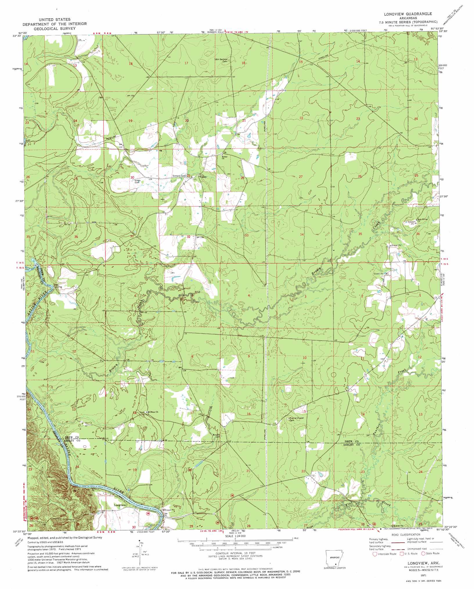
USGS Topo Quad 33091d8 - 1:24,000 scale
| Topo Map Name: | Longview |
| USGS Topo Quad ID: | 33091d8 |
| Print Size: | ca. 21 1/4" wide x 27" high |
| Southeast Coordinates: | 33.375° N latitude / 91.875° W longitude |
| Map Center Coordinates: | 33.4375° N latitude / 91.9375° W longitude |
| U.S. State: | AR |
| Filename: | o33091d8.jpg |
| Download Map JPG Image: | Longview topo map 1:24,000 scale |
| Map Type: | Topographic |
| Topo Series: | 7.5´ |
| Map Scale: | 1:24,000 |
| Source of Map Images: | United States Geological Survey (USGS) |
| Alternate Map Versions: |
Longview AR 1971, updated 1973 Download PDF Buy paper map Longview AR 2011 Download PDF Buy paper map Longview AR 2014 Download PDF Buy paper map |
1:24,000 Topo Quads surrounding Longview
Mckinney |
Warren Ne |
Wilmar North |
Monticello North |
Collins Nw |
Farmville |
Warren |
Wilmar South |
Monticello South |
Cominto |
Hermitage |
Sumpter |
Longview |
Ladelle |
Mist Nw |
Marsden |
Vick |
Milo |
Fountain Hill |
Mist |
New Union |
Marais Saline |
Crossett North |
Hamburg |
Wilmot Nw |
> Back to 33091a1 at 1:100,000 scale
> Back to 33090a1 at 1:250,000 scale
> Back to U.S. Topo Maps home
Longview topo map: Gazetteer
Longview: Crossings
Long View Ferry (historical) elevation 27m 88′Longview: Islands
Trouble Island (historical) elevation 26m 85′Longview: Populated Places
Longview elevation 31m 101′Moody (historical) elevation 40m 131′
Negro Bend (historical) elevation 29m 95′
Longview: Streams
Bear Creek elevation 36m 118′Brown Creek elevation 26m 85′
Panther Creek elevation 35m 114′
Longview digital topo map on disk
Buy this Longview topo map showing relief, roads, GPS coordinates and other geographical features, as a high-resolution digital map file on DVD: