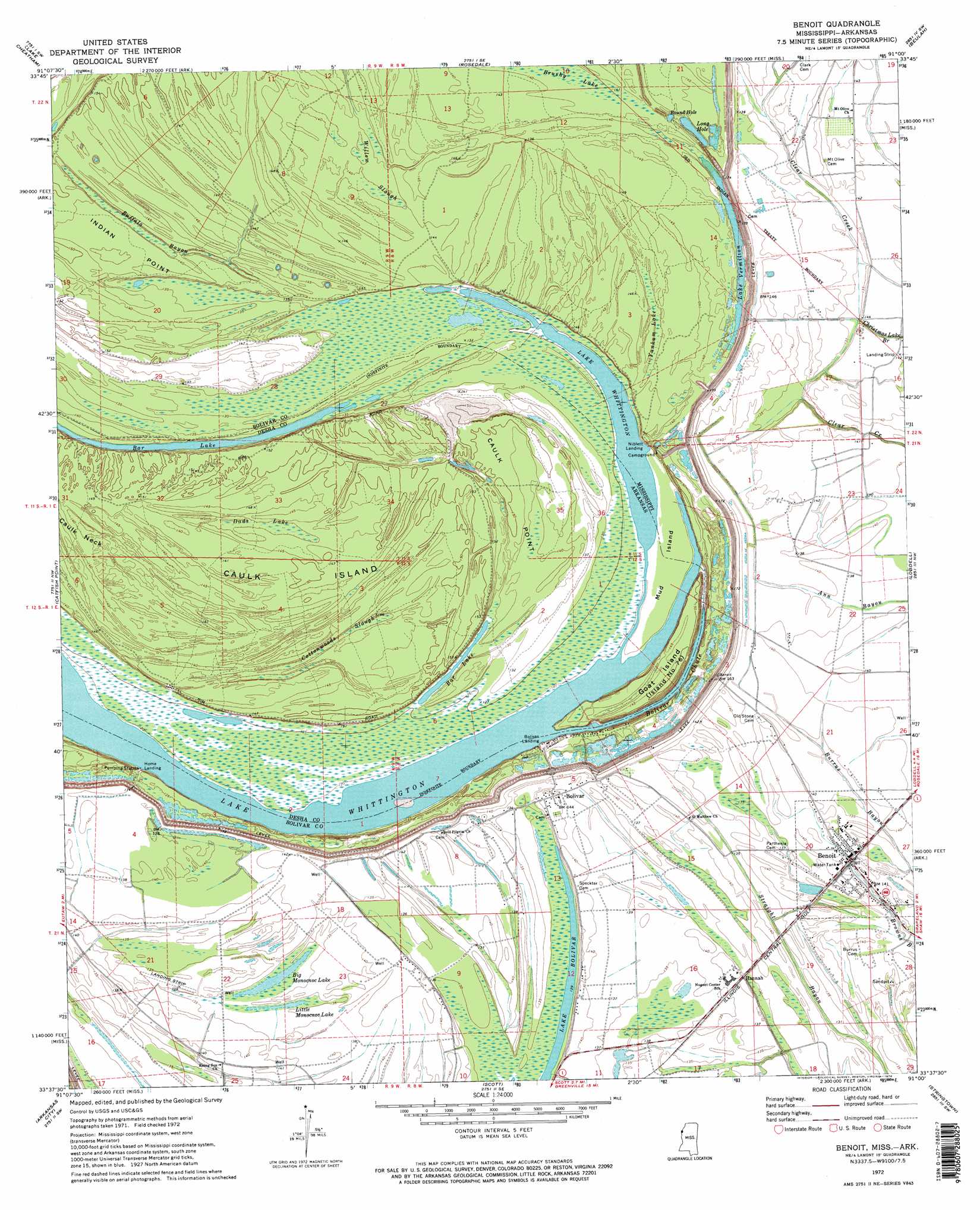
Benoit Topo Map Mississippi
To zoom in, hover over the map of Benoit
USGS Topo Quad 33091f1 - 1:24,000 scale
| Topo Map Name: | Benoit |
| USGS Topo Quad ID: | 33091f1 |
| Print Size: | ca. 21 1/4" wide x 27" high |
| Southeast Coordinates: | 33.625° N latitude / 91° W longitude |
| Map Center Coordinates: | 33.6875° N latitude / 91.0625° W longitude |
| U.S. States: | MS, AR |
| Filename: | o33091f1.jpg |
| Download Map JPG Image: | Benoit topo map 1:24,000 scale |
| Map Type: | Topographic |
| Topo Series: | 7.5´ |
| Map Scale: | 1:24,000 |
| Source of Map Images: | United States Geological Survey (USGS) |
| Alternate Map Versions: |
Benoit MS 1972, updated 1974 Download PDF Buy paper map Benoit MS 1972, updated 1974 Download PDF Buy paper map Benoit MS 2011 Download PDF Buy paper map Benoit MS 2012 Download PDF Buy paper map Benoit MS 2015 Download PDF Buy paper map |
1:24,000 Topo Quads surrounding Benoit
Watson |
Yancopin |
Montgomery Island |
Gunnison |
Shelby |
Kelso |
Lake Cheatham |
Rosedale |
Beulah |
Pace |
Mcarthur |
Catfish Point |
Benoit |
Lobdell |
Skene |
Halley |
Arkansas City |
Scott |
Stringtown |
Shaw |
Macon Lake |
Luna |
Greenville |
Leland |
Holly Ridge |
> Back to 33091e1 at 1:100,000 scale
> Back to 33090a1 at 1:250,000 scale
> Back to U.S. Topo Maps home
Benoit topo map: Gazetteer
Benoit: Areas
Caulk Point elevation 47m 154′Benoit: Bends
Bolivar Bend elevation 40m 131′Benoit: Capes
Indian Point elevation 43m 141′Benoit: Guts
Buffalo Bayou elevation 41m 134′Willow Slough elevation 43m 141′
Benoit: Islands
Caulk Island elevation 46m 150′Goat Island elevation 45m 147′
Mud Island elevation 35m 114′
Mud Island elevation 41m 134′
Benoit: Lakes
Bar Lake elevation 40m 131′Bar Lake elevation 39m 127′
Big Monocnoc Lake elevation 40m 131′
Lake Vermilon elevation 39m 127′
Lake Whittington elevation 39m 127′
Little Monocnoc Lake elevation 40m 131′
Long Hole elevation 40m 131′
Round Hole elevation 41m 134′
Benoit: Populated Places
Benoit elevation 43m 141′Bolivar elevation 43m 141′
Bolivar Landing elevation 40m 131′
Hannah elevation 43m 141′
Home Landing elevation 36m 118′
Jersey Point elevation 45m 147′
Niblett Landing elevation 39m 127′
Benoit: Ridges
Egypt Ridge elevation 41m 134′Benoit: Streams
Bolivar Chute elevation 40m 131′Benoit: Swamps
Brushy Lake elevation 42m 137′Cottonwoods Slough elevation 44m 144′
Dads Lake elevation 44m 144′
Yankum Lake elevation 42m 137′
Benoit digital topo map on disk
Buy this Benoit topo map showing relief, roads, GPS coordinates and other geographical features, as a high-resolution digital map file on DVD: