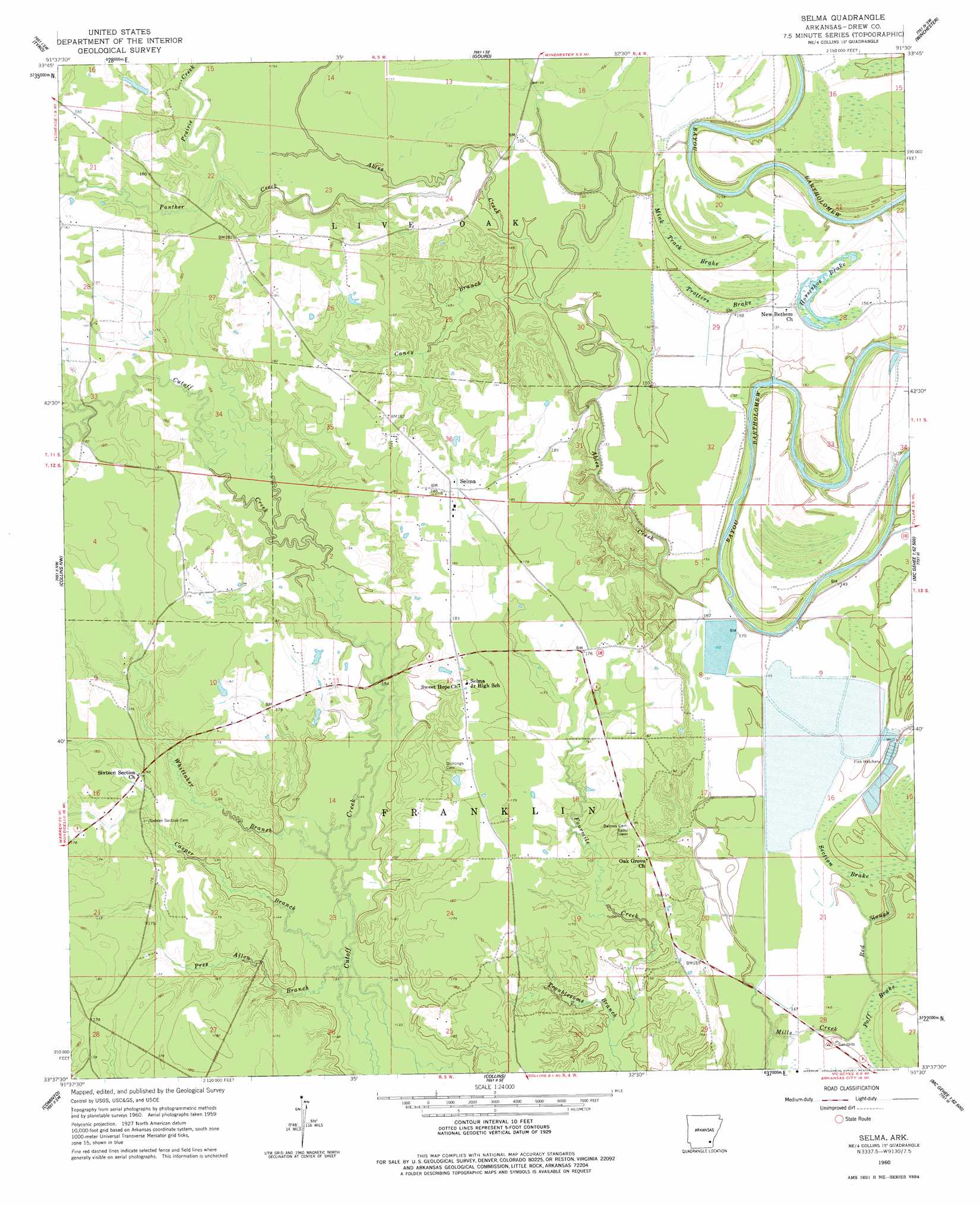
Selma Topo Map Arkansas
To zoom in, hover over the map of Selma
USGS Topo Quad 33091f5 - 1:24,000 scale
| Topo Map Name: | Selma |
| USGS Topo Quad ID: | 33091f5 |
| Print Size: | ca. 21 1/4" wide x 27" high |
| Southeast Coordinates: | 33.625° N latitude / 91.5° W longitude |
| Map Center Coordinates: | 33.6875° N latitude / 91.5625° W longitude |
| U.S. State: | AR |
| Filename: | o33091f5.jpg |
| Download Map JPG Image: | Selma topo map 1:24,000 scale |
| Map Type: | Topographic |
| Topo Series: | 7.5´ |
| Map Scale: | 1:24,000 |
| Source of Map Images: | United States Geological Survey (USGS) |
| Alternate Map Versions: |
Selma AR 1960, updated 1961 Download PDF Buy paper map Selma AR 1960, updated 1977 Download PDF Buy paper map Selma AR 2011 Download PDF Buy paper map Selma AR 2014 Download PDF Buy paper map |
1:24,000 Topo Quads surrounding Selma
Star City |
Avery |
Gould |
Dumas |
Watson |
Relfs Bluff |
Tyro |
Gourd |
Winchester |
Kelso |
Monticello North |
Collins Nw |
Selma |
Mcgehee North |
Mcarthur |
Monticello South |
Cominto |
Collins |
Mcgehee South |
Halley |
Ladelle |
Mist Nw |
Line |
Jerome |
Macon Lake |
> Back to 33091e1 at 1:100,000 scale
> Back to 33090a1 at 1:250,000 scale
> Back to U.S. Topo Maps home
Selma topo map: Gazetteer
Selma: Dams
Wells Lake Dam elevation 55m 180′Selma: Guts
Red Slough elevation 44m 144′Selma: Populated Places
Selma elevation 55m 180′Sixteenth Section elevation 53m 173′
Selma: Reservoirs
Wells Lake elevation 55m 180′Selma: Streams
Ables Creek elevation 43m 141′Caney Branch elevation 45m 147′
Casper Branch elevation 43m 141′
Lower Cutoff Creek elevation 51m 167′
Panther Creek elevation 43m 141′
Prairie Creek elevation 48m 157′
Pres Allen Branch elevation 44m 144′
Troublesome Branch elevation 45m 147′
Upper Cutoff Creek elevation 50m 164′
Whittaker Branch elevation 45m 147′
Selma: Swamps
Horseshoe Brake elevation 47m 154′Mink Track Brake elevation 47m 154′
Poff Brake elevation 45m 147′
Section Brake elevation 49m 160′
Trotters Brake elevation 45m 147′
Selma digital topo map on disk
Buy this Selma topo map showing relief, roads, GPS coordinates and other geographical features, as a high-resolution digital map file on DVD: