Gould Topo Map Arkansas
To zoom in, hover over the map of Gould
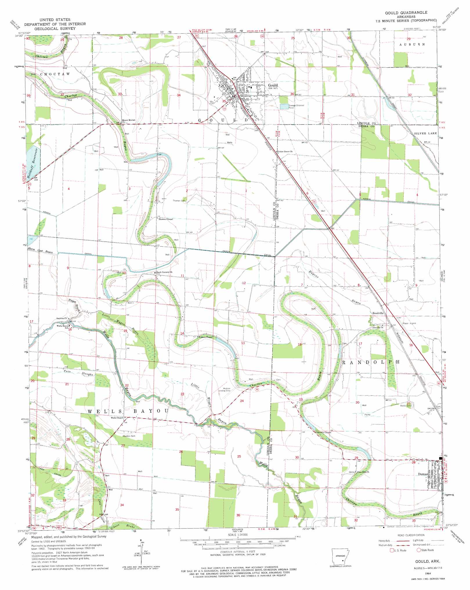
USGS Topo Quad 33091h5 - 1:24,000 scale
| Topo Map Name: | Gould |
| USGS Topo Quad ID: | 33091h5 |
| Print Size: | ca. 21 1/4" wide x 27" high |
| Southeast Coordinates: | 33.875° N latitude / 91.5° W longitude |
| Map Center Coordinates: | 33.9375° N latitude / 91.5625° W longitude |
| U.S. State: | AR |
| Filename: | o33091h5.jpg |
| Download Map JPG Image: | Gould topo map 1:24,000 scale |
| Map Type: | Topographic |
| Topo Series: | 7.5´ |
| Map Scale: | 1:24,000 |
| Source of Map Images: | United States Geological Survey (USGS) |
| Alternate Map Versions: |
Gould AR 1964, updated 1975 Download PDF Buy paper map Gould AR 2011 Download PDF Buy paper map Gould AR 2014 Download PDF Buy paper map |
1:24,000 Topo Quads surrounding Gould
Moscow |
Cornerstone |
Reydell |
One Horse Store |
Tichnor |
Tarry |
Grady |
Cades |
Gillett |
Arkansas Post |
Star City |
Avery |
Gould |
Dumas |
Watson |
Relfs Bluff |
Tyro |
Gourd |
Winchester |
Kelso |
Monticello North |
Collins Nw |
Selma |
Mcgehee North |
Mcarthur |
> Back to 33091e1 at 1:100,000 scale
> Back to 33090a1 at 1:250,000 scale
> Back to U.S. Topo Maps home
Gould topo map: Gazetteer
Gould: Airports
Billy Free Municipal Airport elevation 49m 160′Hudson Landing Strip elevation 46m 150′
Mayer Airport elevation 49m 160′
Reedville Airport elevation 48m 157′
Gould: Canals
Kerch Canal elevation 50m 164′Ladd Canal elevation 50m 164′
Gould: Guts
Choctaw Bayou elevation 54m 177′Eugene Bayou elevation 49m 160′
Gibson Brake elevation 49m 160′
Little Wagon Bayou elevation 47m 154′
Little Wagon Bayou elevation 51m 167′
Twin Sloughs elevation 48m 157′
Wagon Bayou elevation 50m 164′
Wells Bayou elevation 47m 154′
Gould: Populated Places
Flynn elevation 54m 177′Gould elevation 53m 173′
Mills elevation 51m 167′
Parma (historical) elevation 51m 167′
Reedville elevation 50m 164′
Rotan elevation 52m 170′
Gould: Reservoirs
Holthoff Reservoir elevation 52m 170′Gould: Swamps
Curry Brake elevation 48m 157′Gould digital topo map on disk
Buy this Gould topo map showing relief, roads, GPS coordinates and other geographical features, as a high-resolution digital map file on DVD: