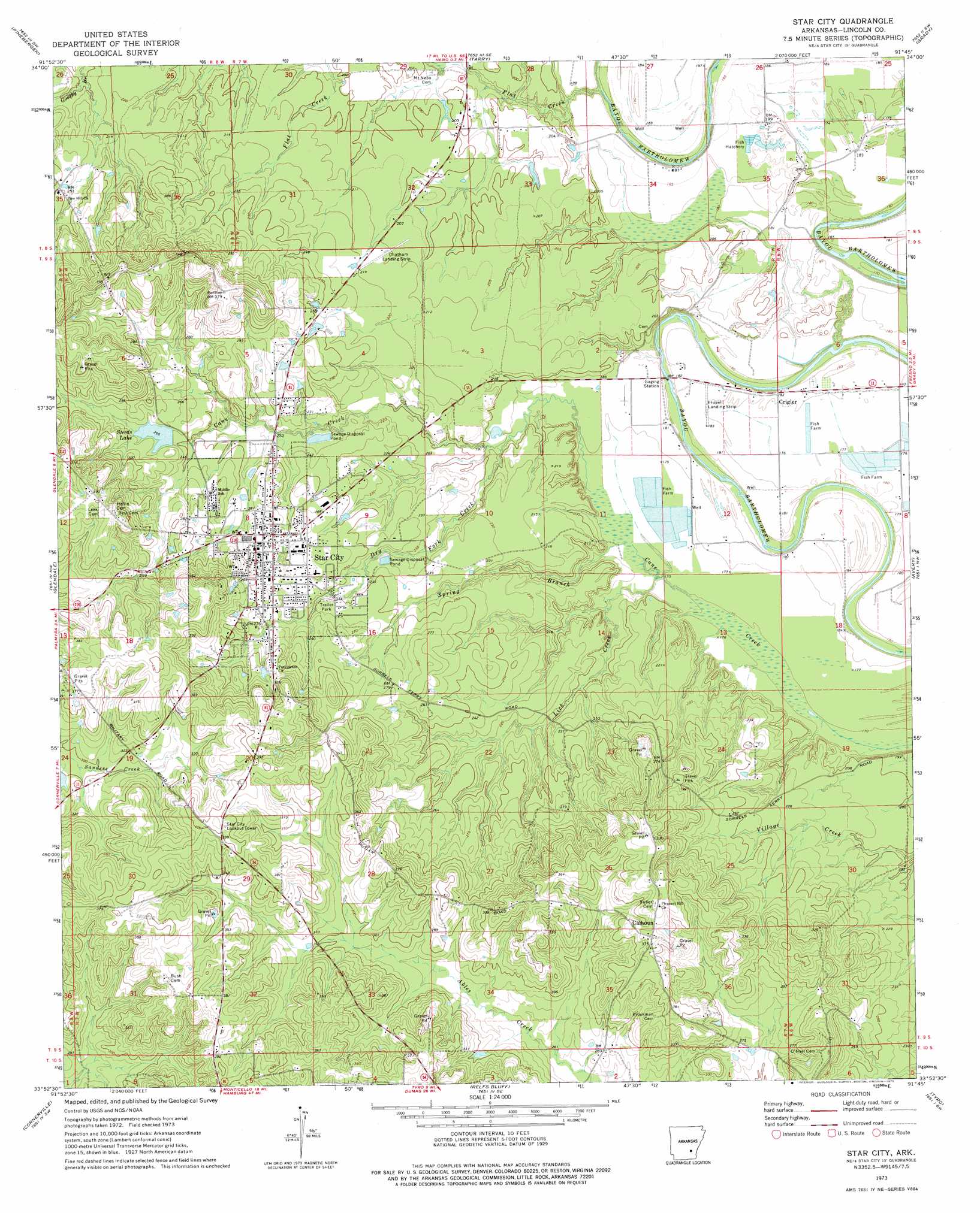
Star City Topo Map Arkansas
To zoom in, hover over the map of Star City
USGS Topo Quad 33091h7 - 1:24,000 scale
| Topo Map Name: | Star City |
| USGS Topo Quad ID: | 33091h7 |
| Print Size: | ca. 21 1/4" wide x 27" high |
| Southeast Coordinates: | 33.875° N latitude / 91.75° W longitude |
| Map Center Coordinates: | 33.9375° N latitude / 91.8125° W longitude |
| U.S. State: | AR |
| Filename: | o33091h7.jpg |
| Download Map JPG Image: | Star City topo map 1:24,000 scale |
| Map Type: | Topographic |
| Topo Series: | 7.5´ |
| Map Scale: | 1:24,000 |
| Source of Map Images: | United States Geological Survey (USGS) |
| Alternate Map Versions: |
Star City AR 1973, updated 1975 Download PDF Buy paper map Star City AR 2011 Download PDF Buy paper map Star City AR 2014 Download PDF Buy paper map |
1:24,000 Topo Quads surrounding Star City
Pine Bluff |
Ladd |
Moscow |
Cornerstone |
Reydell |
Faith |
Pinebergen |
Tarry |
Grady |
Cades |
Calmer |
Glendale |
Star City |
Avery |
Gould |
Herbine |
Cornerville |
Relfs Bluff |
Tyro |
Gourd |
Warren Ne |
Wilmar North |
Monticello North |
Collins Nw |
Selma |
> Back to 33091e1 at 1:100,000 scale
> Back to 33090a1 at 1:250,000 scale
> Back to U.S. Topo Maps home
Star City topo map: Gazetteer
Star City: Airports
Chatham Landing Strip elevation 66m 216′Frizzell Landing Strip elevation 56m 183′
Star City Municipal Airport elevation 97m 318′
Star City: Dams
Patocca Lower Lake Dam elevation 90m 295′Steed Lake Dam elevation 81m 265′
Star City: Lakes
Cane Creek Lake elevation 52m 170′Star City: Populated Places
Calhoun elevation 98m 321′Crigler elevation 56m 183′
Star City elevation 84m 275′
Todd (historical) elevation 57m 187′
Star City: Reservoirs
Patocca Lower Lake elevation 90m 295′Steeds Lake elevation 81m 265′
Star City: Streams
Dry Fork Creek elevation 64m 209′Lick Creek elevation 53m 173′
Spring Branch elevation 53m 173′
Star City digital topo map on disk
Buy this Star City topo map showing relief, roads, GPS coordinates and other geographical features, as a high-resolution digital map file on DVD: