Gardner Topo Map Arkansas
To zoom in, hover over the map of Gardner
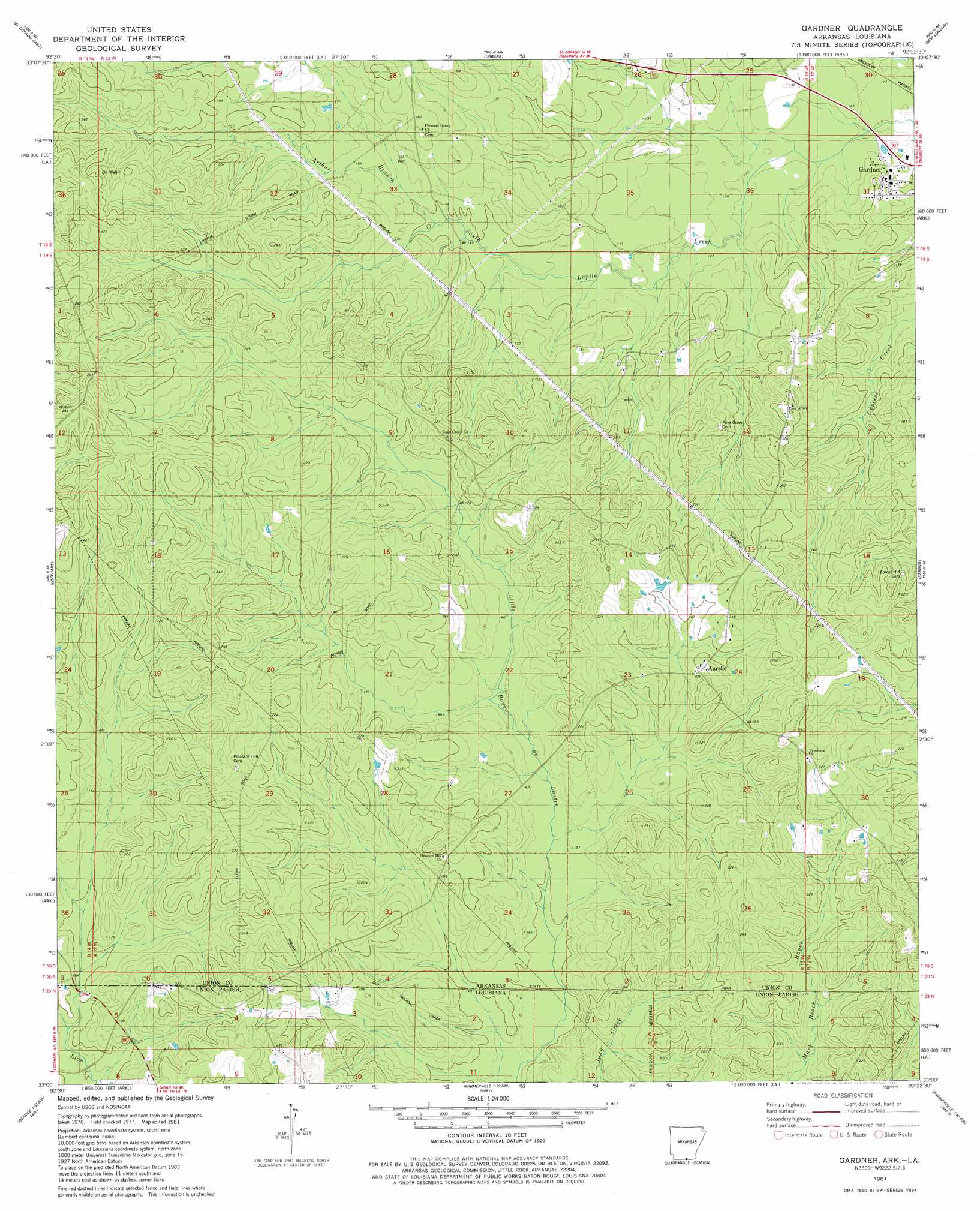
USGS Topo Quad 33092a4 - 1:24,000 scale
| Topo Map Name: | Gardner |
| USGS Topo Quad ID: | 33092a4 |
| Print Size: | ca. 21 1/4" wide x 27" high |
| Southeast Coordinates: | 33° N latitude / 92.375° W longitude |
| Map Center Coordinates: | 33.0625° N latitude / 92.4375° W longitude |
| U.S. States: | AR, LA |
| Filename: | o33092a4.jpg |
| Download Map JPG Image: | Gardner topo map 1:24,000 scale |
| Map Type: | Topographic |
| Topo Series: | 7.5´ |
| Map Scale: | 1:24,000 |
| Source of Map Images: | United States Geological Survey (USGS) |
| Alternate Map Versions: |
Gardner AR 1981, updated 1981 Download PDF Buy paper map Gardner AR 2011 Download PDF Buy paper map Gardner AR 2014 Download PDF Buy paper map |
1:24,000 Topo Quads surrounding Gardner
Smackover |
Calion |
Harrell Brake |
Moro Bay |
Marsden |
El Dorado West |
El Dorado East |
Urbana |
New London |
New Union |
Junction City |
Lockhart |
Gardner |
Strong |
Huttig |
Lillie |
Spearsville |
Truxno |
Marion West |
Marion East |
Bernice |
Shiloh |
Farmerville |
De Loutre |
Haille |
> Back to 33092a1 at 1:100,000 scale
> Back to 33092a1 at 1:250,000 scale
> Back to U.S. Topo Maps home
Gardner topo map: Gazetteer
Gardner: Oilfields
Aurelle Oil and Gas Field elevation 81m 265′Gardner: Populated Places
Aurelle elevation 65m 213′Gardner elevation 50m 164′
Gardner: Post Offices
Aurelle Post Office (historical) elevation 62m 203′Gardner: Streams
Arthur Branch elevation 48m 157′Mark Beach Bayou elevation 49m 160′
Gardner digital topo map on disk
Buy this Gardner topo map showing relief, roads, GPS coordinates and other geographical features, as a high-resolution digital map file on DVD: