New London Topo Map Arkansas
To zoom in, hover over the map of New London
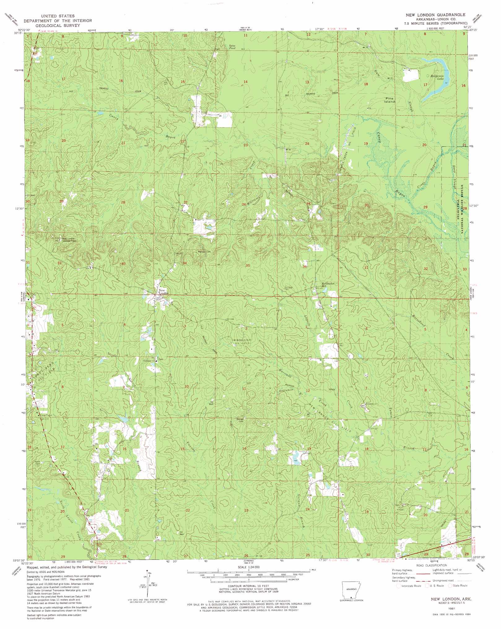
USGS Topo Quad 33092b3 - 1:24,000 scale
| Topo Map Name: | New London |
| USGS Topo Quad ID: | 33092b3 |
| Print Size: | ca. 21 1/4" wide x 27" high |
| Southeast Coordinates: | 33.125° N latitude / 92.25° W longitude |
| Map Center Coordinates: | 33.1875° N latitude / 92.3125° W longitude |
| U.S. State: | AR |
| Filename: | o33092b3.jpg |
| Download Map JPG Image: | New London topo map 1:24,000 scale |
| Map Type: | Topographic |
| Topo Series: | 7.5´ |
| Map Scale: | 1:24,000 |
| Source of Map Images: | United States Geological Survey (USGS) |
| Alternate Map Versions: |
New London AR 1981, updated 1981 Download PDF Buy paper map New London AR 2011 Download PDF Buy paper map New London AR 2014 Download PDF Buy paper map |
1:24,000 Topo Quads surrounding New London
Smackover Ne |
Artesian |
Jersey |
Hermitage |
Sumpter |
Calion |
Harrell Brake |
Moro Bay |
Marsden |
Vick |
El Dorado East |
Urbana |
New London |
New Union |
Marais Saline |
Lockhart |
Gardner |
Strong |
Huttig |
Felsenthal Dam |
Spearsville |
Truxno |
Marion West |
Marion East |
Fish Lake |
> Back to 33092a1 at 1:100,000 scale
> Back to 33092a1 at 1:250,000 scale
> Back to U.S. Topo Maps home
New London topo map: Gazetteer
New London: Guts
Cross Bayou elevation 23m 75′Deep Slough elevation 23m 75′
Gum Slough elevation 24m 78′
New London: Islands
Pine Island elevation 24m 78′New London: Lakes
Benjamin Lake elevation 22m 72′Spice Pond elevation 27m 88′
New London: Oilfields
New London Oil Field elevation 40m 131′North New London Oil and Gas Field elevation 62m 203′
Winchester Oil Field elevation 50m 164′
New London: Populated Places
McGlendon Mill elevation 50m 164′New London elevation 58m 190′
Sawmill elevation 35m 114′
New London: Post Offices
New London Post Office (historical) elevation 61m 200′New London: Streams
Greenhaw Branch elevation 42m 137′Norris Creek elevation 35m 114′
North Lapile Creek elevation 32m 104′
Tatum Branch elevation 30m 98′
Williams Creek elevation 23m 75′
New London digital topo map on disk
Buy this New London topo map showing relief, roads, GPS coordinates and other geographical features, as a high-resolution digital map file on DVD: