Urbana Topo Map Arkansas
To zoom in, hover over the map of Urbana
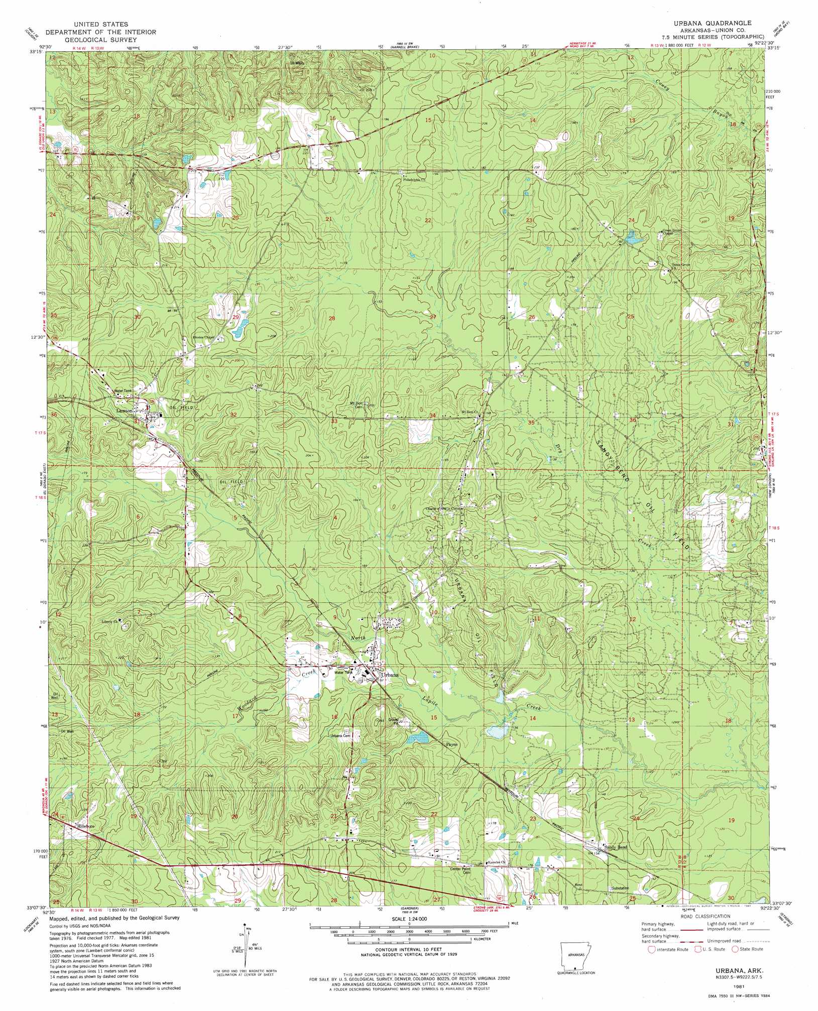
USGS Topo Quad 33092b4 - 1:24,000 scale
| Topo Map Name: | Urbana |
| USGS Topo Quad ID: | 33092b4 |
| Print Size: | ca. 21 1/4" wide x 27" high |
| Southeast Coordinates: | 33.125° N latitude / 92.375° W longitude |
| Map Center Coordinates: | 33.1875° N latitude / 92.4375° W longitude |
| U.S. State: | AR |
| Filename: | o33092b4.jpg |
| Download Map JPG Image: | Urbana topo map 1:24,000 scale |
| Map Type: | Topographic |
| Topo Series: | 7.5´ |
| Map Scale: | 1:24,000 |
| Source of Map Images: | United States Geological Survey (USGS) |
| Alternate Map Versions: |
Urbana AR 1981, updated 1981 Download PDF Buy paper map Urbana AR 2011 Download PDF Buy paper map Urbana AR 2014 Download PDF Buy paper map |
1:24,000 Topo Quads surrounding Urbana
Snow Hill |
Smackover Ne |
Artesian |
Jersey |
Hermitage |
Smackover |
Calion |
Harrell Brake |
Moro Bay |
Marsden |
El Dorado West |
El Dorado East |
Urbana |
New London |
New Union |
Junction City |
Lockhart |
Gardner |
Strong |
Huttig |
Lillie |
Spearsville |
Truxno |
Marion West |
Marion East |
> Back to 33092a1 at 1:100,000 scale
> Back to 33092a1 at 1:250,000 scale
> Back to U.S. Topo Maps home
Urbana topo map: Gazetteer
Urbana: Oilfields
Lawson Oil and Gas Field elevation 58m 190′Sandy Bend Oil Field elevation 44m 144′
Urbana Oil Field elevation 67m 219′
Urbana: Populated Places
Hillsboro elevation 70m 229′Lawson elevation 63m 206′
Payne elevation 49m 160′
Sandy Bend elevation 45m 147′
Urbana elevation 48m 157′
Urbana: Post Offices
Lawson Post Office elevation 63m 206′Urbana Post Office elevation 46m 150′
Urbana: Streams
Dry Creek elevation 34m 111′Woodard Creek elevation 46m 150′
Urbana digital topo map on disk
Buy this Urbana topo map showing relief, roads, GPS coordinates and other geographical features, as a high-resolution digital map file on DVD: