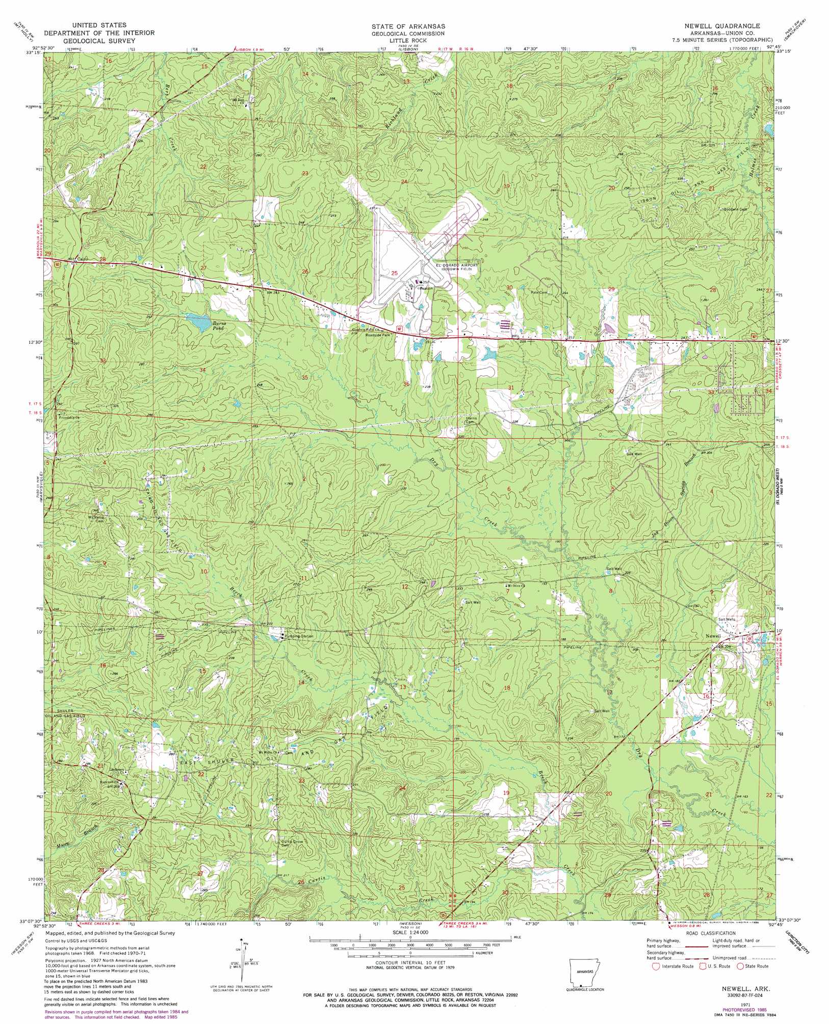
Newell Topo Map Arkansas
To zoom in, hover over the map of Newell
USGS Topo Quad 33092b7 - 1:24,000 scale
| Topo Map Name: | Newell |
| USGS Topo Quad ID: | 33092b7 |
| Print Size: | ca. 21 1/4" wide x 27" high |
| Southeast Coordinates: | 33.125° N latitude / 92.75° W longitude |
| Map Center Coordinates: | 33.1875° N latitude / 92.8125° W longitude |
| U.S. State: | AR |
| Filename: | o33092b7.jpg |
| Download Map JPG Image: | Newell topo map 1:24,000 scale |
| Map Type: | Topographic |
| Topo Series: | 7.5´ |
| Map Scale: | 1:24,000 |
| Source of Map Images: | United States Geological Survey (USGS) |
| Alternate Map Versions: |
Newell AR 1971, updated 1973 Download PDF Buy paper map Newell AR 1971, updated 1983 Download PDF Buy paper map Newell AR 1971, updated 1986 Download PDF Buy paper map Newell AR 2011 Download PDF Buy paper map Newell AR 2014 Download PDF Buy paper map |
1:24,000 Topo Quads surrounding Newell
Stephens |
Buena Vista |
Louann |
Snow Hill |
Smackover Ne |
Village |
Mount Holly |
Lisbon |
Smackover |
Calion |
Spotville |
Marysville |
Newell |
El Dorado West |
El Dorado East |
Emerson Se |
Wesson Sw |
Wesson |
Junction City |
Lockhart |
Haynesville East |
Colquitt |
Summerfield |
Lillie |
Spearsville |
> Back to 33092a1 at 1:100,000 scale
> Back to 33092a1 at 1:250,000 scale
> Back to U.S. Topo Maps home
Newell topo map: Gazetteer
Newell: Airports
Goodwin Field elevation 75m 246′Newell: Oilfields
Cairo Oil and Gas Field elevation 84m 275′East Shuler Oil and Gas Field elevation 87m 285′
Lisbon Oil and Gas Field elevation 64m 209′
Shuler Oil and Gas Field elevation 80m 262′
Newell: Populated Places
Cairo elevation 94m 308′Griffin elevation 69m 226′
Trull elevation 84m 275′
Newell: Reservoirs
Burns Pond elevation 69m 226′Newell: Streams
Curtis Creek elevation 53m 173′Jay Dison Spring Branch elevation 52m 170′
Newell digital topo map on disk
Buy this Newell topo map showing relief, roads, GPS coordinates and other geographical features, as a high-resolution digital map file on DVD: