Smackover Topo Map Arkansas
To zoom in, hover over the map of Smackover
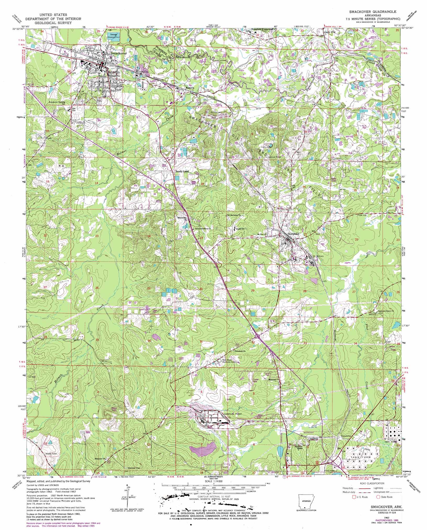
USGS Topo Quad 33092c6 - 1:24,000 scale
| Topo Map Name: | Smackover |
| USGS Topo Quad ID: | 33092c6 |
| Print Size: | ca. 21 1/4" wide x 27" high |
| Southeast Coordinates: | 33.25° N latitude / 92.625° W longitude |
| Map Center Coordinates: | 33.3125° N latitude / 92.6875° W longitude |
| U.S. State: | AR |
| Filename: | o33092c6.jpg |
| Download Map JPG Image: | Smackover topo map 1:24,000 scale |
| Map Type: | Topographic |
| Topo Series: | 7.5´ |
| Map Scale: | 1:24,000 |
| Source of Map Images: | United States Geological Survey (USGS) |
| Alternate Map Versions: |
Smackover AR 1962, updated 1963 Download PDF Buy paper map Smackover AR 1962, updated 1975 Download PDF Buy paper map Smackover AR 1962, updated 1978 Download PDF Buy paper map Smackover AR 1962, updated 1986 Download PDF Buy paper map Smackover AR 2011 Download PDF Buy paper map Smackover AR 2014 Download PDF Buy paper map |
1:24,000 Topo Quads surrounding Smackover
Camden Sw |
Camden |
East Camden |
Woodberry |
Hampton |
Buena Vista |
Louann |
Snow Hill |
Smackover Ne |
Artesian |
Mount Holly |
Lisbon |
Smackover |
Calion |
Harrell Brake |
Marysville |
Newell |
El Dorado West |
El Dorado East |
Urbana |
Wesson Sw |
Wesson |
Junction City |
Lockhart |
Gardner |
> Back to 33092a1 at 1:100,000 scale
> Back to 33092a1 at 1:250,000 scale
> Back to U.S. Topo Maps home
Smackover topo map: Gazetteer
Smackover: Populated Places
Kenova elevation 30m 98′Norphlet elevation 55m 180′
Sandy Land elevation 62m 203′
Smackover elevation 38m 124′
Standard Umpstead elevation 37m 121′
Smackover: Streams
Holmes Creek elevation 31m 101′Smackover digital topo map on disk
Buy this Smackover topo map showing relief, roads, GPS coordinates and other geographical features, as a high-resolution digital map file on DVD: