Hermitage Topo Map Arkansas
To zoom in, hover over the map of Hermitage
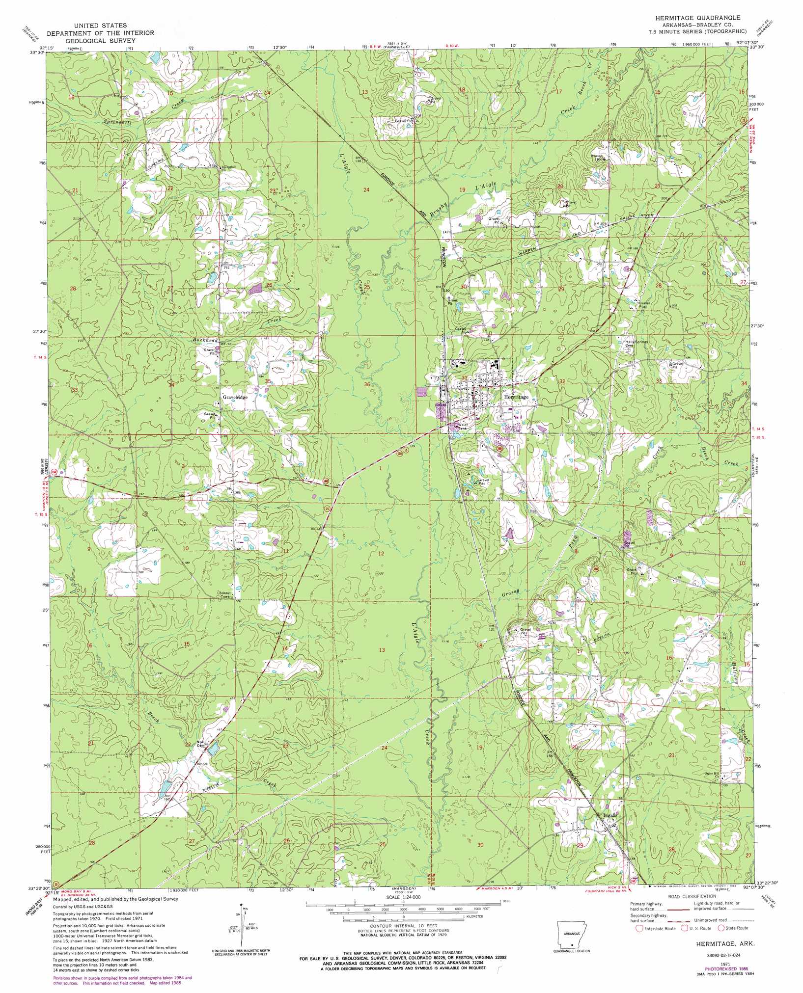
USGS Topo Quad 33092d2 - 1:24,000 scale
| Topo Map Name: | Hermitage |
| USGS Topo Quad ID: | 33092d2 |
| Print Size: | ca. 21 1/4" wide x 27" high |
| Southeast Coordinates: | 33.375° N latitude / 92.125° W longitude |
| Map Center Coordinates: | 33.4375° N latitude / 92.1875° W longitude |
| U.S. State: | AR |
| Filename: | o33092d2.jpg |
| Download Map JPG Image: | Hermitage topo map 1:24,000 scale |
| Map Type: | Topographic |
| Topo Series: | 7.5´ |
| Map Scale: | 1:24,000 |
| Source of Map Images: | United States Geological Survey (USGS) |
| Alternate Map Versions: |
Hermitage AR 1971, updated 1973 Download PDF Buy paper map Hermitage AR 1971, updated 1986 Download PDF Buy paper map Hermitage AR 2011 Download PDF Buy paper map Hermitage AR 2014 Download PDF Buy paper map |
1:24,000 Topo Quads surrounding Hermitage
Chambersville |
Tinsman |
Mckinney |
Warren Ne |
Wilmar North |
Hampton |
Banks |
Farmville |
Warren |
Wilmar South |
Artesian |
Jersey |
Hermitage |
Sumpter |
Longview |
Harrell Brake |
Moro Bay |
Marsden |
Vick |
Milo |
Urbana |
New London |
New Union |
Marais Saline |
Crossett North |
> Back to 33092a1 at 1:100,000 scale
> Back to 33092a1 at 1:250,000 scale
> Back to U.S. Topo Maps home
Hermitage topo map: Gazetteer
Hermitage: Populated Places
Castleberry (historical) elevation 45m 147′Gravelridge elevation 53m 173′
Greenville elevation 67m 219′
Hermitage elevation 57m 187′
Ingalls elevation 50m 164′
Pirlte (historical) elevation 49m 160′
Hermitage: Streams
Beech Creek elevation 36m 118′Beech Creek elevation 46m 150′
Beech Creek elevation 51m 167′
Brushy L'Aigle Creek elevation 40m 131′
Buckhead Creek elevation 41m 134′
Caney Creek elevation 48m 157′
Grassy Pond Creek elevation 35m 114′
Hall Branch elevation 41m 134′
Springhill Creek elevation 48m 157′
Hermitage digital topo map on disk
Buy this Hermitage topo map showing relief, roads, GPS coordinates and other geographical features, as a high-resolution digital map file on DVD: