Artesian Topo Map Arkansas
To zoom in, hover over the map of Artesian
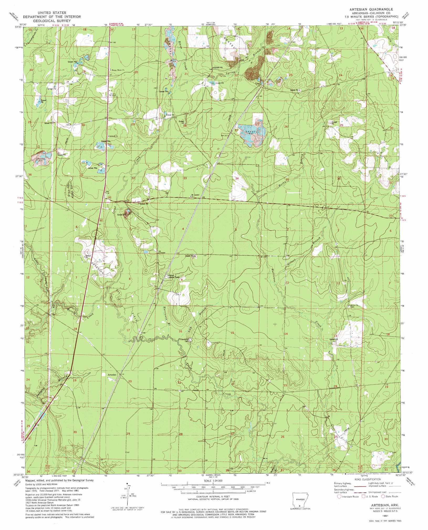
USGS Topo Quad 33092d4 - 1:24,000 scale
| Topo Map Name: | Artesian |
| USGS Topo Quad ID: | 33092d4 |
| Print Size: | ca. 21 1/4" wide x 27" high |
| Southeast Coordinates: | 33.375° N latitude / 92.375° W longitude |
| Map Center Coordinates: | 33.4375° N latitude / 92.4375° W longitude |
| U.S. State: | AR |
| Filename: | o33092d4.jpg |
| Download Map JPG Image: | Artesian topo map 1:24,000 scale |
| Map Type: | Topographic |
| Topo Series: | 7.5´ |
| Map Scale: | 1:24,000 |
| Source of Map Images: | United States Geological Survey (USGS) |
| Alternate Map Versions: |
Artesian AR 1981, updated 1981 Download PDF Buy paper map Artesian AR 2011 Download PDF Buy paper map Artesian AR 2014 Download PDF Buy paper map |
1:24,000 Topo Quads surrounding Artesian
Eagle Mills |
Bearden |
Chambersville |
Tinsman |
Mckinney |
East Camden |
Woodberry |
Hampton |
Banks |
Farmville |
Snow Hill |
Smackover Ne |
Artesian |
Jersey |
Hermitage |
Smackover |
Calion |
Harrell Brake |
Moro Bay |
Marsden |
El Dorado West |
El Dorado East |
Urbana |
New London |
New Union |
> Back to 33092a1 at 1:100,000 scale
> Back to 33092a1 at 1:250,000 scale
> Back to U.S. Topo Maps home
Artesian topo map: Gazetteer
Artesian: Guts
Bangs Slough elevation 31m 101′Artesian: Oilfields
Artesian Oil Field elevation 35m 114′Lloyd Creek Oil Field elevation 44m 144′
Artesian: Populated Places
Artesian elevation 34m 111′Unco elevation 57m 187′
Artesian: Streams
Athant Branch elevation 33m 108′Blann Creek elevation 46m 150′
Gilbert Branch elevation 37m 121′
Hurricane Branch elevation 32m 104′
Jumping Branch elevation 28m 91′
Lick Branch elevation 34m 111′
Merritt Creek elevation 31m 101′
Rocky Branch elevation 40m 131′
Spring Branch elevation 46m 150′
Artesian digital topo map on disk
Buy this Artesian topo map showing relief, roads, GPS coordinates and other geographical features, as a high-resolution digital map file on DVD: