Louann Topo Map Arkansas
To zoom in, hover over the map of Louann
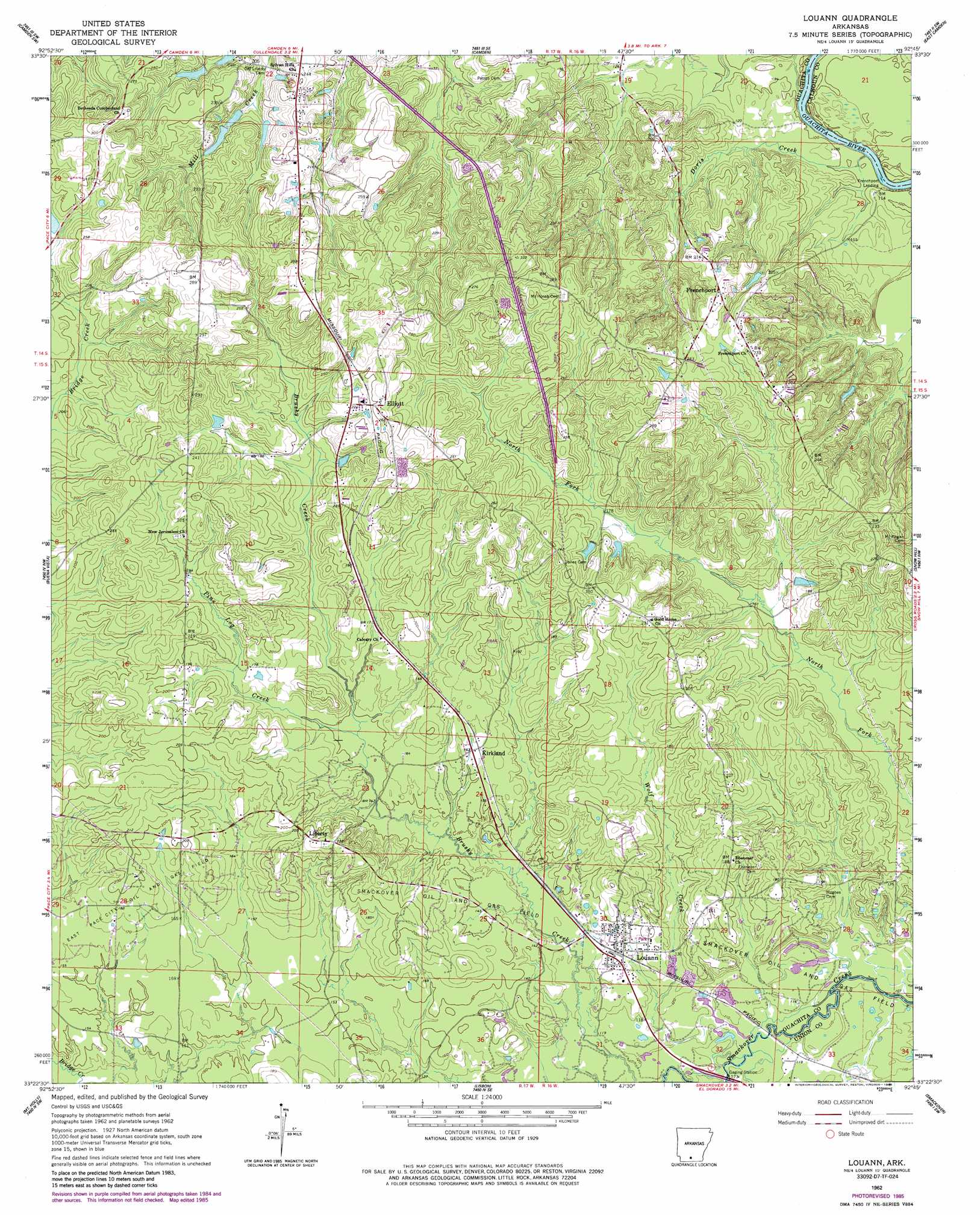
USGS Topo Quad 33092d7 - 1:24,000 scale
| Topo Map Name: | Louann |
| USGS Topo Quad ID: | 33092d7 |
| Print Size: | ca. 21 1/4" wide x 27" high |
| Southeast Coordinates: | 33.375° N latitude / 92.75° W longitude |
| Map Center Coordinates: | 33.4375° N latitude / 92.8125° W longitude |
| U.S. State: | AR |
| Filename: | o33092d7.jpg |
| Download Map JPG Image: | Louann topo map 1:24,000 scale |
| Map Type: | Topographic |
| Topo Series: | 7.5´ |
| Map Scale: | 1:24,000 |
| Source of Map Images: | United States Geological Survey (USGS) |
| Alternate Map Versions: |
Louann AR 1962, updated 1963 Download PDF Buy paper map Louann AR 1962, updated 1978 Download PDF Buy paper map Louann AR 1962, updated 1986 Download PDF Buy paper map Louann AR 2011 Download PDF Buy paper map Louann AR 2014 Download PDF Buy paper map |
1:24,000 Topo Quads surrounding Louann
Chidester |
Bragg City |
Harmony Grove |
Eagle Mills |
Bearden |
Troy |
Camden Sw |
Camden |
East Camden |
Woodberry |
Stephens |
Buena Vista |
Louann |
Snow Hill |
Smackover Ne |
Village |
Mount Holly |
Lisbon |
Smackover |
Calion |
Spotville |
Marysville |
Newell |
El Dorado West |
El Dorado East |
> Back to 33092a1 at 1:100,000 scale
> Back to 33092a1 at 1:250,000 scale
> Back to U.S. Topo Maps home
Louann topo map: Gazetteer
Louann: Oilfields
East Pace City Oil and Gas Field elevation 58m 190′Louann: Populated Places
Elliott elevation 80m 262′Frenchport elevation 74m 242′
Kirkland elevation 52m 170′
Liberty elevation 72m 236′
Louann elevation 42m 137′
Louann: Streams
Doris Creek elevation 26m 85′Pine Log Creek elevation 47m 154′
Wolf Creek elevation 36m 118′
Louann digital topo map on disk
Buy this Louann topo map showing relief, roads, GPS coordinates and other geographical features, as a high-resolution digital map file on DVD: