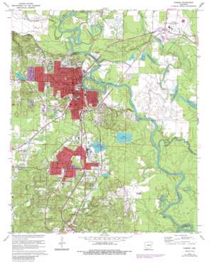
Camden Topo Map Arkansas
To zoom in, hover over the map of Camden
USGS Topo Quad 33092e7 - 1:24,000 scale
| Topo Map Name: | Camden |
| USGS Topo Quad ID: | 33092e7 |
| Print Size: | ca. 21 1/4" wide x 27" high |
| Southeast Coordinates: | 33.5° N latitude / 92.75° W longitude |
| Map Center Coordinates: | 33.5625° N latitude / 92.8125° W longitude |
| U.S. State: | AR |
| Filename: | o33092e7.jpg |
| Download Map JPG Image: | Camden topo map 1:24,000 scale |
| Map Type: | Topographic |
| Topo Series: | 7.5´ |
| Map Scale: | 1:24,000 |
| Source of Map Images: | United States Geological Survey (USGS) |
| Alternate Map Versions: |
Camden AR 1951 Download PDF Buy paper map Camden AR 1971, updated 1973 Download PDF Buy paper map Camden AR 1971, updated 1986 Download PDF Buy paper map Camden AR 2011 Download PDF Buy paper map Camden AR 2014 Download PDF Buy paper map |
1:24,000 Topo Quads surrounding Camden
> Back to 33092e1 at 1:100,000 scale
> Back to 33092a1 at 1:250,000 scale
> Back to U.S. Topo Maps home
Camden topo map: Gazetteer
Camden: Airports
Harrell Field elevation 38m 124′Ouachita County Hospital Heliport elevation 66m 216′
Camden: Bars
Cape Horn Shoals elevation 31m 101′Little Buffalo Shoals elevation 25m 82′
Camden: Crossings
Bradley Ferry (historical) elevation 24m 78′Camden: Dams
Berg Lake Dam elevation 49m 160′Senrac Lake Dam elevation 34m 111′
Camden: Guts
Estridge Bayou elevation 30m 98′Newman Slough elevation 33m 108′
Camden: Lakes
Blue Lake elevation 30m 98′Hook Lake elevation 32m 104′
Little Johnson Lake elevation 31m 101′
Mustin Lake elevation 32m 104′
Pedron Lake elevation 26m 85′
Round Lake elevation 32m 104′
Treadway Slough elevation 26m 85′
Webb Lake elevation 32m 104′
Woodard Lake elevation 28m 91′
Camden: Parks
Carnes Park elevation 47m 154′City School Park elevation 58m 190′
Coleman Stadium elevation 59m 193′
Fairview Park elevation 67m 219′
Fairview Stadium elevation 52m 170′
Fort Southerland Park elevation 73m 239′
Ira Clark Park elevation 48m 157′
Sandy Beach Park elevation 30m 98′
Camden: Populated Places
Camden elevation 61m 200′Cullendale elevation 40m 131′
Fairview elevation 54m 177′
Herbert elevation 36m 118′
Rendezvous elevation 51m 167′
Camden: Post Offices
Camden Post Office elevation 61m 200′Camden: Reservoirs
Berg Lake elevation 49m 160′Senrac Lake elevation 34m 111′
Camden: Streams
Chaffie Creek elevation 33m 108′Ecore Fabre Bayou elevation 24m 78′
Mill Creek elevation 28m 91′
Mizzell Creek elevation 31m 101′
Palmer Bayou elevation 27m 88′
Two Bayou elevation 28m 91′
Two Bayou elevation 26m 85′
Wadleigh Branch elevation 33m 108′
Camden digital topo map on disk
Buy this Camden topo map showing relief, roads, GPS coordinates and other geographical features, as a high-resolution digital map file on DVD:


