Sparkman Nw Topo Map Arkansas
To zoom in, hover over the map of Sparkman Nw
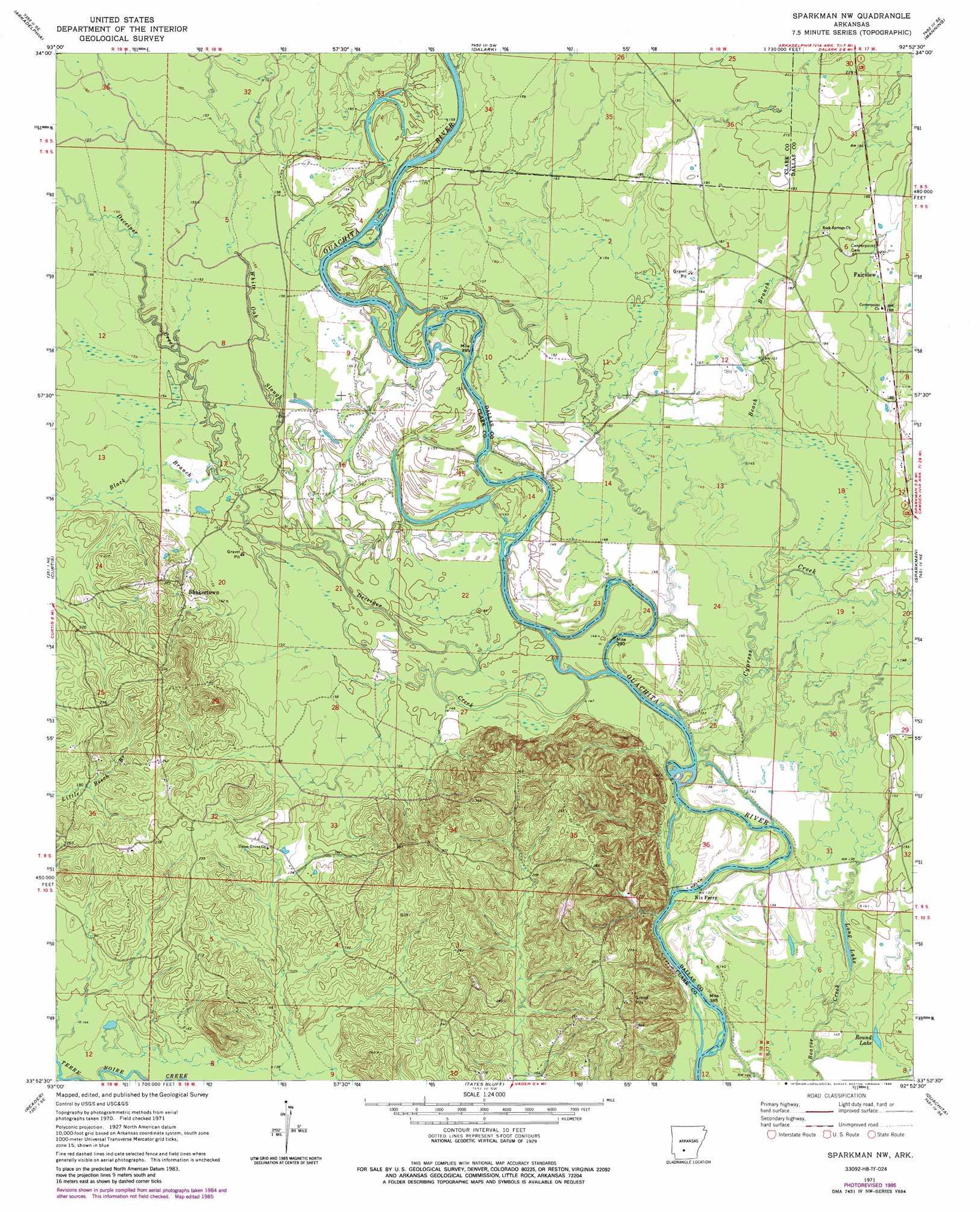
USGS Topo Quad 33092h8 - 1:24,000 scale
| Topo Map Name: | Sparkman Nw |
| USGS Topo Quad ID: | 33092h8 |
| Print Size: | ca. 21 1/4" wide x 27" high |
| Southeast Coordinates: | 33.875° N latitude / 92.875° W longitude |
| Map Center Coordinates: | 33.9375° N latitude / 92.9375° W longitude |
| U.S. State: | AR |
| Filename: | o33092h8.jpg |
| Download Map JPG Image: | Sparkman Nw topo map 1:24,000 scale |
| Map Type: | Topographic |
| Topo Series: | 7.5´ |
| Map Scale: | 1:24,000 |
| Source of Map Images: | United States Geological Survey (USGS) |
| Alternate Map Versions: |
Sparkman NW AR 1971, updated 1973 Download PDF Buy paper map Sparkman NW AR 1971, updated 1986 Download PDF Buy paper map Sparkman NW AR 2011 Download PDF Buy paper map Sparkman NW AR 2014 Download PDF Buy paper map |
1:24,000 Topo Quads surrounding Sparkman Nw
De Gray |
Caddo Valley |
Donaldson |
Round Hill |
Willow |
Hollywood |
Arkadelphia |
Dalark |
Manning |
Tulip |
Gurdon |
Curtis |
Sparkman Nw |
Sparkman |
Princeton West |
Whelen Springs |
Reader |
Tates Bluff |
Ouachita |
Holly Springs |
Bluff City |
Chidester |
Bragg City |
Harmony Grove |
Eagle Mills |
> Back to 33092e1 at 1:100,000 scale
> Back to 33092a1 at 1:250,000 scale
> Back to U.S. Topo Maps home
Sparkman Nw topo map: Gazetteer
Sparkman Nw: Lakes
Long Lake elevation 44m 144′Round Lake elevation 41m 134′
Sparkman Nw: Populated Places
Fairview elevation 59m 193′Hebron (historical) elevation 70m 229′
Jackson (historical) elevation 52m 170′
Shakertown elevation 63m 206′
Sparkman Nw: Streams
Beach Branch elevation 43m 141′Black Branch elevation 50m 164′
Casa Massa Creek elevation 45m 147′
Cypress Creek elevation 36m 118′
Deceiper Creek elevation 40m 131′
White Oak Slough elevation 48m 157′
Sparkman Nw digital topo map on disk
Buy this Sparkman Nw topo map showing relief, roads, GPS coordinates and other geographical features, as a high-resolution digital map file on DVD: