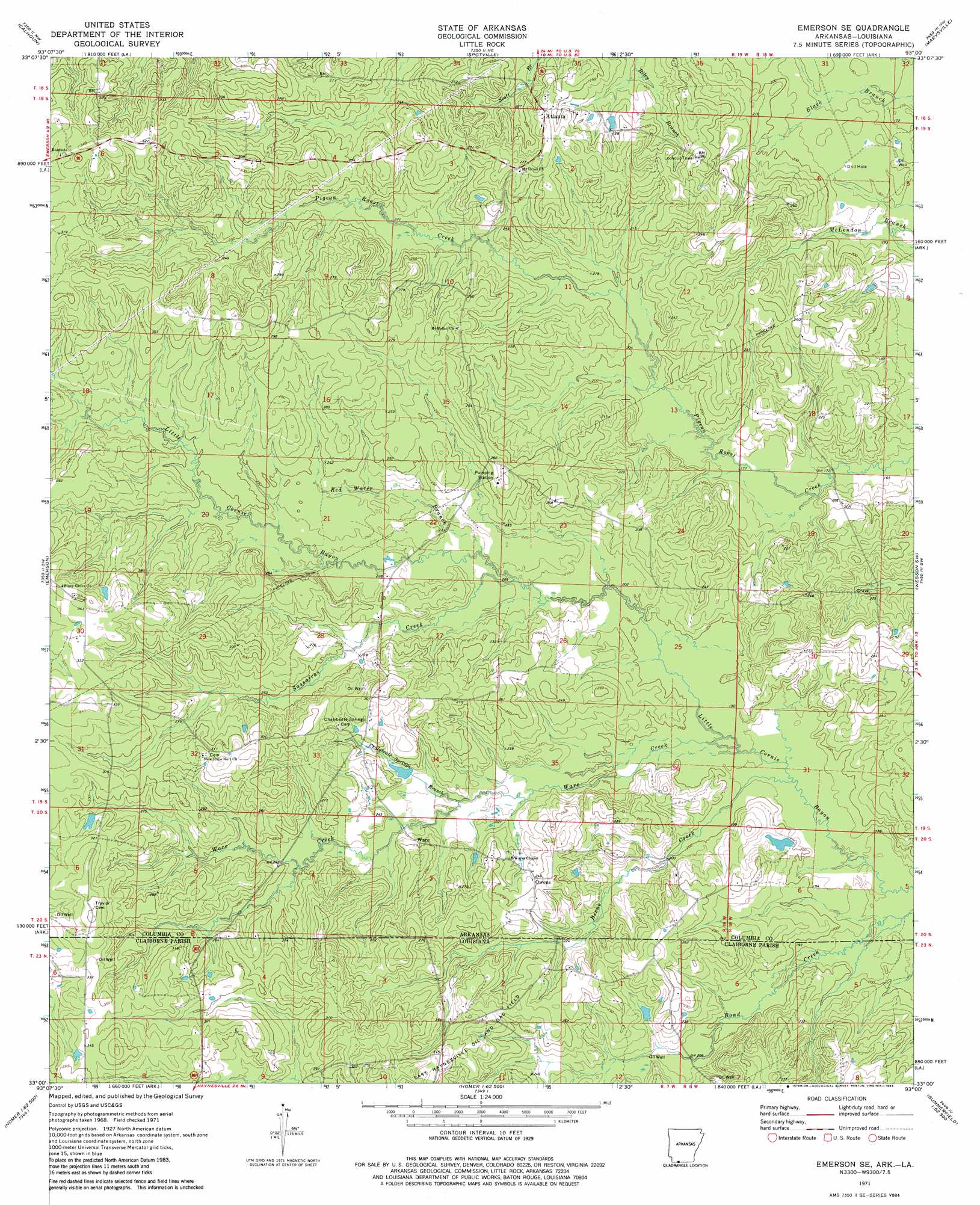
Emerson Se Topo Map Arkansas
To zoom in, hover over the map of Emerson Se
USGS Topo Quad 33093a1 - 1:24,000 scale
| Topo Map Name: | Emerson Se |
| USGS Topo Quad ID: | 33093a1 |
| Print Size: | ca. 21 1/4" wide x 27" high |
| Southeast Coordinates: | 33° N latitude / 93° W longitude |
| Map Center Coordinates: | 33.0625° N latitude / 93.0625° W longitude |
| U.S. States: | AR, LA |
| Filename: | o33093a1.jpg |
| Download Map JPG Image: | Emerson Se topo map 1:24,000 scale |
| Map Type: | Topographic |
| Topo Series: | 7.5´ |
| Map Scale: | 1:24,000 |
| Source of Map Images: | United States Geological Survey (USGS) |
| Alternate Map Versions: |
Emerson SE AR 1971, updated 1973 Download PDF Buy paper map Emerson SE AR 1971, updated 1983 Download PDF Buy paper map Emerson SE AR 2011 Download PDF Buy paper map Emerson SE AR 2014 Download PDF Buy paper map |
1:24,000 Topo Quads surrounding Emerson Se
Waldo |
Magnolia |
Village |
Mount Holly |
Lisbon |
Macedonia |
Calhoun |
Spotville |
Marysville |
Newell |
Walkerville |
Emerson |
Emerson Se |
Wesson Sw |
Wesson |
Shongaloo |
Haynesville West |
Haynesville East |
Colquitt |
Summerfield |
Leton |
Blackburn |
Homer |
Arizona |
Lisbon |
> Back to 33093a1 at 1:100,000 scale
> Back to 33092a1 at 1:250,000 scale
> Back to U.S. Topo Maps home
Emerson Se topo map: Gazetteer
Emerson Se: Dams
Rasberry Lake Dam elevation 74m 242′Emerson Se: Oilfields
East Haynesville Oil and Gas Field elevation 85m 278′Emerson Se: Populated Places
Atlanta elevation 80m 262′Calico Neck (historical) elevation 68m 223′
Owens elevation 75m 246′
Ware elevation 75m 246′
Emerson Se: Reservoirs
Rasberry Lake elevation 74m 242′Emerson Se: Streams
Beene Creek elevation 56m 183′Beene Creek elevation 57m 187′
Chalybeate Springs Branch elevation 66m 216′
Red Water Branch elevation 66m 216′
Sassafras Creek elevation 65m 213′
Ware Creek elevation 57m 187′
Emerson Se digital topo map on disk
Buy this Emerson Se topo map showing relief, roads, GPS coordinates and other geographical features, as a high-resolution digital map file on DVD: