Bradley Ne Topo Map Arkansas
To zoom in, hover over the map of Bradley Ne
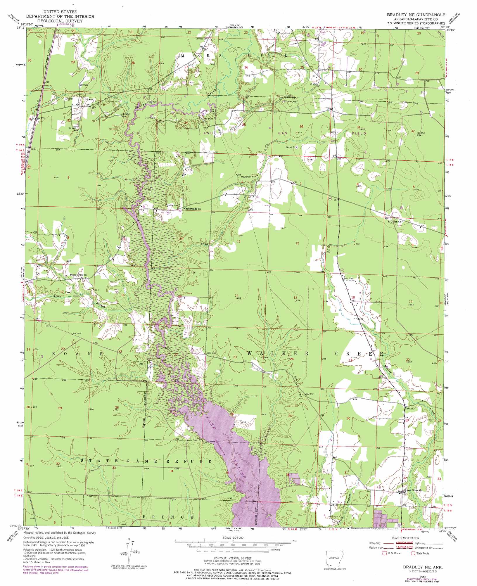
USGS Topo Quad 33093b5 - 1:24,000 scale
| Topo Map Name: | Bradley Ne |
| USGS Topo Quad ID: | 33093b5 |
| Print Size: | ca. 21 1/4" wide x 27" high |
| Southeast Coordinates: | 33.125° N latitude / 93.5° W longitude |
| Map Center Coordinates: | 33.1875° N latitude / 93.5625° W longitude |
| U.S. State: | AR |
| Filename: | o33093b5.jpg |
| Download Map JPG Image: | Bradley Ne topo map 1:24,000 scale |
| Map Type: | Topographic |
| Topo Series: | 7.5´ |
| Map Scale: | 1:24,000 |
| Source of Map Images: | United States Geological Survey (USGS) |
| Alternate Map Versions: |
Bradley NE AR 1952, updated 1953 Download PDF Buy paper map Bradley NE AR 1952, updated 1976 Download PDF Buy paper map Bradley NE AR 1952, updated 1978 Download PDF Buy paper map Bradley NE AR 2011 Download PDF Buy paper map Bradley NE AR 2014 Download PDF Buy paper map |
1:24,000 Topo Quads surrounding Bradley Ne
Fouke Ne |
Boyd Hill |
Old Town |
Falcon |
Lamartine |
Fouke Se |
Garland |
Lewisville |
Buckner |
Waldo |
Doddridge Ne |
Canfield |
Bradley Ne |
Bussey |
Macedonia |
Doddridge Se |
Bradley |
Bradley Se |
Taylor |
Walkerville |
Wardview |
Plain Dealing |
Carterville |
Cullen |
Shongaloo |
> Back to 33093a1 at 1:100,000 scale
> Back to 33092a1 at 1:250,000 scale
> Back to U.S. Topo Maps home
Bradley Ne topo map: Gazetteer
Bradley Ne: Oilfields
McKamie-Patton Oil and Gas Field elevation 87m 285′Bradley Ne: Populated Places
Forest Grove elevation 75m 246′Bradley Ne: Streams
Heirs Branch elevation 67m 219′Bradley Ne digital topo map on disk
Buy this Bradley Ne topo map showing relief, roads, GPS coordinates and other geographical features, as a high-resolution digital map file on DVD: