Waterloo Topo Map Arkansas
To zoom in, hover over the map of Waterloo
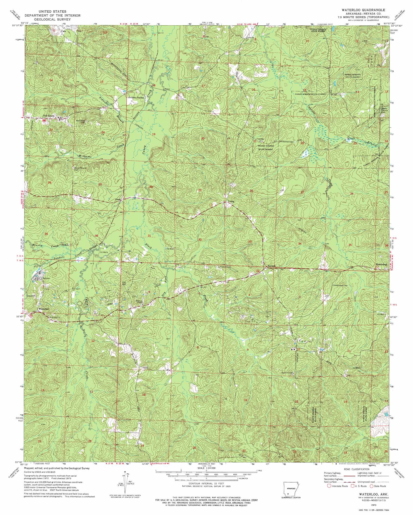
USGS Topo Quad 33093e2 - 1:24,000 scale
| Topo Map Name: | Waterloo |
| USGS Topo Quad ID: | 33093e2 |
| Print Size: | ca. 21 1/4" wide x 27" high |
| Southeast Coordinates: | 33.5° N latitude / 93.125° W longitude |
| Map Center Coordinates: | 33.5625° N latitude / 93.1875° W longitude |
| U.S. State: | AR |
| Filename: | o33093e2.jpg |
| Download Map JPG Image: | Waterloo topo map 1:24,000 scale |
| Map Type: | Topographic |
| Topo Series: | 7.5´ |
| Map Scale: | 1:24,000 |
| Source of Map Images: | United States Geological Survey (USGS) |
| Alternate Map Versions: |
Waterloo AR 1973, updated 1975 Download PDF Buy paper map Waterloo AR 2011 Download PDF Buy paper map Waterloo AR 2014 Download PDF Buy paper map |
1:24,000 Topo Quads surrounding Waterloo
Prescott West |
Prescott East |
Whelen Springs |
Reader |
Tates Bluff |
Emmet |
Laneburg |
Bluff City |
Chidester |
Bragg City |
Bodcaw |
Willisville |
Waterloo |
Troy |
Camden Sw |
Falcon |
Lamartine |
Magnolia Nw |
Stephens |
Buena Vista |
Buckner |
Waldo |
Magnolia |
Village |
Mount Holly |
> Back to 33093e1 at 1:100,000 scale
> Back to 33092a1 at 1:250,000 scale
> Back to U.S. Topo Maps home
Waterloo topo map: Gazetteer
Waterloo: Oilfields
Irma Oil Field elevation 81m 265′Troy Oil Field elevation 97m 318′
Waterloo: Populated Places
Ames elevation 74m 242′Caney (historical) elevation 78m 255′
Mendenhall elevation 106m 347′
Nevark elevation 99m 324′
Oak Grove elevation 106m 347′
Waterloo elevation 105m 344′
Young elevation 99m 324′
Waterloo: Streams
Black Branch elevation 75m 246′Black Creek elevation 73m 239′
Brushy Creek elevation 76m 249′
Dry Fork elevation 75m 246′
Sanders Creek elevation 76m 249′
Tidwell Branch elevation 69m 226′
Williams Creek elevation 69m 226′
Waterloo digital topo map on disk
Buy this Waterloo topo map showing relief, roads, GPS coordinates and other geographical features, as a high-resolution digital map file on DVD: