Spring Hill Topo Map Arkansas
To zoom in, hover over the map of Spring Hill
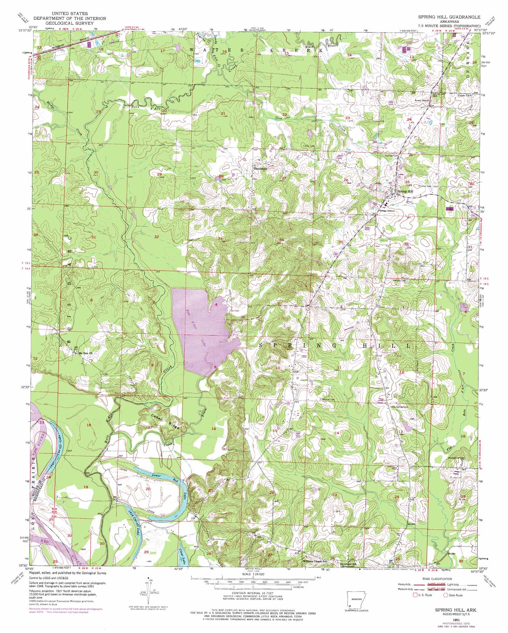
USGS Topo Quad 33093e6 - 1:24,000 scale
| Topo Map Name: | Spring Hill |
| USGS Topo Quad ID: | 33093e6 |
| Print Size: | ca. 21 1/4" wide x 27" high |
| Southeast Coordinates: | 33.5° N latitude / 93.625° W longitude |
| Map Center Coordinates: | 33.5625° N latitude / 93.6875° W longitude |
| U.S. State: | AR |
| Filename: | o33093e6.jpg |
| Download Map JPG Image: | Spring Hill topo map 1:24,000 scale |
| Map Type: | Topographic |
| Topo Series: | 7.5´ |
| Map Scale: | 1:24,000 |
| Source of Map Images: | United States Geological Survey (USGS) |
| Alternate Map Versions: |
Spring Hill AR 1951, updated 1952 Download PDF Buy paper map Spring Hill AR 1951, updated 1976 Download PDF Buy paper map Spring Hill AR 2011 Download PDF Buy paper map Spring Hill AR 2014 Download PDF Buy paper map |
1:24,000 Topo Quads surrounding Spring Hill
Mineral Springs South |
Columbus |
Washington |
Blevins |
Prescott West |
Red Bluff |
Mcnab |
Sheppard |
Hope |
Emmet |
Homan |
Fulton |
Spring Hill |
Patmos |
Bodcaw |
Mandeville |
Fouke Ne |
Boyd Hill |
Old Town |
Falcon |
Fouke |
Fouke Se |
Garland |
Lewisville |
Buckner |
> Back to 33093e1 at 1:100,000 scale
> Back to 33092a1 at 1:250,000 scale
> Back to U.S. Topo Maps home
Spring Hill topo map: Gazetteer
Spring Hill: Crossings
Dooleys Ferry (historical) elevation 68m 223′Spring Hill: Lakes
Bois d'Arc Lake elevation 78m 255′Lower Red Lake elevation 71m 232′
Nineteen hundred and forty Cut-off Lake elevation 71m 232′
Nineteen hundred and sixteen Cut-off elevation 73m 239′
Spring Hill: Parks
Bois D'Arc Creek Wildlife Management Area elevation 75m 246′Spring Hill: Populated Places
Battlefield elevation 107m 351′Spring Hill elevation 115m 377′
Spring Hill: Ridges
Cedar Ridge elevation 83m 272′Spring Hill: Streams
Bridge Creek elevation 75m 246′Cedar Bayou elevation 77m 252′
Goss Creek elevation 80m 262′
Peavine Creek elevation 82m 269′
Sandy Bois d'Arc Creek elevation 79m 259′
Spring Hill digital topo map on disk
Buy this Spring Hill topo map showing relief, roads, GPS coordinates and other geographical features, as a high-resolution digital map file on DVD: