Reader Topo Map Arkansas
To zoom in, hover over the map of Reader
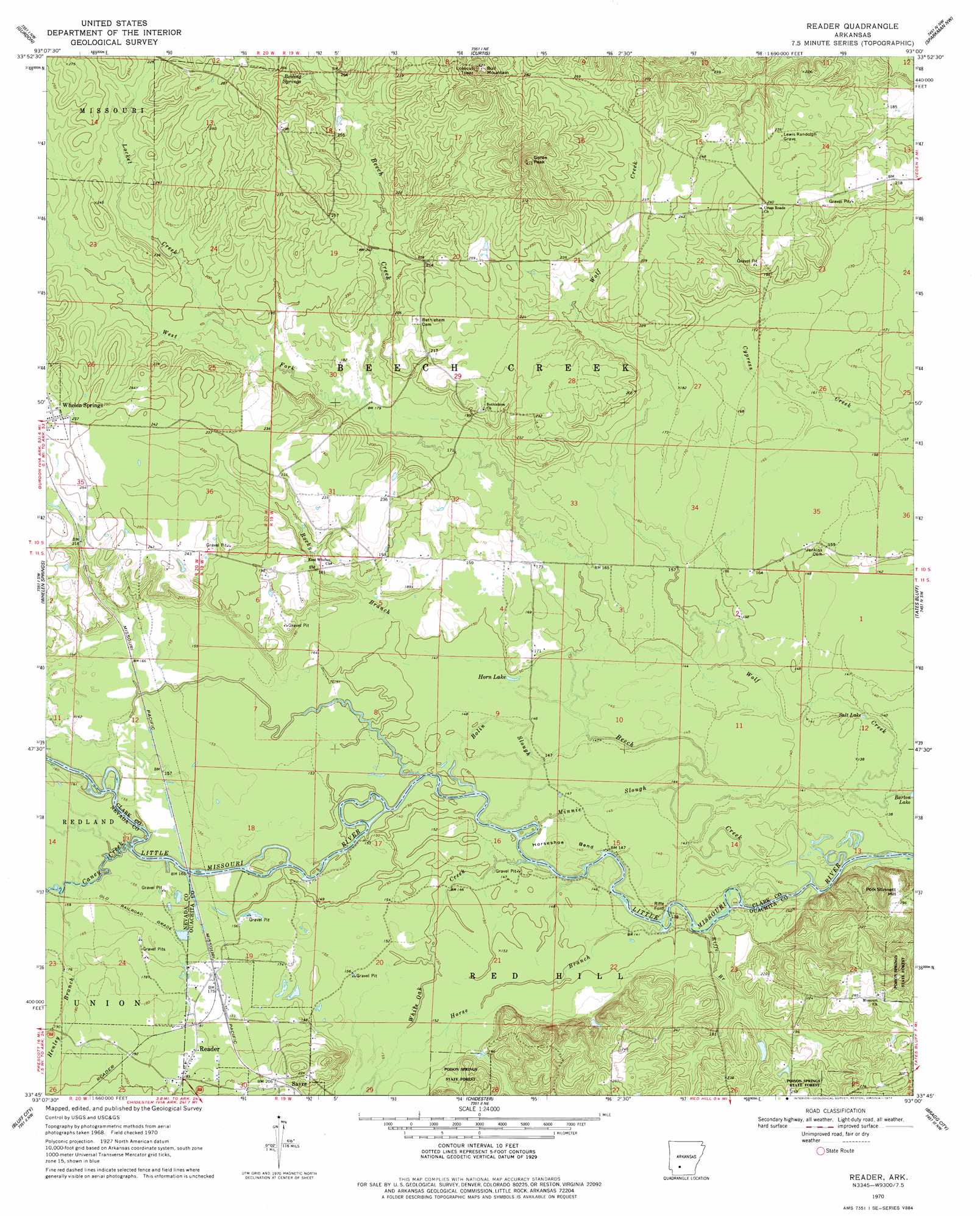
USGS Topo Quad 33093g1 - 1:24,000 scale
| Topo Map Name: | Reader |
| USGS Topo Quad ID: | 33093g1 |
| Print Size: | ca. 21 1/4" wide x 27" high |
| Southeast Coordinates: | 33.75° N latitude / 93° W longitude |
| Map Center Coordinates: | 33.8125° N latitude / 93.0625° W longitude |
| U.S. State: | AR |
| Filename: | o33093g1.jpg |
| Download Map JPG Image: | Reader topo map 1:24,000 scale |
| Map Type: | Topographic |
| Topo Series: | 7.5´ |
| Map Scale: | 1:24,000 |
| Source of Map Images: | United States Geological Survey (USGS) |
| Alternate Map Versions: |
Reader AR 1970, updated 1972 Download PDF Buy paper map Reader AR 1970, updated 1977 Download PDF Buy paper map Reader AR 2011 Download PDF Buy paper map Reader AR 2014 Download PDF Buy paper map |
1:24,000 Topo Quads surrounding Reader
Okolona North |
Hollywood |
Arkadelphia |
Dalark |
Manning |
Okolona South |
Gurdon |
Curtis |
Sparkman Nw |
Sparkman |
Prescott East |
Whelen Springs |
Reader |
Tates Bluff |
Ouachita |
Laneburg |
Bluff City |
Chidester |
Bragg City |
Harmony Grove |
Willisville |
Waterloo |
Troy |
Camden Sw |
Camden |
> Back to 33093e1 at 1:100,000 scale
> Back to 33092a1 at 1:250,000 scale
> Back to U.S. Topo Maps home
Reader topo map: Gazetteer
Reader: Bends
Horseshoe Bend elevation 45m 147′Reader: Crossings
Riffe Ford elevation 44m 144′Reader: Guts
Bolin Slough elevation 46m 150′Minnie Slough elevation 46m 150′
Reader: Lakes
Horn Lake elevation 47m 154′Salt Lake elevation 44m 144′
Reader: Populated Places
Reader elevation 59m 193′Sayre elevation 64m 209′
Reader: Springs
Boiling Springs elevation 72m 236′Reader: Streams
Beech Creek elevation 42m 137′Caney Creek elevation 48m 157′
Henley Branch elevation 51m 167′
Horse Branch elevation 45m 147′
Locket Creek elevation 62m 203′
Rocky Branch elevation 45m 147′
West Fork Beech Creek elevation 56m 183′
White Oak Creek elevation 45m 147′
Reader: Summits
Bull Mountain elevation 109m 357′Gores Peak elevation 121m 396′
Polk Stinnett Hill elevation 86m 282′
Reader digital topo map on disk
Buy this Reader topo map showing relief, roads, GPS coordinates and other geographical features, as a high-resolution digital map file on DVD: