Whelen Springs Topo Map Arkansas
To zoom in, hover over the map of Whelen Springs
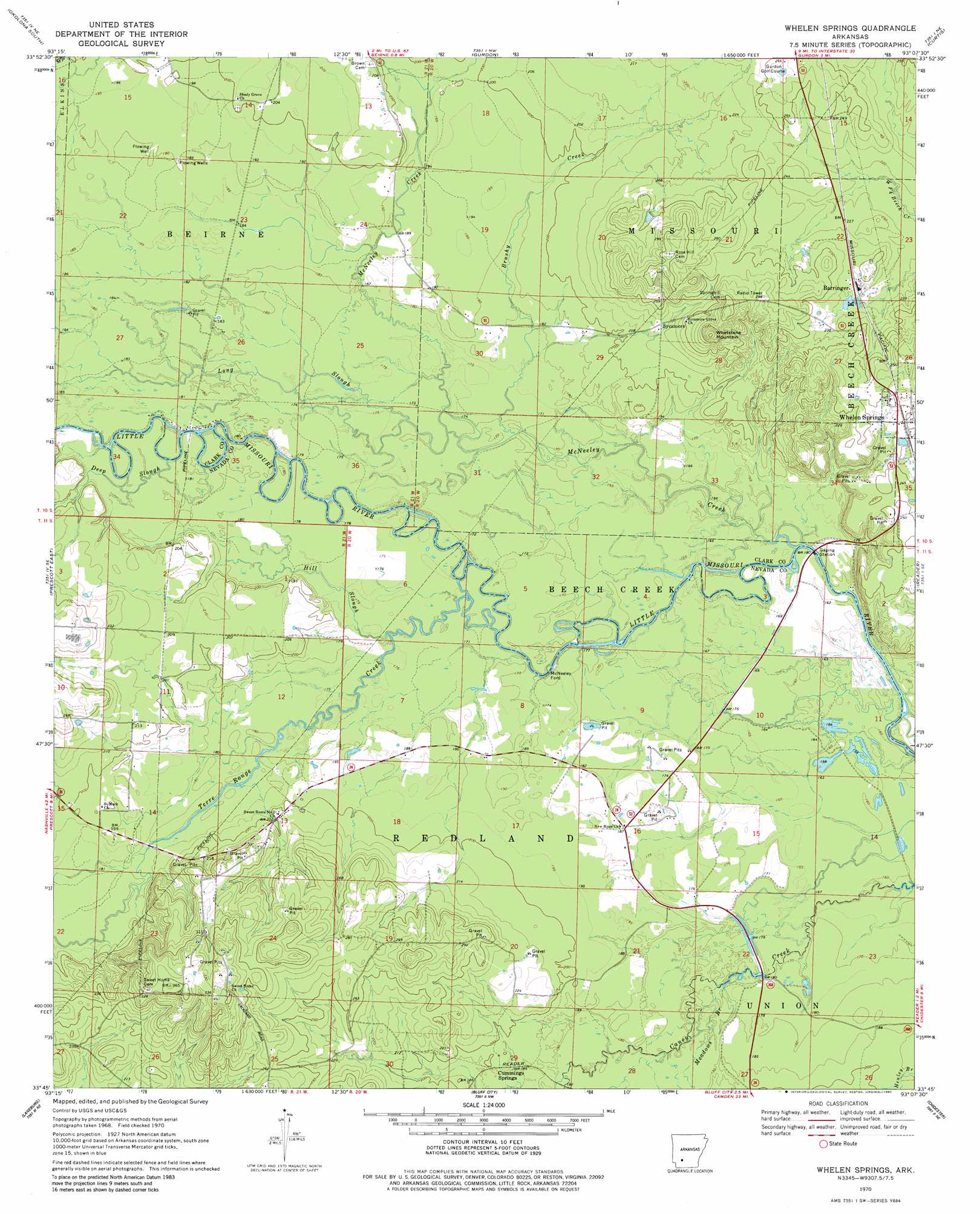
USGS Topo Quad 33093g2 - 1:24,000 scale
| Topo Map Name: | Whelen Springs |
| USGS Topo Quad ID: | 33093g2 |
| Print Size: | ca. 21 1/4" wide x 27" high |
| Southeast Coordinates: | 33.75° N latitude / 93.125° W longitude |
| Map Center Coordinates: | 33.8125° N latitude / 93.1875° W longitude |
| U.S. State: | AR |
| Filename: | o33093g2.jpg |
| Download Map JPG Image: | Whelen Springs topo map 1:24,000 scale |
| Map Type: | Topographic |
| Topo Series: | 7.5´ |
| Map Scale: | 1:24,000 |
| Source of Map Images: | United States Geological Survey (USGS) |
| Alternate Map Versions: |
Whelen Springs AR 1970, updated 1972 Download PDF Buy paper map Whelen Springs AR 1970, updated 1980 Download PDF Buy paper map Whelen Springs AR 2011 Download PDF Buy paper map Whelen Springs AR 2014 Download PDF Buy paper map |
1:24,000 Topo Quads surrounding Whelen Springs
Antoine |
Okolona North |
Hollywood |
Arkadelphia |
Dalark |
Piney Grove |
Okolona South |
Gurdon |
Curtis |
Sparkman Nw |
Prescott West |
Prescott East |
Whelen Springs |
Reader |
Tates Bluff |
Emmet |
Laneburg |
Bluff City |
Chidester |
Bragg City |
Bodcaw |
Willisville |
Waterloo |
Troy |
Camden Sw |
> Back to 33093e1 at 1:100,000 scale
> Back to 33092a1 at 1:250,000 scale
> Back to U.S. Topo Maps home
Whelen Springs topo map: Gazetteer
Whelen Springs: Populated Places
Barringer elevation 73m 239′Cummings Springs elevation 60m 196′
Sycamore elevation 70m 229′
Whelen Springs elevation 78m 255′
Whelen Springs: Streams
Brushy Creek elevation 54m 177′Deep Slough elevation 53m 173′
Hill Slough elevation 53m 173′
Long Slough elevation 53m 173′
McNeeley Creek elevation 49m 160′
Meadows Branch elevation 54m 177′
Terre Rouge Creek elevation 50m 164′
Whelen Springs: Summits
Whetstone Mountain elevation 85m 278′Whelen Springs digital topo map on disk
Buy this Whelen Springs topo map showing relief, roads, GPS coordinates and other geographical features, as a high-resolution digital map file on DVD: