Blevins Topo Map Arkansas
To zoom in, hover over the map of Blevins
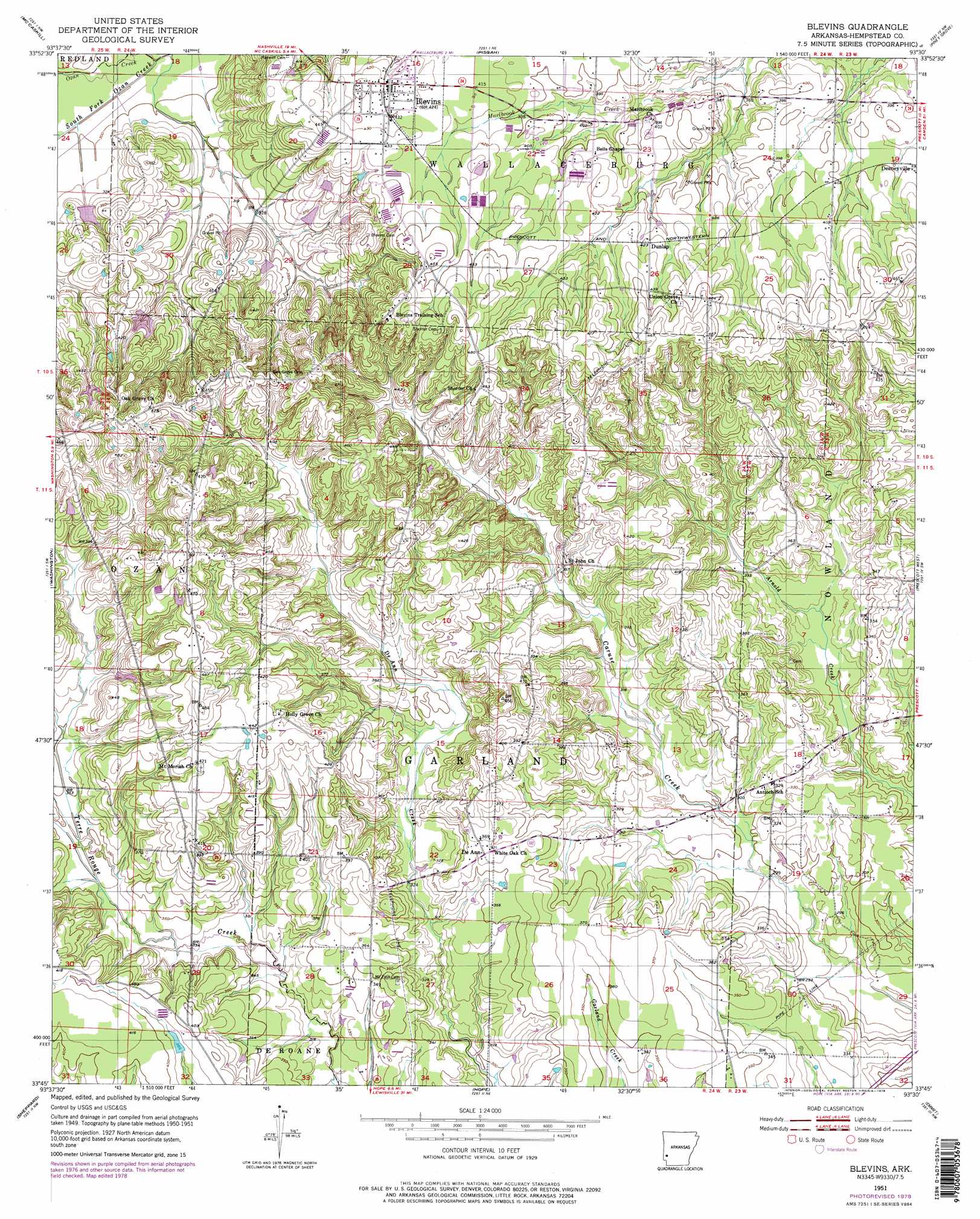
USGS Topo Quad 33093g5 - 1:24,000 scale
| Topo Map Name: | Blevins |
| USGS Topo Quad ID: | 33093g5 |
| Print Size: | ca. 21 1/4" wide x 27" high |
| Southeast Coordinates: | 33.75° N latitude / 93.5° W longitude |
| Map Center Coordinates: | 33.8125° N latitude / 93.5625° W longitude |
| U.S. State: | AR |
| Filename: | o33093g5.jpg |
| Download Map JPG Image: | Blevins topo map 1:24,000 scale |
| Map Type: | Topographic |
| Topo Series: | 7.5´ |
| Map Scale: | 1:24,000 |
| Source of Map Images: | United States Geological Survey (USGS) |
| Alternate Map Versions: |
Blevins AR 1951, updated 1952 Download PDF Buy paper map Blevins AR 1951, updated 1978 Download PDF Buy paper map Blevins AR 1951, updated 1978 Download PDF Buy paper map Blevins AR 2011 Download PDF Buy paper map Blevins AR 2014 Download PDF Buy paper map |
1:24,000 Topo Quads surrounding Blevins
Nathan |
Murfreesboro |
Delight |
Antoine |
Okolona North |
Nashville |
Mccaskill |
Pisgah |
Piney Grove |
Okolona South |
Columbus |
Washington |
Blevins |
Prescott West |
Prescott East |
Mcnab |
Sheppard |
Hope |
Emmet |
Laneburg |
Fulton |
Spring Hill |
Patmos |
Bodcaw |
Willisville |
> Back to 33093e1 at 1:100,000 scale
> Back to 33092a1 at 1:250,000 scale
> Back to U.S. Topo Maps home
Blevins topo map: Gazetteer
Blevins: Dams
H and P Lake Dam elevation 119m 390′Royston Lake One Dam elevation 104m 341′
Royston Lake Three Dam elevation 125m 410′
Royston Lake Two Dam elevation 114m 374′
T A Smith Lake Dam elevation 136m 446′
Blevins: Populated Places
Blevins elevation 131m 429′De Ann elevation 114m 374′
Drab (historical) elevation 143m 469′
Dunlap elevation 131m 429′
Blevins: Reservoirs
H and P Lake elevation 119m 390′Royston Lake One elevation 104m 341′
Royston Lake Three elevation 125m 410′
Royston Lake Two elevation 114m 374′
Smith Lake elevation 136m 446′
Blevins: Streams
South Fork Ozan Creek elevation 93m 305′Blevins digital topo map on disk
Buy this Blevins topo map showing relief, roads, GPS coordinates and other geographical features, as a high-resolution digital map file on DVD: